
Water Monitoring to Continue at Western Gulf Ports
A water monitoring network that helps keep port traffic moving is the responsibility of the Conrad Blucher Institute (CBI) for Surveying and Science at Texas A&M University-Corpus Christi. CBI, in partnership with Woods Hole Oceanographic Institution in Massachusetts, has received the federal contract from the National Oceanic and Atmospheric Administration to continue to operate and maintain the water level and ocean monitoring network along the Western Gulf of Mexico. CBI, as a subcontractor, will operate in the Houston/Galveston and Lake Charles, La. areas through the Physical Oceanographic
Mobile App Boosts Navigation Safety
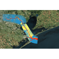
; The app will provide invaluable information, which could increase navigational safety along the ship channel by reducing the number of ships becoming grounded due to insufficient water depth, and help reduce the number of vessel collisions. The “Transit Time!” Mobile App (http://apps.proto.cbi.tamucc.edu/transit), now available for mobile devices, smartphones, and desktop devices, will benefit the commercial navigation community, while future planned extensions of the app will help a broader base of coastal users. The Houston-Galveston Ship Channel, part of the second largest port


