GeoAcoustis Launches New Sub-Bottom Profiler and Software Integration Capabilities
,” said Richard Dowdeswell, Chief Operating Officer at GeoAcoustics.In addition, GeoPulse Compact Sub-Bottom Profiler from GeoAcoustics is now compatible for the first time with the popular Geo Marine Survey System-developed Geo-Suite acquisition software.The combination introduces a new GIS-based solution for the acquisition, processing, interpretation and 3D visualization of data acquired by GeoPulse Compact.Geo Marine Survey System has created a new graphical user interface (GUI) to enable the interoperation between GeoPulse Compact and the Geo-Suite Acquisition software release 2023R1
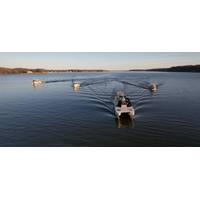
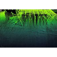
HydroSurv Funded to Commercialize Robotic Seagrass Solution
two years. The partners envisage that this next stage of technology development will propel the concept towards scale deployment and commercial viability.HydroSurv's cloud-based data hosting and visualisation application, EasySurv, facilitates real-time decision making without the need for specialist GIS packages or interrogation skills. EasySurv hosts content-managed data deliverables, processed using machine learning algorithms, alongside the raw data collected from the company’s USVs
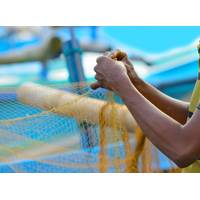
Indian Fishermen Use Smartphones to Map a Vanishing Way of Life
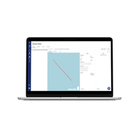
the Coastal Resource Centre, a local environmental activist group.“Our lands are being used to generate electricity. But we are deprived. The sea, the river – which were sources of our livelihood - are polluted in the process,” Saravanan said.Saravanan opened his laptop and pulled up the GIS software he uses to map hundreds of villages in his area, cross-checking the sites designated by fishermen such as Raji against satellite images of the entire area.Saravanan said he learned how to use the software from a friend who had studied software engineering and from YouTube.Next he recruited
Partners Aim to Unlock More Value from Hydrographic Data
functionalities for enhanced data processing features. Verified information will become the key asset and our aim is to make it easily accessible for all project stakeholders without the necessity to be domain experts,” adds Hennemann.“The demand for offloading QPS proprietary data through a GIS system is growing. QPS sees the need for customers to provide data to their end customers through such platforms and we want to respond to this request from our customers. We want to make it as simple and efficient as possible and provide the best possible solutions to our customers,” concluded
NOAA Taps Woolpert for Chesapeake Bay Watershed Study
for more than 50 years. Woolpert will mobilize five hydrographic survey vessels, or nearly a quarter of its fleet, equipped with multibeam and side-scan sonar systems out of the firm’s East Coast hydrographic hub in Charleston, S.C. Vessel locations will be displayed in real time via a customized GIS dashboard to enhance situational awareness and provide real-time progress and information throughout the project.These data will serve several missions in years to come, including navigation, inundation modeling, floodplain analysis, and coastal resilience. Hydrodynamic modeling will help forecasters
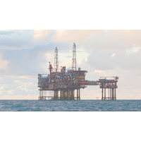
C-Innovation and Grand Isle Shipyard Awarded P&A Work
C-Innovation (C-I) and Grand Isle Shipyard, LLC (GIS) have been awarded a plug and abandonment contract by Helix Alliance Decom, LLC to provide pre-feed services for the decommissioning of three offshore platforms for a major deepwater client.In Phase I of the project, C-I provided ROV services to deliver marine water inspection and integrated the data within MODS software to provide live operations for the client operating fixed leg platforms in 165 - 200 feet of water. The GIS Aerobotics Drone Division provided aerial inspection services. The joint technical innovations aim to determine the current
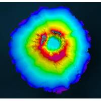
Teledyne Geospatial Partners with Seabed 2030 to Study Submarine Impacts of Volcanic Eruption in Tonga
data being used for comparative studies against previous maps to assess the effects of the eruption on marine life and seafloor composition. Software provided by Teledyne CARIS will also be used to process the data to generate the final products.“As the leading developer of hydrographic and marine GIS software, Teledyne CARIS’ contribution to TESMaP has been invaluable,” commented Seabed 2030 Project Director Jamie McMichael-Phillips. “We are grateful for the provision of this software which has truly been a force multiplier in processing data as part of scientific research&mdash
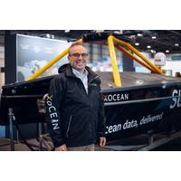
CTO in Focus: “Stop, Listen & Think” - One-on-One with Shepard Smith, XOcean
and we surveyed using survey launches and single beam echo sounders, as well as a ‘brand new’ technology – GPS – around the unexplored areas off the coast of Alaska. The next 10 to 15 years of my NOAA career was technology focused, working on integrating new technology, bringing in GIS and multibeam and database-based systems in through grided bathymetry to speed up our workflows. I also got into the charting side; and I was the chief of our charting division. I finished my career as the Director of the Office of Coast Survey and the U.S. National Hydrographer. Some of my
USACE Galveston Taps eTrac for $13M Hydrographic Surveying, Mapping Contract
to support a wide range of services, which could include planimetric, boundary and utility surveying. In addition, eTrac and Woolpert will support this contract with photogrammetric mapping, engineering and design; geodetic control surveys; and the collection, processing and management of high-accuracy GIS data.Image courtesy eTrac, a Woolpert Compan