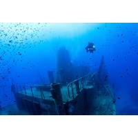
Shipwrecks Teem with Underwater Life, from Microbes to Sharks
typically made of metal or wood. When a vessel sinks, it adds foreign, artificial structure to the seafloor.For example, the World War II tanker E.M. Clark sank on a relatively flat, sandy seabed in 1942 when it was torpedoed by a German submarine. To this day, the intact metal wreck looms over the North Carolina seafloor like an underwater skyscraper, creating an island oasis in the sand.The creatures that reside on and around sunken ships are so diverse and abundant that scientists often colloquially call these sites “living shipwrecks.” Marine life ranging from microscopic critters to some
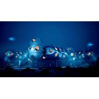
DEEP's #OccupyMare is about Persistent Human Presence Subsea
sea presence will drive the expansion of subsea research and exploration, preservation, and an improved understanding of our interconnection with our ocean,” says Dawn Kernagis PhD, NASA crew member for the NEEMO XXII undersea mission, Vice Chair for Neurosurgery Research at the University of North Carolina, Explorers Club Fellow, and first recipient of US Office of Naval Research Undersea Medicine Program's Predoctoral Award. Dr Kernagis' team currently conducts advanced research for a number of organizations, including the United States Department of Defense and NASA. Following
North American Lobster Industry Confronts 'Ropeless' Traps After Whale Entanglements
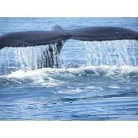
Monhegan Island in Maine. "And it is all the more scary because none of us feel it is going to help (the whales)."Since the start of the year, four North Atlantic Right Whales have been injured after getting entangled in fishing rope, according to government data, including one filmed in North Carolina trailing a pair of lobster traps that U.S. authorities believe came from the Canadian province of Nova Scotia hundreds of miles away.Such entanglements have killed at least nine North Atlantic Right Whales since 2017, making it the second biggest cause of death behind strikes from boats and ships
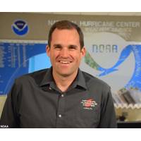
Brennan Named Director of NOAA’s National Hurricane Center
and international partners — along with experience working across NOAA and with other federal agencies to ensure the multifaceted execution of the Nation’s Hurricane Forecast and Warning program.He earned a Bachelor in Meteorology, and a Masters and Ph.D. in Atmospheric Science, all from North Carolina State University.“I had the pleasure of working with Mike for four years at NHC, where I observed his steadfast dedication to the mission of saving lives and property,” said Ken Graham, director of NOAA’s National Weather Service. “Mike is an innovator who has built incredible
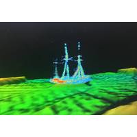
Discovery: Historic Shipwreck Found in Lake Huron
Ironton had been found.In June 2021, Thunder Bay National Marine Sanctuary and Ocean Exploration Trust returned to the site to carry out a more thorough investigation of Ironton. Conducting ROV operations aboard U.S. Coast Guard Cutter Mobile Bay, the research team partnered with the University of North Carolina's Undersea Vehicle Program to collect high-resolution video and further document the wreck. Resting upright and incredibly well preserved by Lake Huron's cold freshwater, Ironton looks almost ready to load cargo.Project PartnersNOAA and the state of Michigan jointly manage Thunder Bay
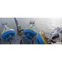
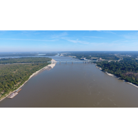
OOI‘s Pioneer Array Relocating to Southern Mid-Atlantic Bight
Charleston, SC aboard the R/V Neil Armstrong to begin test deployments in preparation for the installation of an Ocean Observatories Initiative (OOI) ocean observing system in its new location in the southern Mid-Atlantic Bight (MAB). The science team will deploy two test moorings off the coast of North Carolina, occupying shallow and deep sites of the proposed array. The deployments will supplement computer modeling to ensure the mooring designs perform as expected in the MAB environment. Once the array is fully operational in 2024, the ocean data collected will be available online in near real-time
Below-average Gulf of Mexico ‘Dead Zone’ Measured
5-year average measured size (black dashed lines). (LUMCON/LSU/NOAA)Exposure to hypoxic waters has been found to alter fish diets, growth rates, reproduction, habitat use and availability of commercially harvested species like shrimp. This year, for the first time, scientists from NOAA Fisheries and North Carolina State University began using an experimental model to better understand where shrimp could be found relative to the hypoxic zone.Investments in understanding and addressing hypoxiaThe Hypoxia Task Force is accelerating progress in reducing excess nutrients in the Mississippi/Atchafalaya River
US DoE Funds Marine Energy Projects
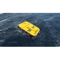
. In their project, Oscilla will build and test in the ocean the MicroTriton, a small wave energy converter platform. The project will involve completing the detailed design and constructing a MicroTriton system capable of supporting and powering a radar transmitter. The system will be tested off the North Carolina coast for several months.Triton Systems, Massachusetts, is working on wave energy Harvesting to power LiDAR buoys. This project will involve the development of a wave energy converter that can power existing LiDAR buoys, which have substantial power requirements and are used to understand site-specifi
NOAA Forecasts Average Summer 'Dead Zone' in the Gulf of Mexico
(gray). (USGS)This is the fifth year NOAA has produced a dead zone forecast using a suite of models jointly developed by the agency and its partners — teams of researchers at the University of Michigan, Louisiana State University, William & Mary’s Virginia Institute of Marine Science, North Carolina State University, Dalhousie University and the U.S. Geological Survey (USGS), who provided the Mississippi River nutrient loading data for the models. NOAA integrates the results of these multiple models into an aggregate forecast and releases the forecast in coordination with these external


