Norway's NPD Taps Argeo for Deep-sea Mineral Exploration in Knipovich Ridge
, and subsurface data that are key in addressing the challenges of remoteness and scale, complex geological settings, as well as environmental sensitivity associated with deep-sea mineral deposits.According to Argeo, all the acquired data collected is processed onboard the Argeo AUVs using onboard-postprocessing and mosaicking software to allow quick turnaround during missions and improved decision-making for the customer.Norway Finds 'Substantial' Mineral Resources on Its SeabedMarine Minerals – A New Opportunity for Subsea Oil and Gas TechnologyNorway Eyes Sea Change in Deep Dive for
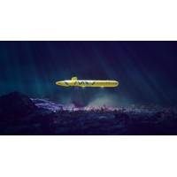
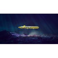
Argeo Scores Ultra-deepwater AUV Work for Undisclosed Customer
specification AUVs. The AUV is modular and very mobile with supporting systems which can be strategically placed in Argeo’s main Geomarkets for rapid deployment serving our global customers with state-of-the-art technology and data. All data collected is processed onboard the AUV using onboard-postprocessing and mosaicking software to allow quick turnaround during missions and improved decision making for the customer
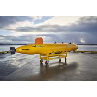
Argeo Buys Two SeaRaptor AUVs
fitted with Teledyne RESON T50-S Multi-Beam dual frequency 200/400 kHz Echo Sounders, Teledyne Benthos Chirp III Sub Bottom Profilers, iXblue PHINS 6000 INSs coupled to Teledyne RDI Tasman DVLs, and CathX Hunter Camera Systems. All data collected will be processed onboard using Teledyne CARIS OnBoard postprocessing and mosaicking software to allow quick turnaround during missions. The AUVs are also fitted with a large variety of scientific sensors from RBR which will take Conductivity, Temperature, Pressure, Turbidity, pH, Dissolved Oxygen, Redox, CH4 and Magnetic measurements to provide valuable water
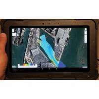
NORBIT DCT – Hydrographic Survey Made Easy
The data is always collected in WGS84 coordinates, and all data is time stamped in the NORBIT hardware. The speed of sound profile is also saved in the same file (or can be added to the processing software if needed). At the same time the raw GNSS/INS observables are recorded and allow for navigation postprocessing of a complete navigation solution even if the RTK dropout happen during the survey or no RTK was available at a survey time.ConclusionsNORBIT’s latest Data Collection Tool (DCT) is a simple and useful tool for new markets to emerge onto the hydrography survey world. The web browser interface