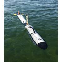
OceanServer Delivers AUV with YSI Integrated Systems
along with new chirp based sonar systems. Shipments for the system have already started. All Iver3 AUV models come standard with OceanServer’s VectorMap Mission Planning and Data Presentation tool, which provides geo-registered data files that can be easily exported to other software analysis tools. This unique AUV design has enabled OceanServer to carve out a very strong position in the research space for Autonomous Underwater Vehicles, sensors and behavioral studies. The VectorMap program can input NOAA ENCs or any geo-referenced charts, maps or photo images, allowing the operator
OceanServer Reports High Demand for Iver3 AUV
and expects to deliver the majority of these vehicles by early in the seconnd quarter of 2016. All Iver3 AUV models come standard with OceanServer’s VectorMap Mission Planning and Data Presentation tool, which provides geo-registered data files that can be easily exported to other software analysis tools. The VectorMap program can input NOAA ENCs or any geo-referenced charts, maps or photo images, allowing the operator to intuitively develop AUV missions using simple point-and-click navigation. According to OceanServer, the base vehicle gives university, government and commercial
Iver3 AUV Sold to Defense Research and Development Canada
along with the Klein 3500 Side Scan and Bathy system for imaging and mapping the seafloor. All Iver AUV models come standard with OceanServer’s VectorMap Mission Planning and Data Presentation tool, which provides geo-registered data files that can be easily exported to other software analysis tools. The VectorMap program can input NOAA Electronic Navigational Charts (ENCs) or any geo-referenced charts, maps or photo images, allowing the operator to intuitively develop AUV missions using simple point-and-click navigation. The Iver AUV gives university, government and commercial
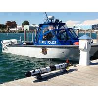
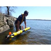
Michigan Police Upgrades Deepwater Capability
deep water search capability as evidence during the two recent deployments on two open cases.” All Iver AUV models come standard with OceanServer’s VectorMap Mission Planning and Data Presentation tool, which provides geo-registered data files that can be easily exported to other software analysis tools. The VectorMap program can input NOAA Electronic Navigational Charts (ENCs) or any geo-referenced charts, maps or photo images, allowing the operator to intuitively develop AUV missions using simple point-and-click navigation. The Iver AUV gives university, government and commercial
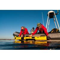
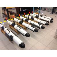
OceanServer Receives Orders for 6 New Iver AUVs
computing for reliable execution of seabed and other surveys. The manufacturer noted that all Iver AUV models come standard with OceanServer’s VectorMap Mission Planning and Data Presentation tool, which provides geo-registered data files that can be easily exported to other software analysis tools. The VectorMap program can input NOAA Electronic Navigational Charts (ENCs) or any geo-referenced charts, maps or photo images, allowing the operator to intuitively develop AUV missions using simple point-and-click navigation. The base vehicle, with a starting price at just over
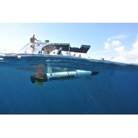
OceanServer Lands US Navy AUV Contracts
for a wide range of water quality sensors, remote helm applications and in-water communications. All Iver AUV models come standard with OceanServer’s VectorMap Mission Planning and Data Presentation tool, which provides geo-registered data files that can be easily exported to other software analysis tools. This unique AUV design has enabled OceanServer to carve out a very strong position in the research space for Autonomous Underwater Vehicles, sensors and behavioral studies. The VectorMap program can input NOAA ENCs or any geo-referenced charts, maps or photo images, allowing the operator
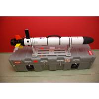
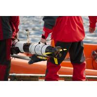
University Selects Iver AUV Baltic Sea Research
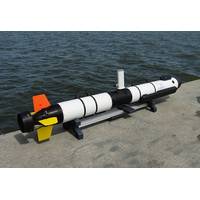
and flexibility to add additional sensors to help support these efforts. The Iver Platform All Iver AUV models come standard with OceanServer’s VectorMap Mission Planning and Data Presentation tool, which provides geo-registered data files that can be easily exported to other software analysis tools. This unique AUV design has enabled OceanServer to carve out a very strong position in the research space for Autonomous Underwater Vehicles, sensors and behavioral studies. OceanServer has delivered over 200 AUV systems to customers around the globe. The base vehicle, with a starting price
Johns Hopkins University Orders Second Iver2 Research AUV
and defined hardware interfaces allow researchers and OEMs to quickly adapt the Iver for a variety of applications. The EP42 vehicle includes OceanServer VectorMap Mission Planning and Data Presentation tool, which provides geo-registered data files that can be easily exported to other software analysis tools. The VectorMap program can input any geo-referenced chart, map or photo image, allowing the operator to intuitively develop missions using simple pointand-click navigation. ocean-server.c
U.S. Navy Purchases Six New Iver AUVs
and in-water communications. Early this year, OceanServer delivered the 200th AUV system. All Iver AUV models come standard with OceanServer’s VectorMap Mission Planning and Data Presentation tool, which provides geo-registered data files that can be easily exported to other software analysis tools. According to the manufacturer, this unique AUV design has enabled OceanServer to carve out a very strong position in the research space for Autonomous Underwater Vehicles, sensors and behavioral studies. The VectorMap program can input NOAA ENCs or any geo-referenced charts, maps or photo