A Game-changer for Flood Forecasting


-
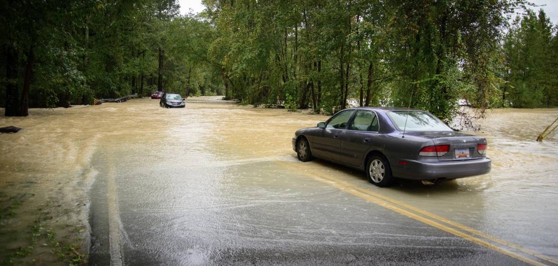
 Photo: NOAA
-
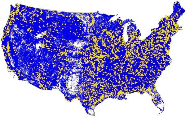 The new National Water Model will provide river forecast guidance at 2.7 million locations (in blue), complementing the 4,000 locations (in yellow) where National Weather Service river forecasts are currently issued. (Credit: NOAA)

Hailed as a game-changer for predicting floods and informing water-related decisions, a newly developed forecasting tool simulates how water moves throughout the nation’s rivers and streams, paving the way for the biggest improvement in flood forecasting the U.S. has ever seen.
Developed by the U.S. National Oceanic and Atmospheric Administration (NOAA) and its partners, the new the National Water Model tool runs on NOAA’s new Cray XC40 supercomputer, using data from more than 8,000 U.S. Geological Survey gauges to simulate conditions for 2.7 million locations in the contiguous United States. The model generates hourly forecasts for the entire river network. Previously, NOAA was only able to forecast streamflow for 4,000 locations every few hours.
NOAA said the model also improves its ability to meet the needs of its stakeholders, such as emergency managers, reservoir operators, first responders, recreationists, farmers, barge operators and ecosystem and floodplain managers, with more accurate, detailed, frequent and expanded water information.
The U.S. has experienced a number of disastrous floods in recent years, including the ongoing flooding this week in Louisiana, accentuating the importance of more detailed water forecasts to help people prepare, NOAA said.
“With a changing climate, we’re experiencing more prolonged droughts and a greater frequency of record-breaking floods across the country, underscoring the nation’s need for expanded water information,” said Louis Uccellini, Ph.D., director of the National Weather Service. “The National Water Model will improve resiliency to water extremes in American communities. And as our forecasts get better, so will our planning and protection of life and property when there’s either too much water, too little, or poor water quality.”
The announcement fulfills a commitment President Obama made to the American public on World Water Day in March. In a White House statement, he called for “cross-cutting, creative solutions to solving the water problems of today, as well as innovative strategies that will catalyze change in how we use, conserve, protect and think about water in the years to come.”
Initially, the model will benefit flash flood forecasts in headwater areas and provide water forecast information for many areas that currently aren’t covered. As the model evolves, it will provide “zoomed-in,” street-level forecasts and inundation maps to improve flood warnings, and will expand to include water quality forecasts.
“Through our partnership with the research, academic and federal water community, NOAA is bringing the state-of-the-science in water forecasting and prediction to bear operationally,” said Thomas Graziano, Ph.D., director of NOAA’s new Office of Water Prediction at the National Weather Service. “Over the past 50 years, our capabilities have been limited to forecasting river flow at a relatively limited number of locations. This model expands our forecast locations 700 times and generates several additional water variables, such as soil moisture, runoff, stream velocity, and other parameters to produce a more comprehensive picture of water behavior across the country.”
The underlying technology for the model was developed by the National Center for Atmospheric Research (NCAR). NOAA developed and implemented the model along with NCAR, the Consortium of Universities for the Advancement of Hydrologic Sciences, the National Science Foundation (NSF) and federal Integrated Water Resources Science and Services Consortium partners.