3D Models of Newly Discovered US WWII Sub


-
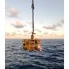
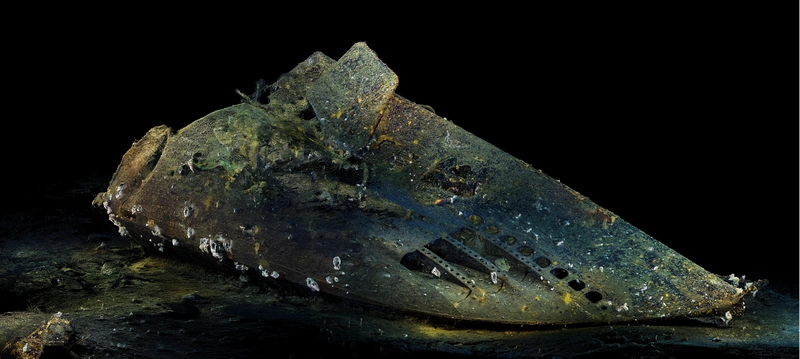 Photo courtesy of Viewport3
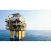
-
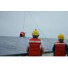
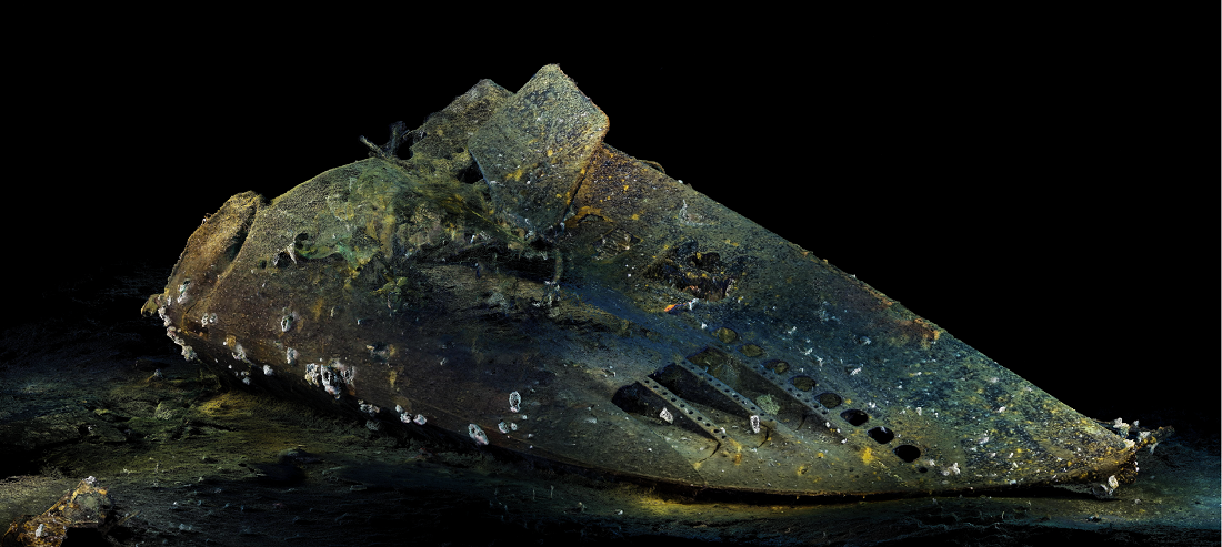
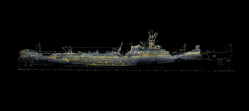 Photo courtesy of Viewport3
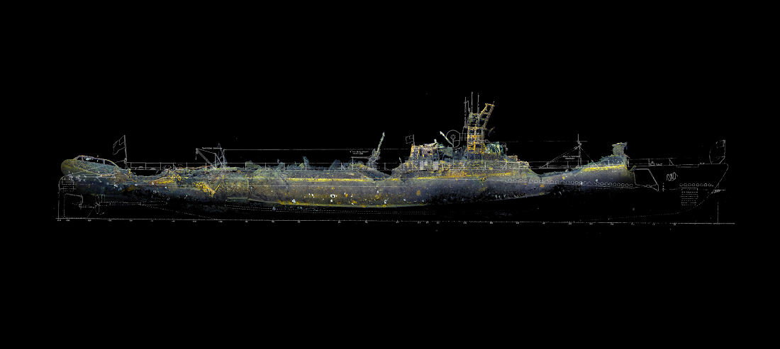
Aberdeen-based subsea 3D scanning specialists, Viewport3, have been collaborating with an eminent international explorer, Tim Taylor to process pioneering underwater 3D scans on the bow and stern of a US submarine which was lost in 1942.
Viewport3 were contracted by Tim Taylor, CEO of New-York based Tiburon Subsea Services and founder of Ocean Outreach Inc, as part of his ongoing “Lost 52 Project”, which he states, “honors the men, their memory and their mission”. The project is responsible for discovery and mapping of 4 out of 8 of the US WWII submarines located to date.
The ‘Lost 52 Project’ thoroughly mapped and filmed the site of the USS Grunion at the end of last year. The team located the missing bow section a quarter of a mile away 300 feet above the main wreckage, off the island of Kiska, Alaska. The discovery completes the mission undertaken by the sons of the submarine’s captain – Mannert L. Abele 12 years ago.
As an aid to the understanding the submarine’s last moments, Viewport3 ‘fused’ the 3D data with the high intensity side scan sonar provided by the customer, showing the relative locations of both parts and surprisingly, the slide made by the stern as it slid down the side of an underwater mountain.
USS Grunion (SS-216) was a Gato-class submarine commissioned on April 11, 1942. On her way through the Caribbean to her first posting in Pearl Harbor she rescued 16 survivors from USAT Jack, which had been torpedoed by a U-boat. Her first war patrol was, unfortunately, also her last. Sent to the Aleutian Islands in June 1942, she operated off Kiska, Alaska, where she sank two Japanese patrol boats. Ordered back to the naval operating base in Dutch Harbor, Alaska, on July 30th, the submarine was never heard from again. She was declared overdue from patrol and assumed lost with all hands, on October 5th, 1942.
Viewport3 have been working with Mr. Taylor to process and develop technical-grade 3D data-sets of the USS Grunion’s bow for use in virtual and augmented reality outreach, educational programs and applications. Viewport3 specialize in providing underwater photogrammetry services - using ROV or diver mounted cameras to obtain highly accurate point-cloud data, which can then be measured, compared, assessed, exported and in this instance, to educate
Viewport3 worked on the extensive project over a period of 4 months, processing 25 hours of HD video of varying quality, frame by frame. The total input for the project was a staggering 5.3 trillion pixels. Co-director of Viewport3, Chris Harvey, developed several new methods of using digital imagery in order to transfer the data into 3D geometry, and process it to create 3D outputs that can be studied and shared globally, without the need to be on-site.
Mr Harvey said: “Using our photogrammetry technology as a digital in-situ preservation technique offers numerous benefits - non-destructive inspection of the site, optimal resource management and an inexpensive capture technique compared to other 3D recording technologies. “We can capture precise, technical-grade results which produce visually correct outputs, whether we are working in archaeology or with operators and marine contractors in the oil and gas industry.
“The work that Mr. Taylor is conducting, coupled with our technology and expertise, is making a wealth of information available across different industries, and opening the door on discovery and expeditions at these unique locations.”
Tim Taylor said: “Viewport3’s proprietary scientific approach extracts geometric information from equipment that is already integrated in most of the modern underwater remote filming systems. It is revolutionary. Spending a short time on site collecting a comprehensive 3D historical baseline model allows archaeologists and historians to spend months back in the lab performing detailed archaeological work. This truly is the future of underwater archaeology. We hope this latest data – with its unprecedented accuracy – will help us to explain what happened to the USS Grunion, as well as honor the entombed sailors.”
Viewport3 specialize in providing underwater 3D scanning and reverse engineering services - using ROV or diver mounted cameras to obtain technical grade point-cloud data, to allow integration and analysis of subsea infrastructure, which in turn informs measured, accurate decision-making.