Trimble to Distribute Teledyne's PDS Software
Trimble partners with Teledyne Marine to distribute its software for construction, hydrographic survey and dredging operations
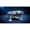
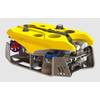
A new agreement will see Trimble distribute a branded version of Teledyne's PDS software package for hydrographic survey, construction and dredging operations—Trimble Marine Construction Software. The software provides measurement and positioning to improve marine construction efficiency and safety.
According to Trimble, its Trimble Marine Construction Software expands its portfolio and extends its connected approach for marine construction companies to enable accurate and robust real-time 3D visualization applications. The software combined with 2D and 3D sonar provides underwater vision in challenging inshore underwater environments and conditions.
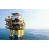
Construction applications for Trimble Marine Construction Software include dredging, cable lay applications, monopile placements, building breakwaters, windmill parks, pipe lay monitoring, rock dumping, excavating, barge management and more.
Dredge applications for the software support hydraulic excavators, wire cranes, bucket dredgers, underwater ploughs, trailing suction hopper dredgers (TSHD) and cutter suction dredgers. The software provides real-time visualization of the dredge head or excavator bucket essential for precise operations to avoid over-dredge or rework. With Trimble Marine Construction Software, the operator can see the actual versus planned surface in 3D, profile and long-section views. It guides the operator to the desired surface and determines the cut or fill to provide a market-leading dredging solution.
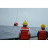
Hydrographic applications for the software include measuring the seafloor or riverbeds for hazardous areas, dredge progress tracking, revetment surveys, maintenance surveys and safe navigation.
The software provides real-time sensor data gathering, computation, display and logs. The data can be displayed either graphically or alphanumerically. It has options to verify the data, remove anomalies and outliers, either manually or automatically. The clean data can be presented in the form of models, tables, files, volumes, nautical charts or reports.
"Trimble's leading machine positioning technologies combined with Teledyne's leadership in subsurface sensing and marine software provide an innovative and ideal solution for marine construction contractors," said Scott Crozier, marketing director of Trimble's Civil Engineering and Construction Division. "Trimble Marine Construction Software extends our solutions to include real-time 3D visualization of the dredge head or bucket with support for scanning sonars to provide the actual as-built surface for more efficient operations."
"Trimble Marine Construction Software is leveraging more than 30 years of Teledyne's global software expertise for both inshore and offshore construction," said William Egan, vice president of Global Imaging Sales & Marketing -Teledyne Marine. "Teledyne Marine is proud to partner with Trimble to provide the robustness Trimble's customers expect in addition to enabling them to integrate the world's most advanced acoustic sonars into their overall solution. Trimble's global distribution network can accelerate implementation of this technology worldwide."