USACE Survey & Mapping Employees Awarded for USV Innovation
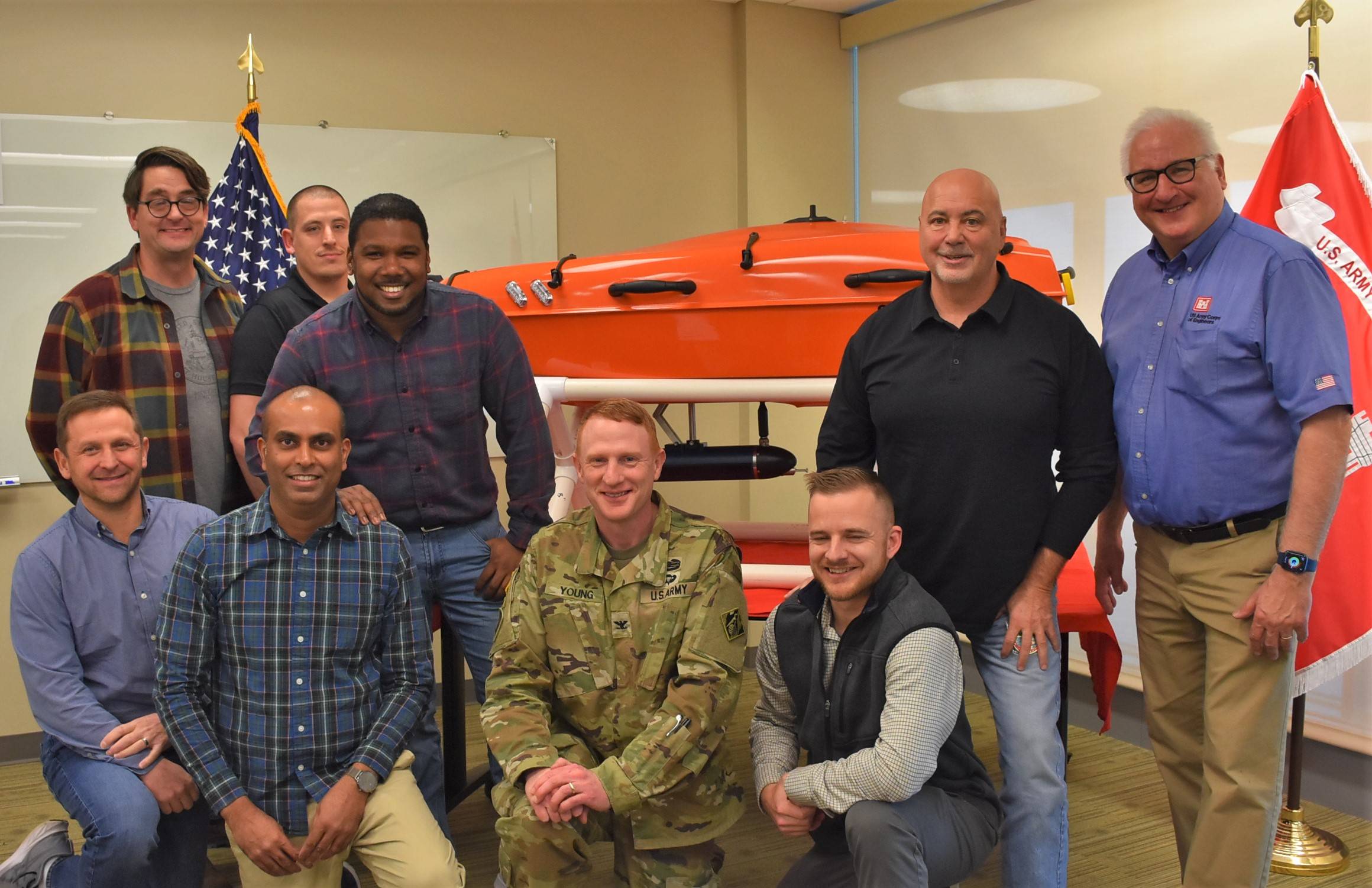
New York District Survey and Mapping Branch employees with New York District Commander Col. Alexander Young and SURVEYOR AMY, an award-winning USV. Left to right, kneeling: John Mraz, Pradeep Bhadur, Col. Young and Joshua Sagona; left to right, standing: Bryan Higgins, Christopher Aballo, Miguel Surage, Survey and Mapping Branch Chief Francis Postiglione and Operations Division Chief Randall Hintz. (Photo: USACE)
U.S. Army Corps of Engineers’ employees in the New York District’s Survey and Mapping Branch, Operations Division, have been recognized with the 2023 Innovation of the Year Award from Army Corps Headquarters in Washington, D.C., a national honor recognizing outstanding accomplishments in engineering forwarding the mission and serving the Nation.
A team of 36 employees planned, designed and built SURVEYOR AMY, a 6.5-foot unmanned craft that can travel at 16 knots and collects hydrographic survey data ─ measuring the physical features of bodies of water and adjacent land areas, including depth of water and configuration of the sea floor. This information is critical for planning, designing, constructing and monitoring the District’s many coastal-storm risk-management projects that reduce flood risk to shoreline communities in New York and New Jersey.
District Commander Col. Alexander Young said, “I’m extremely proud of all employees contributing to this project. Their dedication, expertise and persistence has resulted in a true engineering marvel that greatly benefits New York’s missions. This is teamwork at its finest.”
The unmanned craft, operating for nearly six months, has capabilities beyond coastal-storm risk-management: it can gather data for dam safety, levee and bridge inspections, and in remote, shallow-water locations that are inaccessible by boat. AMY also helps during emergencies: it can be up and running and ready to collect data in a matter of hours, expediting project assessments after severe storms.
The craft’s multi-beam system can collect up to 20,000 points of data per second along the sea floor in high-resolution, three-dimensional detail ─ something beyond the capabilities of survey vessels ─ providing more data in a shorter period of time than could previously be accomplished. A multi-beam sonar system maps the sea floor emitting acoustic waves; the amount of time it takes for the sound waves to return to the receiver calculates the water depth. This system also extracts directional information from returning soundwaves ─ producing a wide swathe of depth soundings.
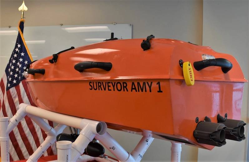 SURVEYOR AMY, a 6.5-foot unmanned survey vessel recognized for national honors by U.S. Army Corps of Engineers’ Headquarters in Washington, D.C. (Photo: USACE)
The idea was in the making for over a decade, as Army Corps survey customers increasingly required critical data in the surf-zone and remote shallow-water areas. (The surf zone is a narrow strip of land/shells on the beach between low- and high-tide lines.) As the requirements for an unmanned craft expanded along with the work of the Survey and Mapping Branch ─ the challenge was designing and building a craft that could gather information safely, accurately and efficiently.
Trials and research were conducted to design and construct a vessel with a sonar system (sound waves that measure distance) with the size and performance standards required. Once a platform was determined, it was constructed in six months’ time. This team effort incorporated decades of employee’ experience in hydrographic survey techniques and knowledge of survey-collection platforms. Integrating these systems on a marine vessel to withstand environmental challenges was a process staff were familiar with.
One unique aspect of AMY is its ability to right itself when marine conditions cause it to flip over. This was accomplished by using a lightweight, rigid hull design powered by twin jet-drive systems. Should the craft capsize, the water-tight structure teamed with a hydrodynamic hull and low center of gravity enable it to right itself back into position.
Leading the team for AMY was Francis Postiglione, a long-time Army Corps employee and Chief of the Surveys and Mapping Branch. He noted the collaborative nature of the project: Many formal meetings were held with manufacturers along with informal staff conversations during lunch hour and break times. The entire Branch was involved in some capacity, drawing on diverse skill sets.
The unmanned craft has the following specifications:
- Size: 24” width x 78” length
- Speed: 16+ knots
- Weight: 150 lbs.
- 2.5 hours survey time on single battery pack
- Multi-beam and side-scan survey system.
Chief of Operations Division Randall Hintz said, “I could see early on they [employees] we’re creating something very special. I encouraged the team to enter the Army Corps competition. Sure enough, the project was recognized for the engineering feat it is. Overall, it’s a great addition to the capabilities of Operations Division and the District in general.”
AMY is equipped to plan missions in advance in an office or other controlled setting. Transported to project sites by survey vessels, once launched, it autonomously collects data via a sonar system (sound waves that measure distance). Given its capability to collect data from a much larger area then survey vessels alone, it significantly increases efficiency.
There were a number of challenges constructing the craft. One was incorporating the requirements of each piece of equipment inside the vessel ─ a very small area. This was true with the tight, compact platform of the multi-beam system due to its size and weight. This obstacle was overcome by creating a system enabling the craft to right itself to avoid damaging sensors or equipment.
Another challenge was discovering how the vessel and sonar reacted in choppy water. It was found that the sonar was coming out of the water and affecting the data. To overcome this, within the size requirements of the vessel, a retractable arm for sonar was constructed and attached to the outside of AMY to accurately collect data.
While Surveyor Amy was created to meet requirements and better serve customers, the end product has created new possibilities about how survey work is performed. The goal for this technology is to become a force multiplier ─ increasing versatility and efficiency while working safely.