Bathymetric Drone Survey with Multisensor Tech


-
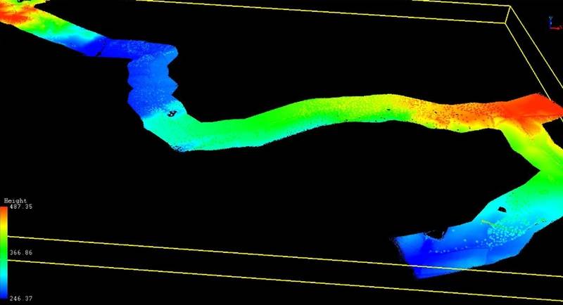 Image courtesy SPH Engineering
-
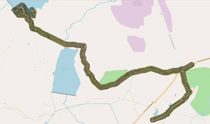 Visualization of the photogrammetry data of the corridor, processed with QGIS software. Image courtesy SPH Engineering
-
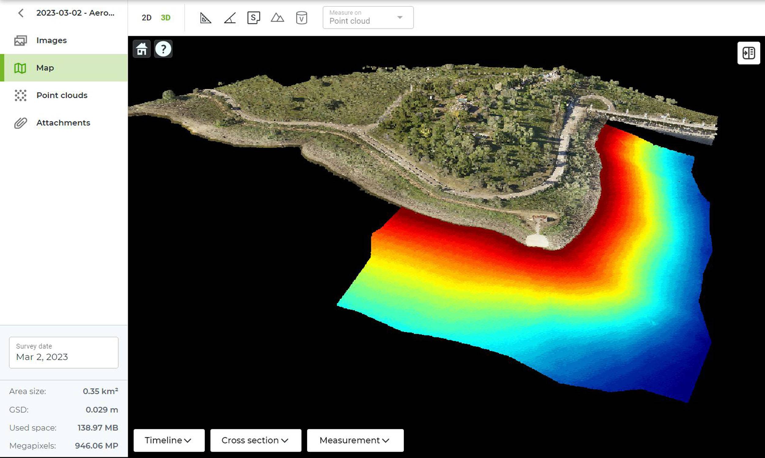
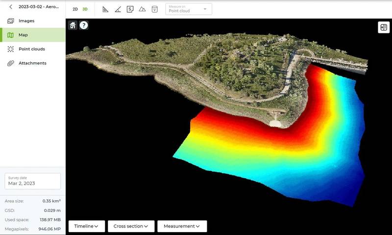 Visualization of bathymetry (from echo sounder) data combined with a colorized point cloud, processed in DroneGIS software. Image courtesy SPH Engineering


Aeromedia U.A.V., S.L., a Spanish company specializing in aerial survey technologies, recently undertook a project involving a comprehensive survey of a 10-km-long corridor in the reservoir Logrosan-Caceres. The project aimed to showcase the power of integrating multiple survey technologies, including LIDAR, high-resolution photogrammetry, and an airborne echo sounder system developed by SPH Engineering, particularly for mapping terrestrial and underwater terrains.
The work aimed at the topography of a water catchment and discharge area near the Ruecas reservoir in Cáceres. LiDAR+RGB techniques were combined in the terrestrial area and the ECT 400S single-beam bathymetric probe in the reservoir area. The bathymetry of about 9 hectares took one day, and the LiDAR flights took one morning. Our client obtained several cartographic products, such as DEMs and point clouds.
The Challenge
The main expectations regarding drone-based solutions were acquisition speed and the captured data's final reliability. The primary challenge was conducting a detailed survey that accurately covered terrestrial and underwater areas. Traditional methods often require separate systems for land and underwater surveying, complicating data integration and increasing project time and cost. Moreover, the need to survey under vegetation and achieve depths of up to 100 meters underwater demanded a solution that could provide exceptional precision and versatility.
The Multisensor Solution
Aeromedia utilized an innovative approach to address these challenges by integrating three technologies.
This multi-sensor solution enabled the team to measure the Earth's surface seamlessly, capturing accurate information from the Digital Terrain Model (TDM), even in areas covered by vegetation, and extending to underwater environments up to depths of 100 meters.
The first was LIDAR (Light Detection and Ranging) technology to capture highly accurate 3D terrain data along the 10-kilometer corridor. LIDAR is renowned for penetrating vegetation and providing detailed elevation information, making it an ideal choice for this project.
The second solution was high-resolution Photogrammetry: Combined with LIDAR, photogrammetry played a crucial role in capturing detailed surface imagery. This technology enabled the creation of precise 3D models and orthomosaics, allowing for a comprehensive understanding of the area's topography.
Last but not least is the airborne Echo Sounder System. The underwater component of the survey was accomplished with an airborne echo sounder system provided by SPH Engineering. This system could capture submerged topography up to 100 meters, enabling the acquisition of valuable data from the reservoir's depths.
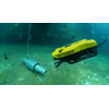
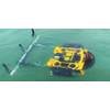
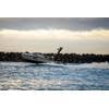
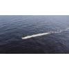
 Single-frequency Echo Sounder ECT400 integrated with DJI M300 drone during the bathymetric survey. Image courtesy SPH Engineering
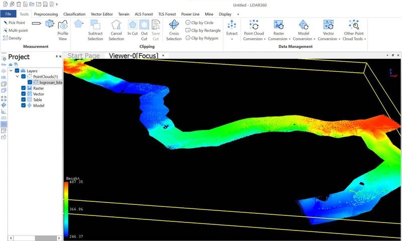 Visualization of LIDAR data of the corridor, processed with LIDAR360 software. Image courtesy SPH Engineering