Case Study: High Accuracy Survey under Bridges


-
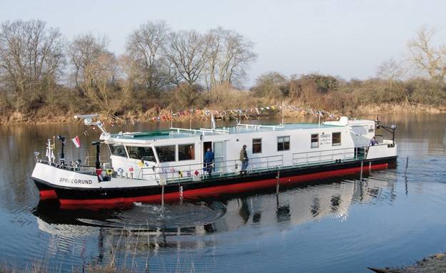 Spreegrund (Photo: SBG Systems)
-
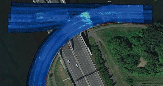
 Google Map Image (Photo: SBG Systems)
-
 Overlapling: 95% Confidence (Photo: SBG Systems)
-
 Seafloor (Photo: SBG Systems)
-
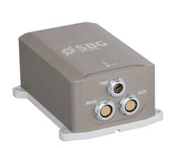 Apogee-E High Accuracy INS (Photo: SBG Systems)


Client: WSA Berlin
Application: Hydrography/Charting
Product: Apogee-E Inertial Navigation System
Project: Multibeam echo sounder stabilization and data georeferencing
The vessel Spreegrund, property of WSA Berlin, has been equipped by MBT, part of MacArtney group, with state-of- the-art equipment including the Apogee-E, the highest accuracy inertial navigation system from SBG. One of the main goals was to obtain very good results when surveying under bridges.
The catamaran survey vessel named Spreegrund serves as survey vessel on German lakes, adjacent canals and rivers (Berlin, Brandenburg, Eberswalde and Lauenburg). It carries out complete surveys at speeds of up to 6 knots and water depths down to 20 meters.
State-of-the-art Hydrography Equipment
The onboard equipment features the fi rst Teledyne RESON T20-P TripleHead multibeam echo sounder providing an excellent swath coverage even in very shallow water environments such as rivers and canals. This set up allows users to survey large areas in a short time. Additional sensors include a Teledyne ODOM CV 100 single beam echo sounder, a Teledyne RDI Navigator DVL and a Valeport SWiFT as well as a Valeport Ultra SV sound velocity sensor. Besides this, the SBG Apogee-E inertial navigation system has been supplied together with two ObeLx-R GNSS heading receivers (Septentrio boards inside) which enable good position acquisition even under poor GNSS environments, e.g. under bridges. The ObeLx-R receivers, manufactured by MBT, MacArtney Germany, and the DVL are connected to the inertial navigation system to get stable position data. The data acquisition software QINSy stores and visualizes all information.
The onboard control system and software work to ensure optimal data acquisition from the survey sensor suite. It is capable of handling enormous data stream of up to 25,000 soundings per second.
Charting Under Bridges with the Apogee INS
Surveying under bridges is a challenging application that fully requires the fusion between inertial and GNSS data. Indeed, GNSS receivers are perturbed when vessels are crossing bridges and may cause outages or incorrect data. In the case of WSA Berlin, this is a day-to-day challenge, explaining why MBT chose an Apogee-E inertial navigation system connected with their own Dual-antenna GNSS receiver (Septentrio inside). “We needed the highest accuracy INS to maintain the very high precision of the overall equipment,” states Alexander Schmidt from MBT.
Combination of Inertial, GNSS and DVL Data
The Apogee-E is the highest accuracy inertial navigation system from SBG. It provides outstanding roll, pitch and heave data and is the only INS of its category to fuse in real-time inertial data with an external DVL and two GNSS receivers. Data are fused to generate outputs for motion compensation and georeferencing. “DVL input in the Apogee-E is a big advantage. It helps for realtime GNSS outages, especially under bridges,” adds Alexander. When GNSS outages occur, the Apogee-E is able to maintain the position in real-time. Its performance is even better when aided by a DVL. The INS integrates velocity data to the internal algorithm to reduce the inner drift of the IMU. “We obtained excellent results with the Apogee-E, the images speak for themselves,” concludes Alexander Schmidt, Technical Sales Manager at MBT, MacArtney.
Apogee-E Features
- 0.008° Roll & Pitch
- Up to 0.025° GNSS Heading using two antennas
- 5 cm Heave, 2.5 cm Delayed Heave
- Post-processing
- Compact and cost-effective solution
- GNSS & DVL aided