Zupt, LLC is a recognized leader in the development and deployment of advanced inertial navigation and positioning solutions for offshore applications. The company specializes in inertial subsea jumper/spool metrology, remote survey operations, offshore wind installations, 3D subsea modeling, and innovative subsea monitoring solutions.
All core technologies are developed in-house, ensuring both innovation and quality control. Key offerings include the C-PINS subsea inertial navigation system, the iRTS Integrated Robotic Total Station for monopile installation, and 3D Recon technology for subsea 3D modeling. Zupt’s solutions consistently reduce vessel time, improve operational accuracy, and minimize offshore risk.
Zupt delivers advanced subsea technologies and services across offshore energy, marine construction, and subsea inspection. Our proprietary C-PINS inertial navigation system has been deployed in over 350 metrologies, offering highly accurate and efficient subsea measurements for jumper and spool tie-ins as an alternative to traditional acoustic methods.
With Remote Metrology Services, our expert surveyors guide offshore measurements from onshore, reducing vessel time and lowering project costs. For the renewables sector, Zupt’s Integrated Robotic Total Station (iRTS) has been successfully deployed in offshore monopile installations, providing precise, real-time positioning data. Our 3D Recon technology creates dense, georeferenced point clouds for subsea modeling and digital twin generation, supporting high-precision navigation. Additionally, HaloCAM enables contactless subsea structure positioning by combining inertial navigation with high-definition imaging, ideal for offshore construction and inspection. Learn more at zupt.com.
Products
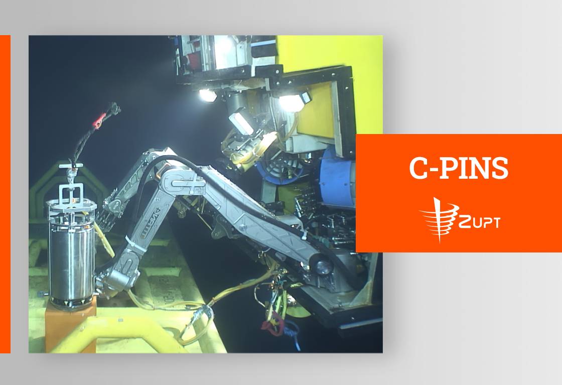
C-PINS
Zupt C-PINS
[Category: Subsea Survey and Metrology]
Zupt’s C-PINS is a high-accuracy subsea metrology tool that delivers fast, reliable, and cost-effective results without the need for traditional acoustic arrays. Designed for use at depths of up to 4,000 meters, it integrates an inertial measurement unit (IMU), pressure sensors and performs precise measurements of subsea structures. Its compact size, single ROV connection, and quick deployment make it well suited for jumper metrology, and buoy demarcations. C-PINS can complete full metrology surveys in as little as 6 to 10 hours, with processed data delivered within 24 hours. This helps offshore teams reduce vessel time, improve accuracy, and make timely operational decisions.
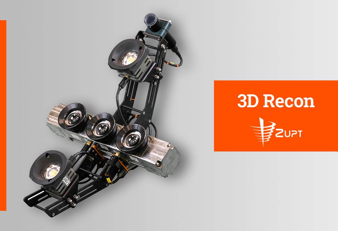
3D Recon V2
Zupt 3D Recon V2
[Category: Subsea Inspection and 3D Data Visualization]
Zupt's 3D Recon V2 is a compact subsea stereo imaging system rated to 4,000 m. It integrates high-resolution machine vision cameras and a MEMS INS/IMU in a single titanium housing. This tight integration enables the creation of real-time sparse point clouds for navigation and quality control, as well as high-density, geospatially accurate 3D models (with ~1:1000 scaling and sub-millimeter resolution at 2 m offset). Designed for integrity management, inspection, jumper/spool metrology, mooring chain link surveys, hull inspection, pipeline out-of-straightness checks, as-built documentation, and relative-to-structure positioning. 3D Recon V2 empowers engineers to make informed decisions about subsea asset integrity efficiently.
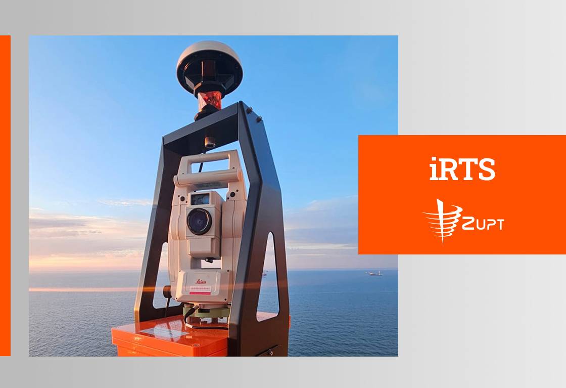
Integrated Robotic Total Station (iRTS)
Zupt iRTS
[Category: Offshore Surveying and Installation Support]
Zupt’s iRTS is a high-accuracy automated prism tracking system capable of tracking targets up to 400 meters away. The integrated unit combines a robotic total station, inertial measurement unit (IMU), and RTK GNSS to provide absolute positioning of the prism mounted on the hammer, along with real-time calculation of monopile penetration rate. Designed specifically to support monopile installation on DP vessels, iRTS delivers time-tagged data with a known time of validity for each measurement, ensuring precise tolerances are maintained throughout the operation.
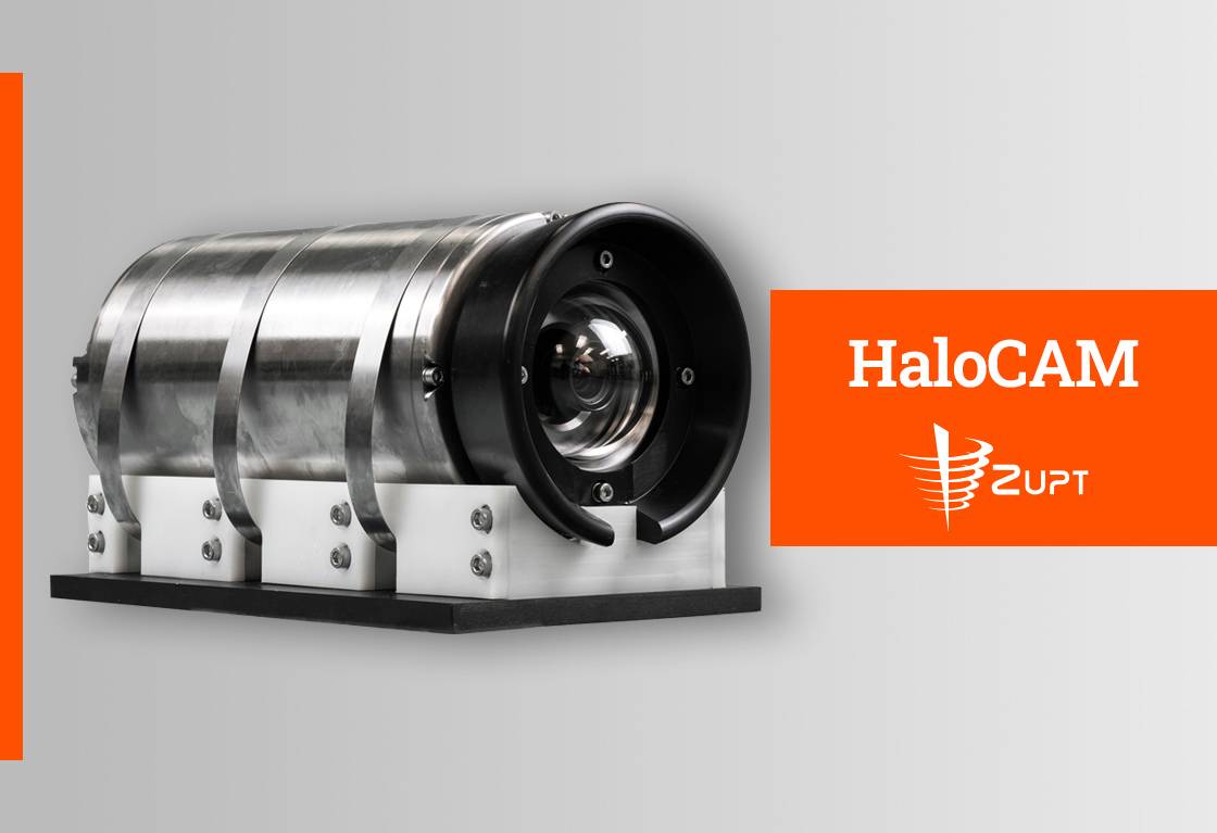
HaloCAM
Zupt HaloCAM
[Category: Real-Time Subsea Visualization]
Zupt’s HaloCAM is a compact, contactless subsea system designed for precise verticality determination of piles and conductor casings in oil and gas and renewable energy projects. It integrates a high-definition subsea camera with a navigation-grade inertial sensor to provide accurate pitch, roll, heading, and position data without requiring mechanical contact. Mounted on an ROV and operating at close range, HaloCAM delivers real-time, high-resolution data to confirm structure verticality during installation. Its main role is to ensure verticality quickly, safely, and reliably, while also supporting absolute structure positioning when combined with acoustic positioning systems.
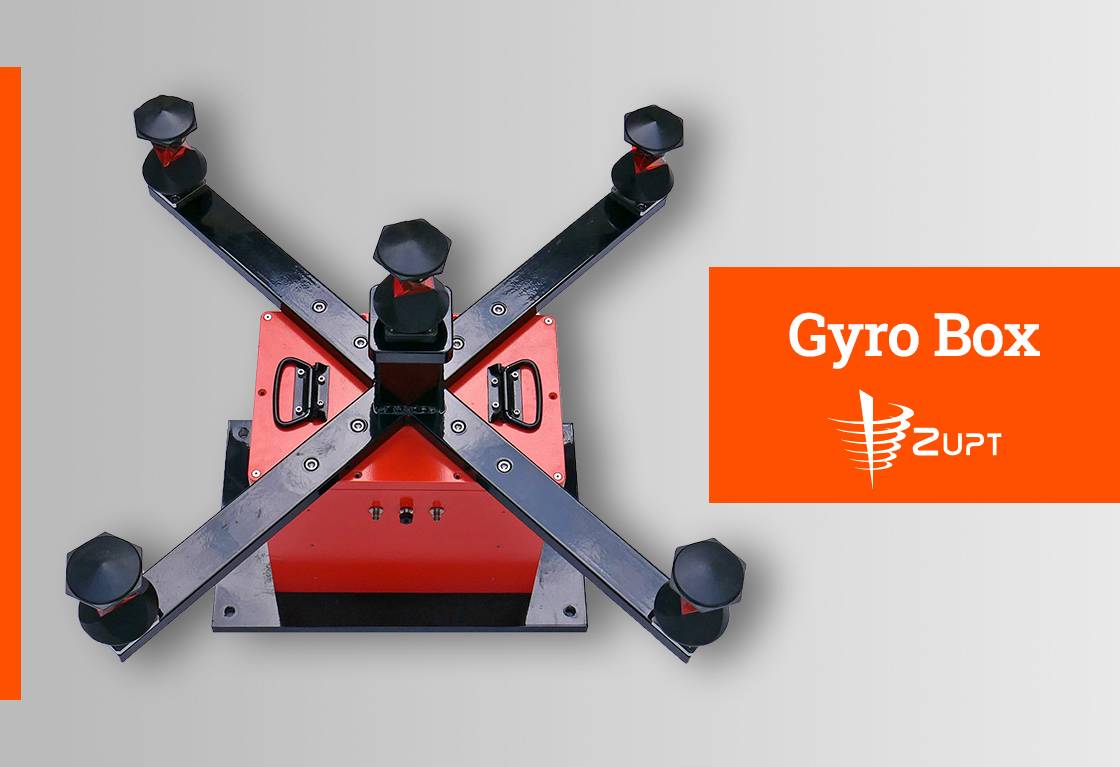
Gyro Box
Zupt Gyro Box
[Category: Precision Alignment and Attitude Measurement Systems]
Zupt’s Gyro Box delivers accurate heading, pitch, and roll data essential for offshore wind installations. Its compact and easy-to-deploy design enables crews to quickly align monopiles and transition pieces without bulky equipment or lengthy setup. Built rugged to withstand harsh offshore environments, the Gyro Box provides reliable real-time data, giving teams confidence during critical installation steps. It also allows easy dimensional control to a known point on the transition piece when the TP flange is not visible or available for direct leveling. Whether accelerating installation or minimizing rework, the Gyro Box is a practical solution that keeps offshore wind projects on track.
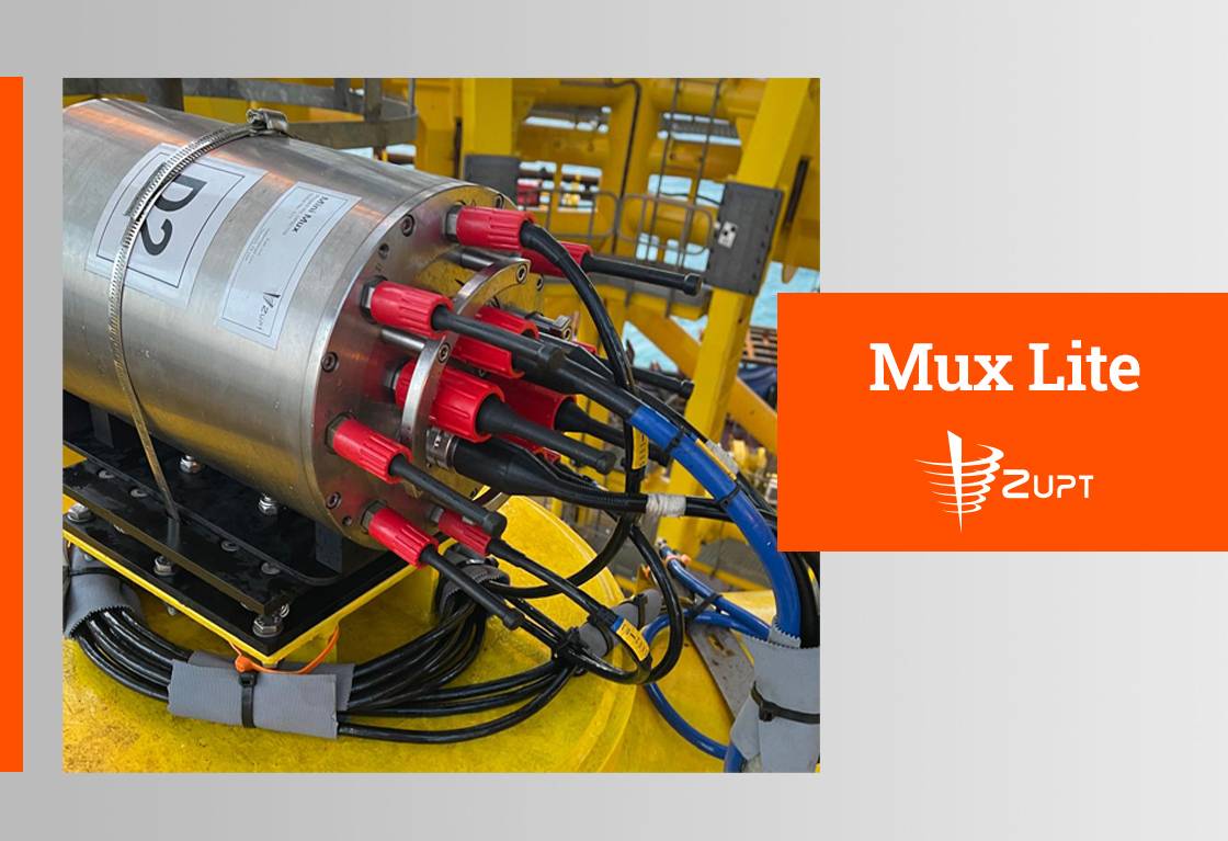
Mux Lite
Zupt Mux Lite
[Category: Subsea Data Management and Sensor Networking]
Zupt’s Mux Lite is a compact subsea multiplexer with serial and analog ports, designed as a simplified, cost-effective, and space-efficient solution. Its user-friendly web interface removes the need for complex topside units, requiring only a computer and 10GB Ethernet switch on the surface vessel for data communication. The Mux Lite reliably transfers fiber optic data through a single cable from subsea sensors to the surface and includes an additional fiber port on the top end cap to allow daisy-chaining multiple units for expanded subsea networking.
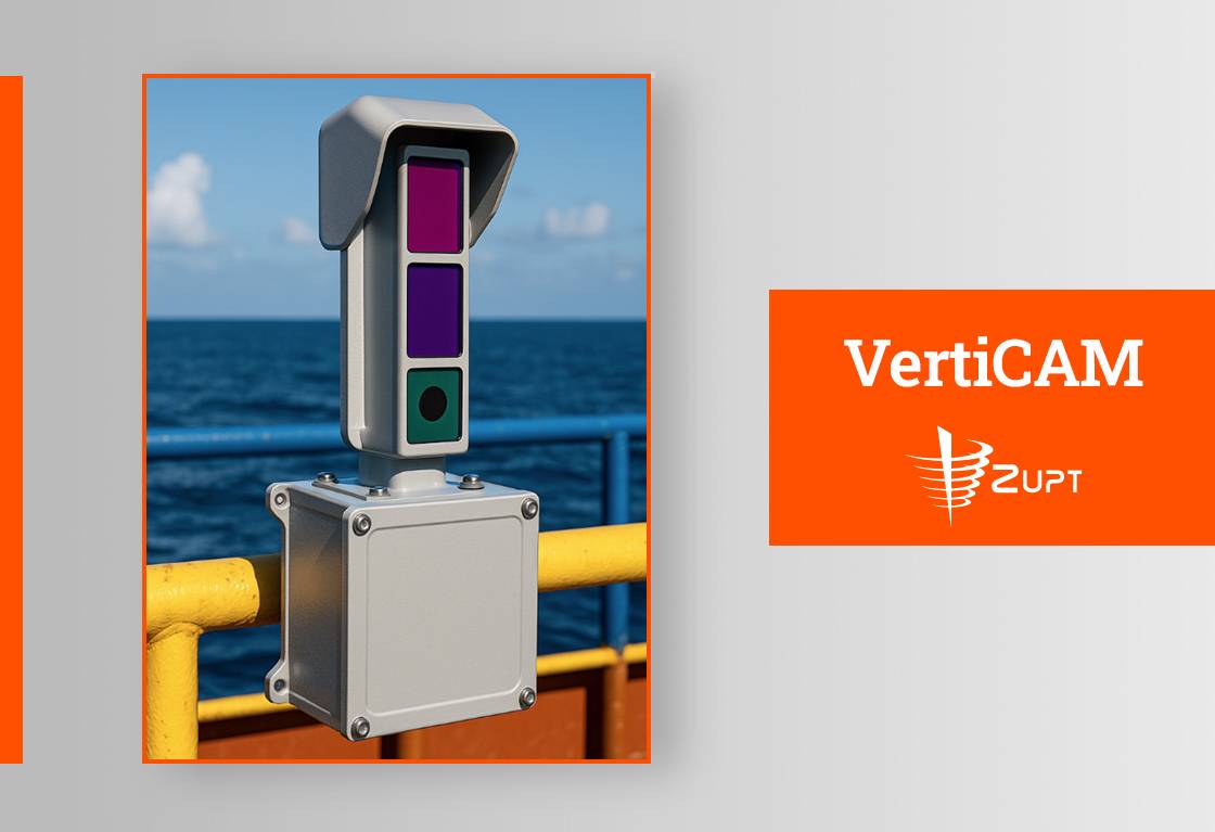
Zupt’s VertiCAM offers a simple, visual way to determine monopile verticality in real time.VertiCAM is a ruggedized Lidar-Camera system tightly coupled to an Inertial Navigation System designed to provide real time data on the verticality of a monopile during the driving process. With an easy-to-read interface, installation teams can instantly interpret the pile’s heading and inclination from the deck or the bridge
Whether used as a standalone check or integrated alongside Zupt’s iRTS system for pile run monitoring, VertiCAM helps improve decision-making. It allows engineers and offshore personnel to observe changes in tilt and make immediate adjustments to ensure alignment with project tolerances.
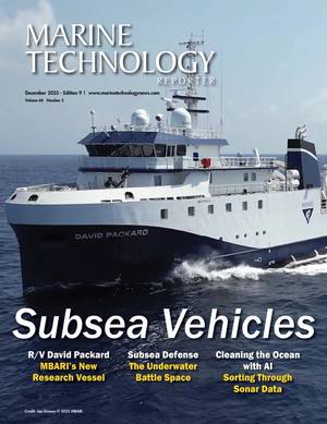
Marine Technology Reporter is the world's largest audited subsea industry publication serving the offshore energy, subsea defense and scientific communities.
Marine Technology ENews is the subsea industry's largest circulation and most authoritative ENews Service, delivered to your Email three times per week