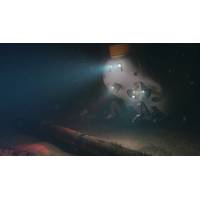
Harvest, 3D at Depth Team in North Sea Project
Group Limited completed a milestone project in the North Sea, partnering with LiDAR technology provider 3D at Depth to deliver remote metrology services for a global subsea services company. The entire operation was conducted with less than 1Mbs of bandwidth and usedboth 4G (broadband cellular network) and VSAT (two-way satellite) connectivity. “We chose Harvest because the technology provides high-fidelity, two-way audio communications, frame-synchronized video, and optimal bandwidth efficiency. This was essential in providing our remote personnel onshore with the situational
On-Demand, Continuous Eelgrass Monitoring
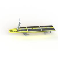
, a new moon pool has been introduced, allowing the sensor to be mounted vertically, with just the sensor cage and probes below the hull. A copper mesh around the probe cage will slow fouling and prevent weed from entering the cage.Communications: The cell coverage in DKP is excellent, and the cellular network was an ideal solution. For the scientists, the mission was a first step at using a moving sensor on an unmanned vessel in a large, complicated embayment.Data: The YSI sensor and the SeaTrac ASV provided a successful combination to collect water quality data. Being able to monitor
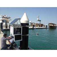
New Tide Gauge, Water Temperature Monitoring Network in UAE
VRS-20 Radars with water temperature being measured using PT100 sensors from General Acoustics. All equipment is solar powered and housed in Valeport's TideStation enclosures. Communication with the stations is being handled using the Smart Telemetry Unit, the ip.buffer, from OceanWise over UAE's cellular network. All scientific and system data is being sent to servers located at Bayanat's offices in UAE. The servers are running Microsoft SQL Server and OceanWise's Ocean Database and Port-Log System software. The servers were supplied by Seatronics and installed by OceanWise who also provided
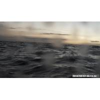
Ocean Drone Live-tweeting Hurricane Iselle
As Hurricanes Iselle and Julio approach the Big Island of Hawai'i, Liquid Robotics’ Wave Glider, named Holoholo, is swimming near Kawaihae Harbor north of Kona, in the path of the storm. Not only is the glider navigating through the impending storm, it is also tweeting photos as it develops. Check out the latest photos and weather reports at https://twitter.com/Holoholo_WG. The waves are getting big! The Wave Glider Holololo is communicating via cellular network. If the hurricanes impact the cellular towers, Liquid Robotics may be offline. liquidr.com


