Inside the new UK Center for Seabed Mapping
fill the gaps, Parker said the big shift was the move to multibeam echo sounders and bathymetric LiDAR systems, which unlike that single beam isolated profile, generates a full picture of the seabed, said Parker.“I think the second pick is a fairly obvious one for me, the advent of global navigation satellite systems,” said Parker. “It's easy to forget that GPS on your phone or GPS on your ship is a relatively recent thing. When I started in the '90s, the United States GPS was just starting to become available for civil use, but it was limited in terms of its constellation.&rdquo
Autonomous Navigation – with or without GNSS
as an opportunity to reduce cost, risk to humans and our carbon footprints.But they don’t come without challenges. Because they’re unmanned and require control remotely, we are even more reliant on having accurate navigation systems onboard and currently that largely rests on Global Navigation Satellite Systems (GNSS).As a primary navigation source, GNSS is well used, but there are conditions where purely relying on it could create some risks. This could be where line of sight to a GNSS constellation is lost while transiting under bridges or through busy harbours, or near significant structures
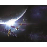
Project to Enable Autonomous Navigation in Denied Environments
A new project involving leading ship technology companies aims to help unmanned autonomous vessels navigate, even when they lose access to global navigation satellite systems (GNSS). The project will combine underwater positioning systems from Sonardyne International Ltd. and Guidance Marine Limited’s relative surface positioning systems into one integrated solution to enable vessels to maintain safe passage in GNSS-denied environments or for dynamic positioning systems to maintain their position if they lose GNSS access or other sensors fail.The AutoMINDER (Autonomous MarIne Navigation in

Shell Ocean Discovery XPRIZE Announcements at OI2018
;Computer Vision Survey of Offshore Structures’ (15.15-15.35) with Diego Carvalho, Vision Engineer, Fugro Intersite; and ‘Towards Resilient Positioning’ (11.20-11.45) with Dr Nick Ward, Research Director, General Lighthouse Authorities of the UK & Ireland. “Global Navigation Satellite Systems have become essential for maritime positioning,” says Dr Ward, “but they are vulnerable to disruption. There is a need for an integrated approach to positioning using all available means.” In addition to the insights provided by the exhibition and main conference
Kongsberg Position Refrence System Integrates GNSS Services
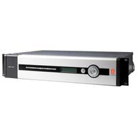
Kongsberg Maritime has expanded its established satellite position reference system portfolio with the introduction of a new system that integrates all available Global Navigation Satellite Systems (GNSS) and all possible correction services. The new DPS 432 combines full decimetre accuracy with high integrity and availability of GNSS data, supporting the safety and efficiency of offshore operations that rely on advanced Dynamic Positioning (DP) systems. DPS 432 integrates signals from GPS, GLONASS, BeiDou and Galileo, and regional correction signals including SBAS (e.g. WAAS, EGNOS, MSAS, GAGAN)
Fugro Awarded a Three-Year Positioning Contract by PGS
marine seismic and electromagnetic services, data acquisition, imaging, reservoir services and multi-client library data. Fugro, a provider of precise satellite positioning to the offshore oil and gas industry, will supply PGS vessels with a number of completely independent Global Navigation Satellite Systems (GNSS). These systems include Fugro’s recently launched Starfix.G4 - the first commercial GNSS service to utilise all available GNSS systems (GPS, GLONASS, Galileo and BeiDou), giving sub-decimetre accuracy - and Starfix.G2+, a global service offering centimeter accuracy in both
FUGRO Upgrades Offshore Positioning Service
station or local transmission link, overcoming the logistical challenges and range limitations associated with coastal RTK systems. The launch of G2+ follows the recent launch of Fugro’s G4 satellite correction service, which is the first to take advantage of all four global navigation satellite systems: GPS, GLONASS, BeiDou and Galileo.
Fugro Launches G4 Service
Fugro has further extended its technology leadership in the field of GNSS augmentation systems for offshore positioning applications with the launch of its G4 service. The new satellite correction service is the first to take advantage of all four GNSS (Global Navigation Satellite Systems): GPS, GLONASS, BeiDou and Galileo. GNSS augmentation services significantly improve position accuracy compared to unaided GNSS receivers, which are commonly used in the consumer sector. By using all available GNSS satellites, Fugro’s G4 service is designed to improve availability and reliability


