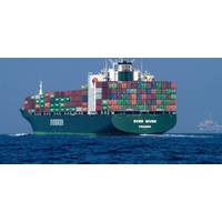
Canada Trials S-100 on St. Lawrence River
digital data that can be added to navigational charts. Unlike traditional paper or electronic charts, the new standard integrates real-time information – like depths, landmarks, tides, and currents into a single, dynamic format.Until November 2025, Canada is offering S-100 digital navigation products and services free of charge to mariners, stakeholders, developers and other interested parties to test performance in real-life scenarios. The complex conditions of the St. Lawrence River, such as varying water depths, changing currents and navigational aids, position it as an ideal testing
NOAA Hires Fugro to Monitor Shoreline Changes in Texas, Louisiana
funding from the federal government related to Hurricane Ida recovery.Mike Aslaksen, Chief of NOAA’s National Geodetic Survey’s Remote Sensing Division stated: “NOAA, through its private sector partners, is excited to provide the mapping data required for updating NOAA navigation products while also benefiting coastal and inland inundation modeling, which is critical to answering coastal resilience needs.”Dave White, Programs Director for Remote Sensing and Mapping Services for Fugro in the Americas, said: “We greatly value our partnership with NOAA and are pleased
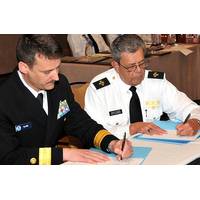
New Members Join NOAA’s Hydrographic Services Advisory Panel
, Carnival Cruise Lines, Miami, Fla. They joined the panel’s 10 current members in February. The panel is seeking five new members for a four-year term that starts January 1, 2019 and runs through 2022. “Improving and maturing the next generation of navigation products and services for increased safety and efficiency of marine transportation is crucial to keep commerce flowing through our nation's ports and waterways,” said Rear Admiral Shepard M. Smith, director, NOAA's Office of Coast Survey. “Panel members give NOAA critical perspectives on
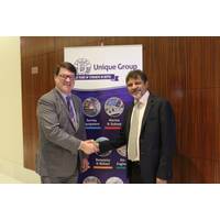
Unique Group, Kongsberg Maritime Restore Partnership
, KSA, Kuwait, Qatar and the UAE. The two companies presently have an agreement in place for Nigeria and Kenya. The Kongsberg Maritime range of underwater mapping products includes the EM 712RD, EM 2040C and 2040P, EA440/EA640, and the Geoacoustics range among others. The underwater navigation products include the HiPAP range of underwater positioning systems and the cNODE underwater positioning transponders. KONGSBERG also provides a range of products and solutions for underwater acoustics that help with search and recovery, marine engineering, security and surveillance and various

MTR100: Greensea
, powers capabilities like inertial navigation, device management, vehicle control, and mission management. And it’s all anchored by the library’s comprehensive health and status management framework. Technology Products Using the OPENSEA operating platform, Greensea provides inertial navigation products (INSpect GS) and vehicle control systems (Balefire) for a full range of autopilots and autonomy. All Greensea products provide a fully integrated platform for vehicles to work as a unified system. Greensea is a small business serving the marine industry, including manned, unmanned
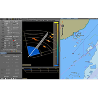
FarSounder 3D Sonar for NACOS Platinum
entered an integration partnership with Wärtsilä SAM Electronics. The partnership will see 3D sonar data from FarSounder’s navigation systems visualized and controlled directly from all NACOS MULTIPILOT workstations. The unique forward-looking capabilities of FarSounder's navigation products add a new dimension of situational awareness to the NACOS Platinum Series. “After working with Wärtsilä SAM Electronics for many years on common navigation projects, we look forward to this integration opening new opportunities for both companies,” said Cheryl
NOAA Offers a New Way to See Currents
is an excellent example of taking the environmental data that U.S.IOOS collects, and putting that information into the hands of people who need it,” said Zdenka Willis, director of the NOAA-led U.S. IOOS Program. “By working to translate that data into an existing suite of real time navigation products and services, we are showing that NOAA’s investment in key observational platforms provides the vital services our maritime communities rely upon to operate both safely and efficiently.” CO-OPS is an organization of experts in understanding tides, currents and water levels,
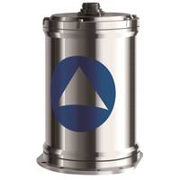
iXBlue’s OCTANS NANO Hits the Market
OCTANS NANO has already raised by Ashtead Technology, one of the world’s leading offshore integrated equipment solution and rental companies. Allan Pirie, Ashtead Technology CEO, said, “Based on extremely positive customer feedback on reliability and performance of iXBlue inertial and navigation products, we were pleased to learn of the new OCTANS NANO system. With confidence in market demand and appreciating the advantage of the lower total cost of ownership of the new OCTANS NANO, we were keen to include the system in our product catalogue.” OCTANS NANO’s titanium housing
NOAA & US Power Squadrons Sign Agreement
cooperative charting program, USPS members scan both the water and the land and make note of changing conditions that may not be reflected on NOAA nautical charts. They then submit their reports online, so that NOAA cartographers can review and, if appropriate, incorporate the changes into navigation products including charts, publications, and databases. Back in 1963, leaders in the U.S. Coast and Geodetic Survey , one of NOAA's predecessor agencies, recognized the challenge of maintaining over 1,000 U.S. nautical charts covering 95,000 miles of coastline . Acknowledging that sparse resources