Canadian Shipwreck Hunters Unleash New Tech
and accurate, when using Norwegian Subsea MRUs. And, as the company focuses more on the subsea sector, comprehensive multibeam solutions are set to become less costly, while offering the required data precision and reliability.Some of this is down to Sid’s pioneering vision to upgrade his onboard equipment in order to better serve his own, and Mathew’s commitment to Newfoundland’s maritime history. In his own words: “The swells can be so bad, but the Norwegian Subsea MRU manages them better than most. It really makes multibeam surveys work in ways I could not achieve before
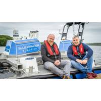
Blue Armada Robotics Buys HydroSurv USV, More Orders Coming
platform, fits very well into the long-term strategy of Blue Armada Robotics' service development and technological integration plan.”HydroSurv’s REAV-60 measures six meters long with multi-day endurance with a battery hybrid powertrain. Its payload allows for a diverse range of onboard equipment, including inspection-class ROV systems. Blue Armada has fittingly named their first REAV-60 ‘Arctos 1’, Latin for ‘Bear.’ Latacz described it as “Strong, resilient, and reliable—our bears of the sea.”This particular USV is just the beginning for
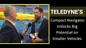
Hydroid's Most Compact AUV Ever Produced
as fins from the outside to provide a hydrodynamic, streamlined form factor. The REMUS M3V includes a powerful thruster, which enables it to cut through strong ocean currents – it can achieve speeds of up to 10 knots or more. A customized DVL solution Navigational accuracy of onboard equipment is crucial to the operation of AUVs, given they are untethered vehicles that must be able to find their own way to and from their targets. To that end, the REMUS M3V needed to include small-form Doppler Velocity Log (DVL) sensors and related equipment to help accurately measure the AUV&rsquo
Case Study: High Accuracy Survey under Bridges
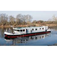
survey vessel named Spreegrund serves as survey vessel on German lakes, adjacent canals and rivers (Berlin, Brandenburg, Eberswalde and Lauenburg). It carries out complete surveys at speeds of up to 6 knots and water depths down to 20 meters. State-of-the-art Hydrography Equipment The onboard equipment features the fi rst Teledyne RESON T20-P TripleHead multibeam echo sounder providing an excellent swath coverage even in very shallow water environments such as rivers and canals. This set up allows users to survey large areas in a short time. Additional sensors include a Teledyne ODOM CV 100
Orca ESS Retrofit for Norwegian Research Vessel
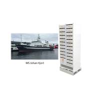
cell-level thermal runaway isolation which does not require active cooling techniques such as liquid cooling to be effective. The 64-meter research vessel John Hjort is equipped for fisheries and environmental research and will mainly operate in the Norwegian Exclusive Economic Zone. The onboard equipment includes advanced acoustic instruments for fish detection and echo integration and gear for operating various types of bottom and mid water trawls, various types of plankton samplers, CTD and other lowering probes and water samplers for environmental observation. “After extensive
Virtual Aids to Navigation Mark Research Equipment
is VAtoN A Virtual Aid to Navigation is created when a signal sent from a transmitter in an accessible location is used to mark a remote point. This mark is displayed as a special feature or hazard on a vessel’s ECDIS, chart plotter or AIS display when within range. The ship’s onboard equipment is then able to alert crews to the presence of and if they are on a collision course with the marked navigational hazard. (As published in the March 2015 edition of Marine Technology Reporter - http://www.marinetechnologynews.com/Magazine)
Virtual Aids to Navigation Mark Research Equipment
provides. A Virtual Aid to Navigation is created when a signal sent from a transmitter in an accessible location is used to mark a remote point. This mark is displayed as a special feature or hazard on a vessel’s ECDIS, chart plotter or AIS display when within range. The ship’s onboard equipment is then able to alert crews to the presence of and if they are on a collision course with the marked navigational hazard. Vesper Marine was selected to provide this technology to the French company CGG. A geoscience company that provides geological and geophysical survey and analysis
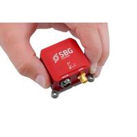
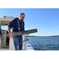
SBG Systems Debuts Miniature Inertial Sensors
automatically adjusts to the wave frequency. With very low noise gyroscopes, an internal GNSS receiver coupled with DGPS corrections, and an IP68 enclosure, Ellipse Series is definitely the best miniature inertial sensor for motion monitoring, wave measurement, and stabilization and orientation of onboard equipment (camera, antennas, etc.). The Ellipse Series will be presented at OCEAN'S 14 exhibition, in St-John's, Canada. ITAR Free Ellipse A, N, E models are available for order. The Ellipse-D model will be available on Q1 2015. sbg-systems.com

Unmanned Surface Vessels
that can deliver accurate geo-referenced bathymetric measurements and high-quality imagery with minimum transport, launch and recovery efforts.” The concept of SONOBOT is to offer the end user a modular system with several configuration options and deliver a ready-to-use vehicle with all the onboard equipment installed and ready for immediate action. Specifically for the SONOBOT, EvoLogics used the patented S2C broadband communication technology to build an advanced single-beam echo sounder, capable of delivering precise and accurate depth measurements even in very shallow waters. The side scan