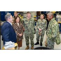
Submarine Group Two Commander Visits NUWC Newport
how much of the Navy’s operational success begins in places like Division Newport — long before a system is delivered to the fleet.“There’s a debt of gratitude that the nation has for the work that you do here,” Smith said. “It’s largely unsung — the end product of your research — the capabilities, the vehicles, the tools, the things that we put into the warfighters’ hands. [Sailors] often don’t have the tale that goes all the way back to where it began.”Smith said that while new systems often receive attention when they reach
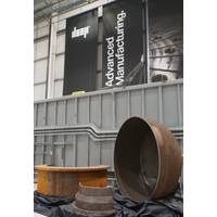
AiP Granted for Additive Manufacturing of Pressure Vessels for Human Occupancy
operates one of the largest concentrations of Wire Arc Additive Manufacturing (WAAM) systems globally.WAAM enables the manufacture of large-scale metal components with complex geometries. Unlike powder based additive manufacturing, WAAM uses an electric arc to melt wire feedstock, which gives the end product a higher level of material quality.Compared to traditional manufacturing techniques, such as forging, WAAM offers greater speed of production, along with being able to support a higher degree of design complexity.WAAM’s significant benefits were first realized in the automotive, aeronautical
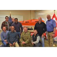
USACE Survey & Mapping Employees Awarded for USV Innovation
coming out of the water and affecting the data. To overcome this, within the size requirements of the vessel, a retractable arm for sonar was constructed and attached to the outside of AMY to accurately collect data.While Surveyor Amy was created to meet requirements and better serve customers, the end product has created new possibilities about how survey work is performed. The goal for this technology is to become a force multiplier ─ increasing versatility and efficiency while working safely
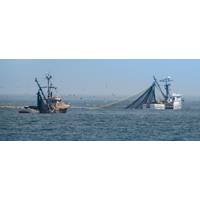
The Information Age is Transforming Fishing Worldwide
in much of the world.This approach has led to overfishing, stock depletions, habitat destruction, the senseless killing of unwanted by-catch and wastage of as much as 30% to 40% of landed fish. Industrial fishing has devastated artisanal pre-industrial fleets in Asia, Africa and the the Pacific.The end product is largely a commodity that travels around the world like a manufactured part or digital currency, rather than fresh domestic produce from the sea. An average fish travels 5,000 miles before reaching a plate, according to sustainable-fishing advocates. Some is frozen, shipped to Asia for processing

Subsea Europe Services Names Operations Manager Offshore
;While Technology development and integration enable easier to use, more automated technology, professional marine surveyors like Jorge can provide tangible added value by ensuring that the full capabilities of the diverse equipment we supply is leveraged to streamline survey performance and improve end-product quality.&rdquo
Robotics Community Gains Access to Xsens IMUs
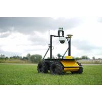
, while Clearpath Robotics is a recognized authority on ROS technology, and its robot platforms are all built on ROS.MTi-series products are also all supported by the MT Software Suite, a development and configuration tool which enables users to quickly integrate an IMU into robots or other types of end product.Photo: Xsen
Untethered Vehicle Tech Continues to Advance Autonomy
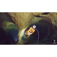
tracking. They recently released a paper describing a new feature detection algorithm that outperforms current algorithms in the market, which will be used in their software tools. The software tools can generate a three-dimensional mesh from any point cloud or sonar, and from analyzed video data. The end product is a “3D mesh” with the “full resolution of the image” even though the underlying point-cloud has been reduced.EIVA’s Software Output Showing sonar and video data “mesh” (Credit: EIVA)Another presentation of novel ideas came from Terradepth’s Ken
Hydroid Appraised at CMMI V2.0 Maturity Level 3
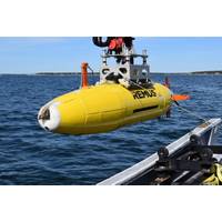
company performance. The level 3 appraisal indicates that Hydroid is performing at a “defined” level. At this level, company processes are well characterized and understood, and are described in standards, procedures, tools and methods. It also means that Hydroid’s set of end-to-end product development processes, which is the basis for maturity level 3, is established and improved over time
Swathe Services Named HYPACK Dealer for UK, Ireland
HYPACK hydrographic survey software to customers purchasing R2Sonic packages and also to anyone operating within the offshore industry. The HYPACK 2016 software system provides surveyors with all of the tools required to design surveys, process data, reduce it and generate a high quality end product. It can be used for a wide range of tasks, from collecting hydrographic survey data or environmental data to simply positioning a vessel in an engineering project. The software is suited for use on both large and small vessels. Existing customers include those on vessels

 December 2025


