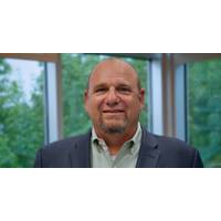
Franks to Lead Jacksonville University's Marine Science Research Institute
marine science education and research."Dr. Franks has developed the relationships to continue the work started by Dr. White," said Dr. Christopher Corbo, Dean of the College of Arts and Sciences. "The MSRI began as a center for marine science education that directly supports the St. Johns River, the City of Jacksonville, and its coastal areas. He will continue the long-standing collaborations, develop new ones, and enhance the work of the institute towards a national stage."Dr. Franks' commitment to placing students at the heart of his work has been a driving force behind his
BOEM, Jacksonville, U.S. Army Corps Ink Shore Protection Deal
them to dredge nearly 1.4 million cubic yards of sand from federal waters for periodic renourishment of the Duval County shoreline. The shore protection project, using sand from the seafloor of the federal Outer Continental Shelf (OCS), will restore a 10-mile stretch of coast between the St. Johns River entrance and the Duval County/St. Johns County boundary along the Atlantic Ocean. Dredging is expected to begin in the summer of 2016. “BOEM is pleased to support the City of Jacksonville with this restoration project,” said BOEM Director Abigail Ross Hopper. “Local communities
Jacksonville Adds PORTS Real-time Data System
Officials from NOAA, the Jacksonville Marine Transportation Exchange, and the Jacksonville Port Authority officially dedicated a new information system today which will increase safety for ships using the St. Johns River. The system, called Physical Oceanographic Real-Time System (PORTS), provides real-time information on water levels, currents, meteorological conditions, and under-bridge clearance, giving users critical information when traveling through the river. The St. Johns River in Jacksonville will become the 23rd location to use the system and is the second largest PORTS ever


