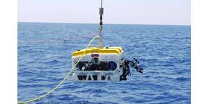
FAU Receives Grant to Transform Underwater Robotic Communication
the College of Engineering and Computer Science. “Ultimately, it enhances the ability of autonomous systems to operate cooperatively in real-world ocean environments.”The partnership builds on the complementary expertise of FAU’s CA-AI and Hydromea SA, as well as on ongoing National Science Foundation-funded CA-AI work on networked swarms of autonomous underwater vehicles
The Politics of a Subsea Data Cable Link to Antarctica
Antarctica is the only continent without a fiber-optic connection.The technology required to get one there is available, but the creation of such infrastructure raises geopolitical questions, including its potential military use, say researchers from Germany.The US National Science Foundation has plans to build a subsea data cable link from New Zealand or Australia to its McMurdo research base in Antarctica. There’s been no update on the project under the current administration, and research funding has been cut to the Foundation, perhaps casting the plan in doubt.There’s another project
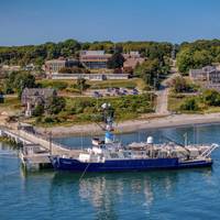
Retiring the R/V Endeavor: Celebrating a Lifetime of Accomplishments and Memories
to have over 730 successful science missions. It's a real testament to the crew, technicians and scientists on board because 50 years of success is almost unheard of. It's the longest running oceanographic vessel in the fleet," Thornton said. "It's a testament to the National Science Foundation (NSF) and the ship's operators for being able to successfully run a vessel that long. There was a lot of care, a lot of thought, a lot of planning and good people that went into making sure she had successful operation for this number of years.Gruebel also feels that Endeavor's
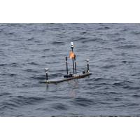
Monitoring the Restless Earth for the Next “Big One”
Zone. It was here that the Chignik earthquake struck – and USGS was ready for a post-earthquake response mission.Just a couple of years before, three GNSS-A monitoring sites had been set up on the seafloor off Alaska, in the Aleutian subduction zone, by a team of scientists funded by US National Science Foundation (NSF).Several Wave Glider surveys had been carried by the USGS and Scripps prior to the M8.2 Chignik earthquake, monitoring the position of the sites in about 1,200 m water depth.Within weeks of the earthquake, USGS had their Wave Glider back out to measure what movement there had been
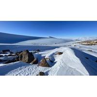
Scientists Discover Six Million Year Old Ice in Antarctica, Offers Unprecedented Window into a Warmer Earth
;s past climate, where abundant geological evidence indicates much warmer temperatures and higher sea levels compared to today.The research was led by Sarah Shackleton, assistant scientist in Geology & Geophysics, and John Higgins of Princeton University, who are affiliated with the National Science Foundation-funded Center for Oldest Ice Exploration, or COLDEX, a collaboration of 15 U.S. research institutions led by Oregon State University.“Ice cores are like time machines that let scientists take a look at what our planet was like in the past,” said Shackleton, who has participated
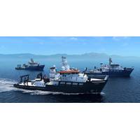
Sonardyne Technology Selected for New Oceanographic Research Vessels
Underwater positioning and tracking technology from Sonardyne has been chosen for three new oceanographic research vessels being built under the US' National Science Foundation (NSF) Regional Class Research Vessel (RCRV) construction program.Led by Oregon State University, the RCRVs are being built for the US' Academic Research Fleet (ARF), enabling a new era of coastal and regional marine science. To support the RCRV's scientific missions, across diverse marine environments, Oregon State University selected Sonardyne's Ranger 2 Gyro USBL 7000, engineered to meet both the demanding
Marine Heatwaves Impact Food Webs
affected those microscopic organisms to see if those impacts were connected to the amount of carbon being produced and exported to the deep ocean.”The research team used information collected by the Global Ocean Biogeochemical (GO-BGC) Array, a collaborative initiative funded by the US National Science Foundation and led by MBARI that uses robotic floats to monitor ocean health.The GO-BGC project has deployed hundreds of autonomous biogeochemical Argo (BGC-Argo) floats, which measure ocean conditions such as temperature, salinity, nitrate, oxygen, chlorophyll, and particulate organic carbon (POC)
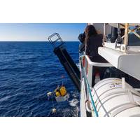
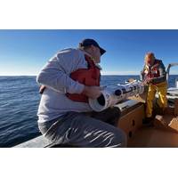
Seismometers Retrieved for Slow-Slip Earthquake Study
Earth Observatory, and the University of Rhode Island are the research partners on this project. Scientific research funding for this project has come from New Zealand's Ministry for Business, Innovation and Employment, Germany’s Helmholtz Association, the United States National Science Foundation, and Japanese government science funding
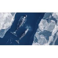
Whale Fecal Samples Link Ocean Warming to Rising Algal Toxins in Arctic Waters
19 years. While domoic acid was less prevalent (in some years no DA was detected), this study shows for the first time that domoic acid exposures in Arctic waters are increasing due to warming and loss of sea ice.Scientists used data from a monitoring mooring in the Beaufort Sea, funded by the National Science foundation’s Arctic Observing Network, to compare toxins in the bowhead whales to environmental conditions. “It was fortuitous that we’ve maintained a long-term mooring near the whale feeding site, which provided the opportunity to investigate the role of the changing circulation