Marine Technology News Search
Search term • "advanced navigation"
Create an email alert for "advanced navigation"
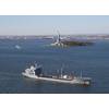
Yes, Oceanographers Can Help Predict Piracy Attacks
The US Naval Meteorology & Oceanography Command named a 2013 Computerworld Honors Laureate for its counter-piracy predictive modelling. The Naval Meteorology and Oceanography Command (NAVMETOCCOM) received the award for a modeling capability developed by Naval oceanographers at Stennis Space Center that predicts the likelihood of pirate attacks. IDG's Computerworld Honors Program selected NAVMETOCCOM…
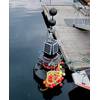
Aker Solutions Wins Umbilical Contract in West Africa
Aker Solutions has been awarded a contract from Technip to deliver umbilicals for the Girassol Resources Initiative (GirRI) phase 2 development off the coast of Angola. Contract value is undisclosed. Aker Solutions will deliver two dynamic power and control steel tube umbilicals, one dynamic power cable and ancillary equipment. GirRI is located in Angola's Block 17, 210 kilometres west of Luanda. The development is 1,300 metres under sea level.
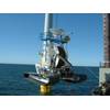
Proserv Unveils Global R&D Subsea Technology Hub
Rapidly growing international energy services company Proserv officially launched a global research and development (R&D) hub in Norway to design innovative subsea controls and communications technologies. This new group strengthens Proserv’s evolving international infrastructure in support of its subsea production systems business which includes facilities in the U.K. providing subsea systems test…
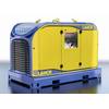
The eLPP: Lamor’s New Power-Pack
Lamor Corporation launched its next generation smart eco Lamor Power Pack (eLPP 55-80) at Spillcon in Cairns, Australia. The eLPP is one unit with multiple functions to operate several oil spill response units: skimmers, pumps and boom reels simultaneously, as well as other hydraulically driven equipment with green technology. In staying ahead of new and stricter legislation, Lamor eLPP series has…
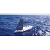
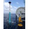
SailBuoy Unmanned Surface Vehicle for Ocean Monitoring
(1) Oceanic Platform of the Canary Islands (PLOCAN). PO Box 413, Telde. Spain; (2) Christian Michelsen Research (CMR). PO Box 6031, Bergen, Norway; (3) Instituto Canario de Ciencias Marinas (ICCM). PO Box 56, Telde. Ocean observatories play a crucial role in relevant aspects of the climate system on longer time-scales, including among others, global heat budget, sea level rise, potential variations in the meridional overturning circulation…
China-U.S. Ocean Thermal Energy Plant Development
Lockheed Martin and Reignwood Group to develop South China Sea ocean thermal energy conversion (OTEC) power plant. A memorandum of agreement between the two companies was signed recently in Beijing. Following the ceremony, both companies met with United States Secretary of State John Kerry during his first official state visit to the People’s Republic of China. The 10-megawatt offshore plant, to be designed by Lockheed Martin…
MWCC Establishes SURF Shorebase in Mobile, Ala.
Marine Well Containment Company (MWCC) announced that Mobile, Ala. has been selected as the shorebase location to house the well containment company’s subsea umbilicals, risers and flowlines (SURF) equipment. MWCC's SURF equipment is an integral part of the company's expanded containment system (ECS) that will enhance the company’s well containment capabilities in the deepwater U.S. Gulf of Mexico.
New, New York Harbor Current Meter
NOAA uses data from a new current meter in New York harbor operated by New Jersey’s Stevens Institute of Technology. The system provides enhanced real-time information to mariners travelling through the nation’s second busiest port. The Stevens current meter measures the direction, speed, and volume of ocean currents in the harbor’s navigation channels, north of the Narrows between Brooklyn and Staten Island.
Subsea Installation with IHC Waterhammer
IHC Hydrohammer, part of IHC Merwede, successfully used seawater instead of oil as a drive mechanism for the offshore installation industry. The company has developed and tested IHC Waterhammer technology to prepare it for launch to the market. This sustainable product development minimises potential oil spill hazards in the marine environment and presents new opportunities for deep-water offshore pile driving that will be beneficial to the future growth of offshore construction.
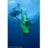
Mariscope Introduces New ROV to South America and Europe
In cooperation with the Kentucky-based company Acamar Maritime Solutions, LLC, Mariscope has developed the new McClean ROV cleaning system. The McClean is the first ROV with rotational heads using cavitation jetting technology to clean many types of underwater structures. During the official presentation carried out in March, 2013, in the city of Puerto Montt, Chile, Chuck Phillippe from ACAMAR and Christian Haag from Mariscope demonstrated the potentials of the system.
GE Spotlights Hi-tech Portfolio at OTC 2013
GE continues to expand its technology portfolio to address the challenges of offshore drilling & production and the rigors of deepwater drilling. Several GE business units showcased their latest products and services for the offshore sector in at the 2013 Offshore Technology Conference (OTC), which was expected to draw nearly 90,000 attendees. “With one of the industry’s most comprehensive portfolios of advanced technology solutions and services…
Guidance for NSF on National Ocean Research Priorities
Within the past decade, new science and technologies have led to breakthroughs and discoveries that have fundamentally altered our basic understanding of the oceans and their relationship to human populations. The value of the ocean to society has been highlighted by multiple commissions (the Pew Oceans Commission; the U.S. Commission on Ocean Policy) and a science-based National Ocean Policy has been developed.
Ocean Science and Exploration Focus on Capitol Hill
Explorer and director James Cameron will be on Capitol Hill on Tuesday, June 11, with Dr. Susan Avery, president and director of Woods Hole Oceanographic Institution for a series of public events and a Senate hearing. Central to their visit is the display of the Deepsea Challenger, the only human-occupied vehicle currently able to access the deepest parts the ocean. Cameron developed the vehicle over seven years and used it in March 2012 to dive to the deepest spot in the ocean…
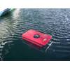
Tideland Solar Buoys Mark Wrecks in Norwegian Arctic
Two SB-138P polyethylene buoys with solar-powered ML-140 LED lanterns from Tideland Signal are being used to mark wrecks in the approaches to the port of Narvik in the far north of Norway. The new SB-138P buoys are replacing old battery-operated steel buoys from the 1980s that required extensive maintenance and costly battery changes. They are wreck-markers for the British 8770 ton iron- ore carrier Romanby and the Swedish 8…
HoOK R&D Project Examines Offshore Crane Ops
With funding from the Federal Ministry of Economics and Technology and supported by “Projektträger Jülich” (PTJ) [project sponsors Jülich], over the next three years Hamburg University of Technology, Mareval AG Hamburg and the maritime engineering company HeavyLift@Sea will conduct research into the improvement of tools for the simulation of offshore crane operations. The project is named HoOK - Hochseeoperationen mit Kranen [Offshore Operations with Cranes].
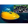
Acoustic Pingers for Submarines and AUVs
U-Boat Worx reported that personal submarine and autonomous underwater vehicle (AUV) sales are on the rise. Not long ago personal submarines were high tech toys available only to the super wealthy and AUVs were expensive pieces of equipment used primarily by the military and oil industry. Thanks to advances in technology that reduced their cost, both are now in widespread use by individuals, businesses and universities.

OFG Expands AUV Capability
OFG has invested in a 3000m-rated Hugin Autonomous Underwater Vehicle (AUV), Chercheur, equipped with a sensor and software suite for efficient inspection of pipelines and infrastructure, pipeline route studies, site geohazard surveys, environmental monitoring surveys, and other seafloor-based applications such as UXO, archeology, salvage, and minerals exploration. Chercheur is equipped with high resolution interferometric synthetic aperture sonar (HiSAS)…
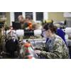
Unmanned Warrior: The Science behind the Systems
It is an exciting time to be a science advisor in the Navy. I am fortunate to be assigned by the Office of Naval Research to Adm. Phillip Davidson, commander of U.S. Fleet Forces, and work to identify and provide technical solutions to capability gaps currently facing our operational naval forces. Office of Naval Research-Global sponsors 25 science advisors at naval commands around the world. Our job takes us to the front lines to understand challenges facing our Navy and Marine Corps…
Subsea 7 Vessel Installs iXBlue DP-PHINS
iXBlue DP-PHINS Inertial Navigation System has been proven in operation offshore West Africa for Subsea 7. The system delivers a robust and secure position reference in the case of corrupted positioning from satellite systems due to ionospheric Interference. The 4 500 t DP2 Construction Support / Flex Lay vessel Simar Esperança has successfully completed FMEA (Failure Mode Effect Analysis) trials using the state of the art DP-PHINS inertial navigation system.
Pharos Acquires 1200HP Subsea Cable Trencher
Pharos Offshore Group has acquired an SMD built 1200HP cable burial tool. The Universal Trenching Vehicle (UTV 1200) is a unique low and wide Remotely Operated Vehicle (ROV) specifically designed to bury submarine power cables. Modifications to the 1200HP UTV 1200 are underway. The enhancements will facilitate more effective post lay/installation burial and improve the handling and stability of the vehicle.


