BOEM Publishes Final Notice of Sale for Cook Inlet Lease Sale
waters, the Bureau of Ocean Energy Management today announced the Final Notice of Sale for the Cook Inlet Outer Continental Shelf Oil and Gas Lease Sale 1. Officially authorized under the “One Big Beautiful Bill Act” and commonly known as BBC1, this marks the first of six lease sales in Alaska’s Cook Inlet required by the legislation.“Regular and predictable federal leasing is the minimum standard for maintaining domestic energy production,” said BOEM Acting Director Matt Giacona. “Energy security is national security, and this sale reflects a clear, congressionally
Matson Partners with WhaleSpotter
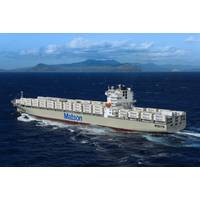
, Matson provided WHOI with a $1 million research grant, as well as access to vessels and crews, to help advance the system's development.Since then, Matson has successfully trialed three WhaleSpotter units on its container ships and has ordered four additional units for vessels serving Hawaii and Alaska.Field deployments on Matson ships have demonstrated that WhaleSpotter can detect surfacing whales miles away and deliver verified alerts within seconds."The technology is remarkable — and now refined to meet our zero-false-alert requirements," said Matt Cox, Chairman and CEO of Matson

Lockheed Martin Invests $50M in Saildrone to Advance USV Capabilities for US Navy
while ships were stuck in port, quarantined, and immobile. We had about 45 Saildrone USVs deployed around the world when COVID hit. Unable to travel to service the systems, the fleet continued to perform flawlessly, performing some vital tasks normally undertaken by ships. One such example was the annual Alaska pollock fish stock survey in the Bering Sea, which we undertook entirely remotely. The data we collected found more fish than anticipated, which enabled NOAA to set a higher catch limit for that year. This had a significant positive commercial impact on the Bering Sea fishing industry.We began working

NOAA Invests $95M in Mid-Life Vessel Renovation
The National Oceanic and Atmospheric Administration (NOAA) awarded a $95 million contract to JAG Alaska, Inc., a shipyard based in Alaska, for a mid-life renovation of the Oscar Dyson. This project not only enhances NOAA’s operational readiness but also boosts Alaska’s economy by creating skilled jobs.A highlight of the upgrade is Siemens Energy’s SISHIP BlueDrive PlusC low-voltage direct current (LVDC) propulsion system, which improves fuel efficiency and reduces emissions. The system minimizes specific fuel consumption (g/kWh) during operations, aligning with NOAA’s
Marine Heatwaves Impact Food Webs
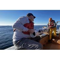
, the University of British Columbia, the University of Southern Denmark, and Fisheries and Oceans Canada.To explore the impacts of marine heatwaves on ocean food webs and carbon flows, the research team combined multiple datasets that tracked biological conditions in the water column in the Gulf of Alaska for more than a decade. This region experienced two successive marine heatwaves during this time, one from 2013 to 2015 known as “The Blob,” and another from 2019 to 2020.“The ocean has a biological carbon pump, which normally acts like a conveyor belt carrying carbon from the surface
ASL and Sofar Ocean Engage in Marketing, Distribution Partnership
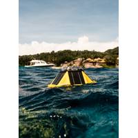
ASL Environmental Sciences Inc. has announced a new strategic marketing and distribution partnership with Sofar Ocean, bringing innovative oceanographic solutions to Canada and Alaska. This collaboration strengthens ASL’s position as a trusted supplier of advanced ocean monitoring technologies while enhancing Sofar’s reach in northern markets.At the center of this partnership is the Sofar Spotter Platform a compact, solar-powered metocean buoy that delivers real-time data on waves, winds, sea surface temperature, barometric pressure, and more. Rugged yet portable, the Spotter Buoy connects
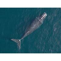
New England Aquarium Researchers Use Drone Technology to Monitor Climate Change Impacts on Whales
Scientists are using drone technology to study how changing ocean conditions are impacting whales, advancing this non-invasive research technique in both New England waters with North Atlantic right whales and in Alaska with killer whales.Scientists with the Anderson Cabot Center for Ocean Life at the New England Aquarium recently captured drone images of killer whale mothers with calves in Prince William Sound in the northern Gulf of Alaska during field research in June, in collaboration with the non-profit North Gulf Oceanic Society (NGOS). Photogrammetry uses high-resolution
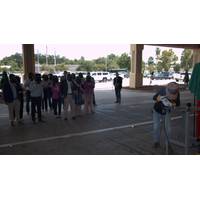
Keel Laid for NOAA Charting and Mapping Vessel
safely navigate the nation’s ports and harbors.The name Surveyor points to one of NOAA’s key missions — to conduct surveys of coasts and waterways — and it's also the name of two former ships. Like its former namesakes, the new Surveyor will be homeported in Ketchikan, Alaska.Data collected by NOAA ships are integrated into nautical charts and other products that are essential to mariners in U.S. waters. Since 1807, originally as the U.S. Coast Survey, NOAA has kept people and commerce moving safely through U.S. waters. Today, the agency supports nearly $5.4 trillion
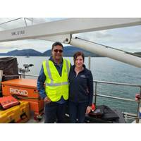
Pioneer Consulting Completes Submarine Cable Marine Route Surveys in Alaska
Pioneer Consulting, a full-service submarine fiber optic telecommunications consulting and project management company, announced the completion of the marine route surveys for the “Fiber Internet Serving Homes” projects, which consist of the FISH West and FISH South submarine cable systems in Alaska. Contracted by Cordova Telecom Cooperative, Inc., a member-owned telecommunications cooperative, the survey was completed in cooperation with Benthic GeoScience.Pioneer Consulting supervised the survey and provided a representative on board the main survey vessel. Survey activities included:Investigation
 December 2025


