NOAA, Partners to Map Seafloor Off the Cook Islands
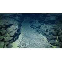
This summer, NOAA Ocean Exploration will conduct an expedition on NOAA Ship Okeanos Explorer to map, explore and characterize deep waters off the coast of the Cook Islands. The effort is in partnership with the Cook Islands Seabed Minerals Authority.Using remotely operated vehicles (ROVs), mapping technologies and onsite sensors, the team will explore abyssal plains and the Manihiki Plateau. Operations will include imaging and sampling the seabed and water column to compare a variety of deep-ocean habitat types.The 28-day expedition will take place in July and August 2026. While the expedition is

NOAA-Led Expedition Maps Cook Islands’ Exclusive Economic Zone
Exploration Vessel Nautilus, operated by the Ocean Exploration Trust, successfully completed a three-week mission to map and explore the Cook Islands’ Exclusive Economic Zone (EEZ). This collaborative effort, led by the National Oceanic and Atmospheric Administration (NOAA) through its Ocean Exploration program and supported by a grant to the Ocean Exploration Cooperative Institute (OECI), marks a milestone in strengthening U.S.-Cook Islands partnerships in marine resource management.Guided by priorities set by the Cook Islands Seabed Minerals Authority (SBMA), the expedition employed



 August 2026