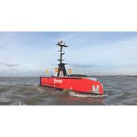
From Radar Returns to Safe Decisions: Radar Processing for Maritime Autonomy
the radar track, object classification and enhanced bearing measurement from a video track, and cargo information from the AIS.Cambridge Pixel's SPx Fusion Server correlates track reports from multiple radar sources and AlS into single fused tracks. Credit: Cambridge PixelPosition integrity without GPSAutonomous vessels commonly depend on GNSS/GPS. Loss of signal is a problem, whereas jamming can prevent reliable reception and spoofing can cause a receiver to report a plausible but false position.In coastal areas, radar can provide an independent cross-check of GNSS-derived positions. Cambridge
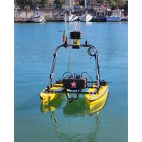
MTCOM: Building the Connected Port of Tomorrow
for obstacle detection, it continuously monitors environmental conditions while navigating safely through complex port areas.Its modular payload architecture allows the integration of a wide range of sensors, enabling the USV_EL CAT to operate as a mobile sensing and communication node. Combined with GPS/INS navigation, long-range Wi-Fi, LTE and satellite communications, and a user-friendly Ground Control Station providing real-time GPS tracking, video streaming and system monitoring, the platform delivers real-time data and ensures connectivity between autonomous platforms, port infrastructure and

Quantum Sensing Beats GPS-Denied Navigational Challenges
The same error-prone sensitivity that has slowed down the development of quantum computers is being turned into an advantage for GPS-denied navigation.A new quantum sensing technology from Australia-based Q-CTRL has most recently caught the interest of Lockheed Martin and the US Defense Innovation Unit, but the company is already working with the Australian Department of Defence, the UK Royal Navy, the US Department of Defense and Airbus.These agencies are interested in a quantum-sensing-based navigation system, because amidst growing international conflict, GPS denial is being increasingly used as a

Meet ‘Super GPS’: XONA Ups the Space Race Ante
With a mission to power the current and next-generation of GPS-enabled products and systems, XONA Space Systems keeps the mantra ‘precision, power and protection’ in all that it does as this 2020-start-up designs, builds and launches its fleet of low earth orbit satellites. We spoke with XONA CEO Brian Manning for his insights on how this could impact the maritime, offshore energy and subsea sectors.The following was excerpted from Maritime Reporter TV’s interview with XONA CEO Brian Manning. Watch the full interview here:To start … XONA Space Systems … when and why was
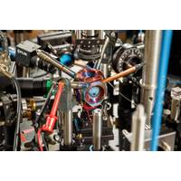
Shed the Satellite: Quantum Sensors hold Promise for Future GPS-Free Navigation
quantum sensors — sensors that use quantum mechanics to outperform conventional technologies — from the lab into commercial use, said Sandia National Laboratories scientist Peter Schwindt.Sandia developed the chamber as a core technology for future navigation systems that don’t rely on GPS satellites, he said. It was described earlier this year in the journal AVS Quantum Science.Countless devices around the world use GPS for wayfinding. It’s possible because atomic clocks, which are known for extremely accurate timekeeping, hold the network of satellites perfectly in sync.But
 August 2026