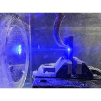
Bright Prospect: Blue Lasers for the Deep Sea
turn, generate recoil forces upon contact with components, which destabilize remotely operated underwater vehicles (ROVs) and often cause them to drift away.Consequently, the industry shows great interest in contact- and force-free, low-wear, low-maintenance alternatives – possibilities that laser technology in particular can offer. Initial attempts, however, were not very successful. Early efforts to use conventional infrared (IR) lasers to cut structures during oil platform decommissioning proved only partially practical. The primary reason: infrared radiation (wavelength 1000 nm) is completely

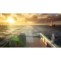
Advanced Navigation Opens Subsea Robotics Center in Australia
center is one of several investments made by Advanced Navigation as it continues to expand its global reach and capabilities. The company has established headquarters in Sydney with research centers throughout Australia, including Brisbane for aerial drone technology, Canberra for photonic and laser technology and Newcastle for quantum sensing.In addition to novel autonomous subsea robotics, Advanced Navigation delivers AI-enhanced navigation technologies for land, sea, air and space applications
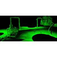
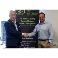
3D at Depth Gets Patent for Subsea Structure Monitoring
3D at Depth, a subsea LiDAR laser technology company said Tuesday it had received a new patent 11.249.193, "Systems and Methods for Monitoring Underwater Structures," from the U.S Patent and Trademark Office. The patent's claims focus predominantly on leak detection and identifying changes to surfaces and volumes on and around underwater assets via the company's patented active optical measurement device, the company said."3D at Depth collects and processes four-dimensional data in line with client requirements, including millimetric three-dimensional data taken over time
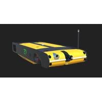
3D at Depth Acquires Hybrid AUV/ROV
Subsea laser LiDAR (SL) technology and 3D data visualization solutions specialist 3D at Depth Inc. has acquired Saab Sabertooth Hybrid AUV / ROV. The company said that the multi-million-dollar investment will complement 3D at Depth's SL Subsea LiDAR laser technology systems and 3rd party geophysical equipment, giving the company "an impressive spread of integrity measurement equipment.""The Hybrid AUV / ROV coupled with 3D at Depth's patented SL Subsea LiDAR laser with remote sensing technology adds an extra layer of measurement and repeatability. In addition to normal
Subsea LiDar Specialist Ventures into Offshore Geophysical Survey Business
3D at Depth, a company specializing in commercial Subsea LiDAR (SL) laser technology, and a provider of underwater survey services and 3D data solutions, on Tuesday announced the launch of its offshore Geophysical Survey Services division. According to 3D at Depth, the new division will provide surveys to support both nearshores, inshore, and offshore deepwater development activities focused in the areas of offshore wind farms, pipeline routes, environmental site surveys, offshore oil and gas projects, and civil engineering surveys. The firm said that its new division was supported by a team
3D at Depth Partners with STR
Subsea LiDAR laser technology and 3D data solutions company 3D at Depth Inc.announced Tuesday it has partnership with Subsea Technology & Rentals Australia PTY Ltd (STR).According to 3D at Depth, the partnership has been formed to support its expanding customer base within the Asia Pacific region, and bundle 3D at Depth’s Subsea (SL) LiDAR laser systems with STR’s subsea technology. The new bundled offering provides a turnkey solution to help customers improve the efficiencies and reliability of their offshore operations. 3D at Depth said it will continue to maintain operational and
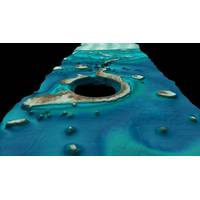
Fugro Advances Bathymetric Lidar Mapping Capabilities
density than any comparable system on the market - and we’ve recorded seafloor depths as deep as 42 meters during a recent survey.”Described as a first-of-its-kind multibeam lidar system, RAMMS was developed in partnership with Areté Associates. The system utilizes push-broom laser technology and is based on 20 years of cutting-edge military technology for mine detection, developed via the U.S. Navy Small Business Innovated Research (SBIR) program. It is also underpinned by over 25 years of bathymetric lidar experience for nautical charting.The sensor’s compact design allows
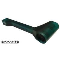
Precision Underwater Laser Scanner for Divers
. Dr. Grant Thomson, Savante Managing Founder said, “In 2005, we pioneered the development of our first SCUBA-diver operated laser scanner in support of a marine-science research project. The CTS-3D underwater laser scanner represents almost 15 years of continuous underwater laser technology development and enables assets to be surveyed dynamically and in minimal time without the need for mechanical tools such as calipers, rulers or impression-casting tools. Weighing less than 1kg in water, the tool is solid-state, making it robust for shallow water operations and extending to operations
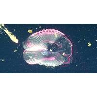
Lasers Shed Light on the Inner Workings of the Giant Larvacean
New laser technology is allowing MBARI scientists to look into the structure of giant larvaceans–tadpole-like marine animals that are important players in ocean ecosystems. In a recent paper in Science Advances, MBARI researchers described a new method for measuring the flow of seawater through larvaceans and other gelatinous animals. The results will help scientists understand how much carbon dioxide the oceans are absorbing from the atmosphere. Larvaceans play a significant role in moving carbon from the upper part of the ocean down into the deep sea. They build balloon-like mucus structures