Fugro Advances Bathymetric Lidar Mapping Capabilities
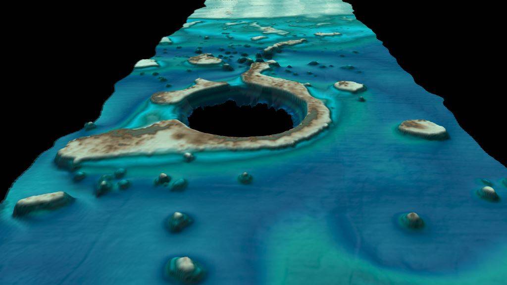
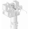
Fugro’s new first-of-its-kind airborne multibeam system, RAMMS, provides efficient bathymetric lidar surveys for nearshore and coastal mapping (Image: Fugro)
Fugro is introducing a new bathymetric lidar system that delivers industry-leading depth penetration and point densities for nearshore and coastal mapping. Known as RAMMS (Rapid Airborne Multibeam Mapping System), the field-proven technology promises to deliver an efficient and cost-effective solution, dramatically improving upon other bathymetric lidar mapping capabilities.
“Traditional bathymetric lidar technology requires customers to compromise between price, depth penetration and data density,” said Ed Saade, president of Fugro USA and regional director for Fugro’s Marine Division in the Americas. “With RAMMS, there’s no trade-off. It can achieve 3-Secchi disk depth penetration at a higher observation density than any comparable system on the market - and we’ve recorded seafloor depths as deep as 42 meters during a recent survey.”
Described as a first-of-its-kind multibeam lidar system, RAMMS was developed in partnership with Areté Associates. The system utilizes push-broom laser technology and is based on 20 years of cutting-edge military technology for mine detection, developed via the U.S. Navy Small Business Innovated Research (SBIR) program. It is also underpinned by over 25 years of bathymetric lidar experience for nautical charting.
The sensor’s compact design allows for rapid deployment on small aircraft of opportunity, including unmanned, fixed-wing aircraft. The resulting operational efficiencies are enhanced through rapid processing and data transfer capabilities.
“We believe RAMMS will bring significant value to hydrographic organizations, coastal zone/floodplain managers and engineers,” Saade said, noting a successful hydrographic charting demonstration project recently performed in Belize, covering 165 square kilometers. Fugro is currently using RAMMS to complete several large-scale surveys in the Americas with projects in other regions expected to follow.
RAMMS is the second major technology innovation offered by Fugro in partnership with Areté Associates. In 2015 the companies launched the pioneering aerial survey platform known as ROCIS (Rapid Ocean Current Imaging System) to measure surface ocean currents. In high demand since then, Fugro has collected more than 168,000 nautical miles of ROCIS data in the U.S. Gulf of Mexico to support offshore oil and gas operations.