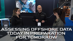
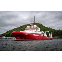
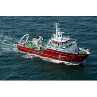
Fugro’s Blue Eclipse® USV Makes Commercial Debut
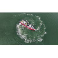
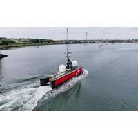
This week, Fugro announced the first commercial contract for its Blue Eclipse® uncrewed surface vessel (USV).For the first time in its history, Norway’s MAREANO will use USV technology to acquire seabed mapping data for the Norwegian Hydrographic Service.The Blue Eclipse®, the largest USV in Fugro’s fleet, will survey over 675 square kilometers in the North Sea, with water depths ranging from 90 to 250 meters.Equipped with advanced high-resolution, high-density multibeam echo sounders and sub-bottom profiler data acquisition systems, the USV will gather comprehensive datasets
Fugro to Support Norway’s USV Seabed Mapping Program
Fugro has been awarded a contract by the Norwegian Hydrographic Service (NHS) to support the 2025 MAREANO seabed mapping program.For the first time in its history, MAREANO will use uncrewed surface vessel (USV) technology to acquire the data, with Fugro deploying its new 18-meter Blue Eclipse USV for the initiative.The approach aims to advance the move towards lower carbon emissions in seabed mapping while ensuring high-quality data acquisition for the responsible management and preservation of Norway’s marine resources.The Blue Eclipse, the largest USV in Fugro’s fleet, will survey over
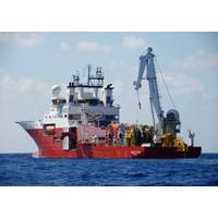
Fugro Wraps UP Seabed Mapping Work Offshore Norway
Fugro has completed the survey work for the 2024 MAREANO seabed mapping program, including an innovative environmental DNA (eDNA) service, as part of a hydrographic survey contract awarded by the Norwegian Hydrographic Service (NHS).Supported by the Central Government of Norway, MAREANO is a multidisciplinary initiative aimed at mapping the seabed to generate scientific information for the responsible management and preservation of Norway’s marine resources.This year’s survey covered an extensive 2,823 km² region in the North Sea, with water depths ranging from 146 to 337 metres.
Fugro Mapping Arctic Waters off Norway
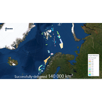
The Norwegian Hydrographic Service has awarded Fugro another hydrographic survey contract as part of the MAREANO seabed mapping program, financed by Norway’s Ministry of Trade, Industry and Fisheries, and the Ministry of Environment.Fugro said it has already completed 10 surveys for the program since 2006 and acquired over 140,000 km2 of data. This latest survey will collect high-resolution, high-density multibeam echosounder and sub-bottom data to produce seamless datasets for the Norwegian mapping program. The fieldwork will run from June to late October this year.The survey area covers
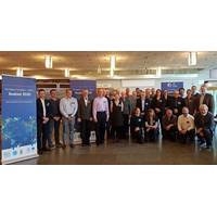
Seabed 2030 Meeting Held in Stockholm
data. The combined area of these contributions in terms of square kilometers will be announced later this year.Organizations presenting details on their mapping efforts to the group included the Canadian Hydrographic Service; the Danish Geodata Agency; the Italian Ministry of Defense; the Norwegian Hydrographic Service; the US National Geospatial-Intelligence Agency; Italy’s National Institute of Oceanography and Experimental Geophysics; Fugro; Kongsberg Maritime; TE Subcom; the Geological and Mining Institute of Spain; and NOAA’s National Marine Fisheries Service, among others.Following
Fugro Resumes Norwegian Seabed Mapping Project
Fugro has been awarded a hydrographic survey contract, valued at NOK 44.7 million (approximately €4.7 million), by the Norwegian Hydrographic Service. The survey is part of the MAREANO seabed mapping program, which is financed by Norway’s Ministry of Trade, Industry and Fisheries, and the Ministry of Climate and Environment. Fugro has successfully completed numerous surveys for the program since 2006, collecting more than 100,000 square kilometers of data.In water depths that typically range from 80 meters to 1,700 meters, the survey area of approximately 14,500 square kilometers is located
Fugro Begins Survey for Norwegian Hydrographic Service
Fugro said it has commenced a hydrographic survey encompassing an area of Norwegian waters of approximately 15,000 square kilometers. Awarded by the Norwegian Hydrographic Service, the contract value is 34.5 million NOK (approximately $4 million). The survey is part of the MAREANO program, for which Fugro has completed a number of surveys since 2006. The Norwegian program maps depth and topography, sediment composition, contaminants, biotopes and habitats. It takes place in the Barents Sea with various areas located above the 78th parallel and typical water depths ranging from 80 to 3
Fugro to Survey Part of Barents Sea
Fugro OSAE GmbH informs it has been awarded a €3.6 million hydrographic survey contract by the Norwegian Hydrographic Service (NHS). The survey encompasses an area of over 13,200 km² in the Barents Sea and the Norwegian Sea and is part of Norway's MAREANO project. A contract option allows for the extension of the survey area by two thirds. Fugro explain that this area in the Barents Sea is located at the northern-most part of Norway, near the Russian border, in water depths between 150 and 250 metres. In the Norwegian Sea the survey area is located approximately 100 miles offshore with
NHS Appoints Fugro for 2014 MAREANO Survey
Fugro OSAE GmbH announced it has been awarded a €3.6 million hydrographic survey contract by the Norwegian Hydrographic Service (NHS). The survey encompasses an area of over 13,200 km² in the Barents Sea and the Norwegian Sea and is part of Norway’s MAREANO project. A contract option allows for the extension of the survey area by two thirds. The area in the Barents Sea is located at the northern-most part of Norway, near the Russian border, in water depths between 150-250 meters. In the Norwegian Sea the survey area is located approximately 100 miles offshore with water depths