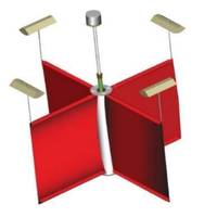
Meet ‘Super GPS’: XONA Ups the Space Race Ante
; says Brian Manning, CEO, XONAPhoto copyright DC Studio/AdobeStockWhen you say you're going to be full service, what does that look like?We can start services with basic capabilities available in a few areas of the world with less than 20 satellites. The final system is about 250.With this new satellite network, what exactly will XONA be offering?The best way to think of it is Super GPS.There are a couple big challenges that you can boil down into three major pain points: precision, power and protection. From a precision standpoint, it's going from something that is several meters down to several
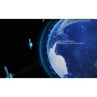
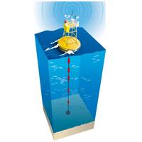
Canada and Spain Scientists Establish Antarctic Ocean Observatory
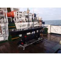
Sorribas Cervantes, director of the Unit of Marine Technology of the CSIC.The proposed site of the cabled seafloor observatory is in a small embayment called Johnsons Dock at a depth of 23 metres. It is modelled on one of ONC’s Arctic observatories at Gascoyne Inlet, and will use the Iridium satellite network to transmit the data every 30 minutes to ONC for processing, archival and distribution.The observatory will consist of a CTD scientific instrument that measures conductivity, temperature and depth. Additional sensors will track dissolved oxygen concentrations as well as optical properties including
Academia’s Climate Change Challenge is Far from Academic
sensors to detect how deep light (needed for photosynthesis) is penetrating,” Johnson explained. “Each float profiles from about 2 km depth to the surface every 10 days, making measurements on the way up. At the surface, each float sends the data home through the Iridium satellite network.” Phytoplankton consume carbon dioxide and release oxygen at a specific ratio, and by measuring oxygen release over time, scientists can better understand the role played by marine life in the carbon cycle. By combining the work of hundreds of floats that reach the surface at various
MetOcean Wins USCG Contract to Supply SAR Buoy
ocean surface, a critical measurement parameter when accurately detecting a person or asset lost at sea.Each buoy is equipped with an Iridium satellite transceiver, GPS, lightflasher, air, and sea surface temperature sensor. The suite of sensors enables the buoy to provide data through the Iridium satellite network. The Iridium transceiver also allows SARoperators to communicate via satellite with the buoys during an active SAR event. Bi-directional over-the air commands can be sent by operators through MetOcean’s secure LiNC data management system, a critical ability if the buoy enters a region
NASA’s JPL Using Teledyne Marine APEX Profiling Floats
Teledyne Marine announced the recent sale and deployment of three APEX profiling floats to NASA’s Jet Propulsion Laboratory in Southern California. The three floats were equipped with RBR CTD sensors, Short-Burst-Data for communication over the Iridium Satellite Network, and special parachutes for air deployment. The rise in global sea levels will be a major environmental challenge for the 21st Century. For this reason, it is of increasing importance that we improve our methods and understanding for predicting this process. A recent major initiative to do this has been led by JPL Scientist
NATO Uses IoT to Study the Oceans
embedding SPOT Trace devices in freely drifting buoys and setting them afloat in the Mediterranean and in Arctic waters to monitor surface drift behaviour. SPOT Trace tracks the movement of these ‘drifters’ and transmits their position data over Globalstar’s Low-Earth Orbit (LEO) satellite network. The CMRE carries out oceanography and ocean acoustics studies as part of innovative and field-tested Science & Technology (S&T) solutions to address defense and security needs of the NATO Alliance. The data is helping CMRE to measure and understand sea currents with the aim of
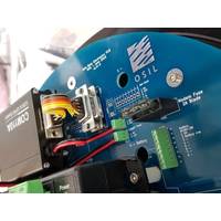
OSIL Offers New Low-cost Satellite Modem
Ocean Scientific International Ltd (OSIL) has added a new low-cost, low-power satellite modem to its range of telemetry equipment. The system will publish data, including traditionally high cost/volume currents and waves, from any location globally using the Iridium satellite network. Monthly line rental costs are minimal, and data costs are kept low (as little as 4p per message) by using SBD messaging with big bundle deals available for multiple or long term deployments. Conventionally current and wave data transmitted via satellite has proved expensive for the end user owing to the
Autonomous Marine Water Sampling Completed ‘On-demand’
Robotics Operations Team from their California headquarters almost 9,000 kilometers away and covered over 2,700 kilometers at sea. The integrated Cefas Water Sampler allowed scientists to collect 11 samples, on demand, over the duration of the mission by sending commands over the Iridium satellite network. This meant that samples could be collected in areas of particular interest, in contrast to the previous mission in which sampling was done at preset times regardless of the route taken. Sampling helps scientists assess the health of the world’s oceans. Harmful algal blooms can
WHOI Helps Locate El Faro’s Voyage Data Recorder
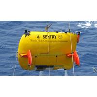
by RV Atlantis’s telepresence link will continue to ensure the remaining survey is completed to the highest standards possible. The Sentry operations team is using a mobile telepresence unit (MTU) to transmit data and images from the ship to shore. The MTU uses the computer and satellite network onboard Atlantis for real-time communications to a network designed and operated by the Inner Space Center at the Univ. of Rhode Island. Sentry is capable of operating in depths of 6,000 meters. It carries a variety of scientific sensors and uses sidescan and other sonar to create