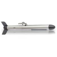
New Real-time SonarWiz Interface for PulSAR Sidescan Sonar
Enhanced mapping capability allows for broader use of PulSAR for hydrography and other applications. A powerful new tool for real-time seafloor mapping is available for those using Kongsberg GeoAcoustics' PulSAR sidescan sonar thanks to a new interface with Chesapeake Technology's SonarWiz mapping software. The new SonarWiz interface allows PulSAR users to acquire data from multiple sensors, process imagery in real time, generate state of the art mosaics, create detailed contact reports and produce sophisticated outputs leveraging a wide range of formats. “We wanted
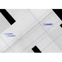
CTI Debuts Contact Rationalizing and Map Corrections Software
well received especially in areas like Alaska where high currents are common and accurately positioning a towed sonar is extremely difficult,” said John Gann, Vice President of Software Development at Chesapeake Technology, Inc. CTI said it is committed to ongoing improvements to its SonarWiz mapping software and has several new releases monthly. The new Map Rectification and Contact Rationalization features are the result of customer requests. The new release of SonarWiz is free to all customers who have a current Extended Maintenance Agreement. chesapeaketech.com