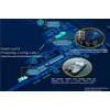
Saildrone Maps Cayman Islands EEZ
Source: Saildrone
Saildrone has mapped the seafloor in the Cayman Islands Exclusive Economic Zone (EEZ) to support the nation's efforts in fisheries management, offshore energy planning, resource exploration, strengthening maritime security, and protecting fragile habitats.
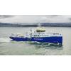
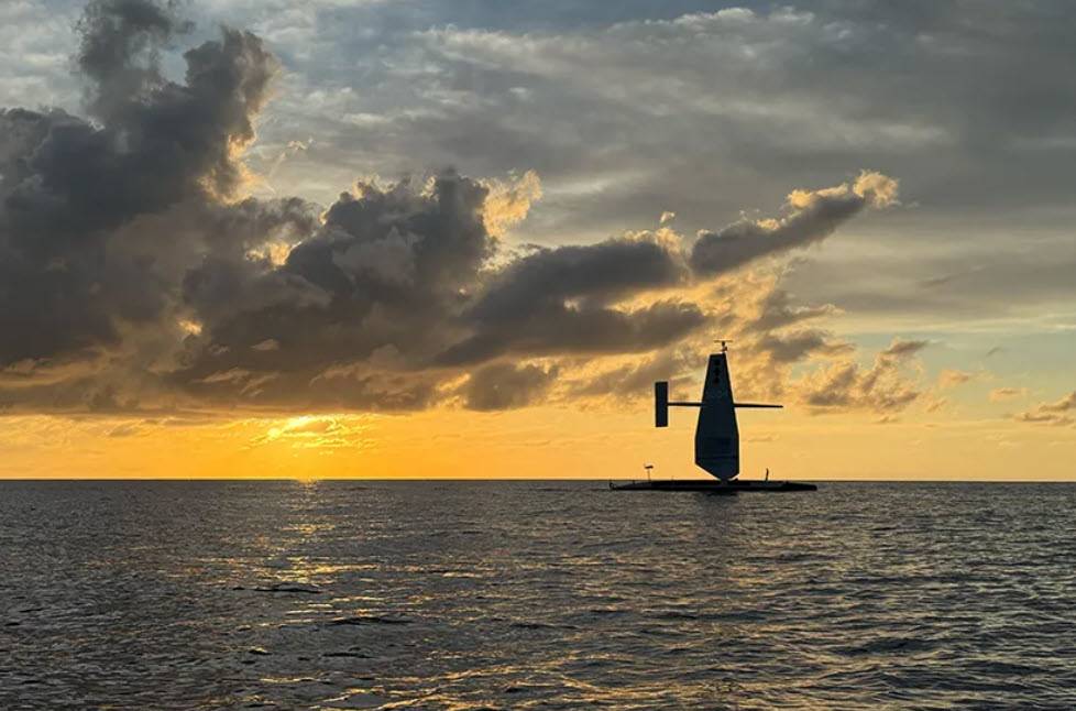
When the Saildrone Surveyor SD-3001 arrived in the Cayman Islands in 2024, the objective was unprecedented: conduct a complete deepwater multibeam survey of a nation’s exclusive economic zone using an uncrewed, autonomous platform—and deliver the first complete EEZ map of any Caribbean country.
Over the course of approximately 300 mission days, Saildrone surveyed approximately 90,000 square kilometers of seabed.
Traditional vessel-based mapping is prohibitively expensive for many Caribbean island nations, says Saildrone. Generous philanthropic funding from the London & Amsterdam Trust Company Limited, a Cayman-based organization that wants to leave a lasting legacy to the Cayman Islands, combined with the endurance and efficiency of the Saildrone Surveyor unmanned surface vehicle (USV), created a unique pathway for the country to leapfrog decades of incremental data collection and establish a complete, modern baseline of its marine environment.
The effort offers valuable lessons for future autonomous mapping campaigns—especially for developing Caribbean states seeking cost-effective ways to chart their waters and manage their maritime resources.
The Cayman EEZ presented many operational challenges. The region experienced unprecedented sargassum blooms, prompting the Saildrone team to refine its operating procedures for managing repeated encounters with dense mats of floating seaweed. This included new approaches to clearing the sound velocity profiler (SVP) and enhanced remote diagnostics to detect biofouling early—both critical for ensuring clean, reliable multibeam data.
The Surveyor also endured multiple severe-weather systems and extended periods of high sea states. Operating safely and consistently in these conditions helped validate the platform’s proven capability to remain on survey up to sea state seven.
Meanwhile, the autonomy and endurance of the USV allowed the Saildrone team to maintain survey progress through long stretches of remote ocean without human presence onboard. Watchstanders monitored the mission continuously from thousands of miles away, using Saildrone’s Mission Portal to assess coverage, quality, environmental conditions, and system health in near real-time. This remote-operations model—central to the success of the Cayman campaign—also demonstrated how small island nations can access global-standard hydrography without owning, maintaining, or staffing a survey vessel.
The Surveyor’s integrated multibeam suite—Kongsberg EM 304 MKII and EM 2040 MKII systems—proved capable of achieving high-quality data across a depth range from 20 m to 7,000 m, filling critical gaps in previously uncharted seabed. Equally important was the performance of Saildrone’s co-developed, inductively charged AML Oceanographics SVP system, designed for remote operation and long-duration endurance. The ability to execute 900+ SVP casts without manual intervention ensured consistent data accuracy across the mission.
The team also refined cloud-based data processing workflows, enabling preliminary products to be reviewed during the mission rather than months later. Combined with persistent satellite connectivity, this approach shortened the feedback loop, improved QC, and ensured that the Cayman Government and the UK Hydrographic Office (UKHO) would receive high-confidence data sets for charting and long-term marine planning.
For many islands with developing economies, the barrier to comprehensive ocean mapping is not only cost, but also logistics, including vessel charter fees, fuel, crew, mobilization, demobilization, and long transits to deepwater survey grounds. The Cayman project demonstrated that an autonomous platform can significantly reduce these burdens.
The Surveyor required minimal shoreside infrastructure and operated entirely without local crew—an enormous advantage for nations without hydrographic departments or survey vessels.
Prior to the Saildrone survey, the extent to which the Cayman EEZ had been surveyed with modern multibeam sonar technology was only 20,000 sq km of seafloor concentrated around the deep water of the Cayman Trench. One of the priorities of the mission was to survey four fishing banks—60 Mile Bank, Lawfords Bank, Pickle Bank, and 12 Mile Bank—which serve as crucial hotspots of biodiversity supporting fisheries, tourism, and recreation, and are indicators of the health of the Cayman Islands’ marine ecosystem.
Now, for the first time in the nation’s history, the Government will possess a complete, modern baseline of its marine domain—data that would otherwise have been financially unattainable.
As the raw data transitions to the UKHO for processing, and later to Seabed 2030 for global mapping contributions, the Cayman mission serves as a blueprint for how autonomous systems can help growing island states access the same level of marine intelligence as the world’s largest economies.