Marine Technology News Search
Search term • "advanced navigation"
Create an email alert for "advanced navigation"
Aker Solutions Awarded Troll extension
International oil service group Aker Solutions has been awarded a contract by Statoil to deliver three subsea trees, tubing hangers and a tool package to the Troll field on the Norwegian continental shelf. Estimated contract value is NOK 250 million. The extension is a call-off from a contract signed with Statoil in February 2012. The spare tubing hangers will be utilized on several parts of the Troll field.
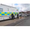
Tritech Hammerhead Offers Search Benefits
Tritech’s high-resolution survey sonar is proving an invaluable tool in search and recovery operations. Yorkshire and the Humber Police areas, through their regional underwater search and marine unit, have been using the Tritech SeaKing Hammerhead system to locate missing persons. The system was recently deployed at Snailsden Reservoir, in the peak district, South Yorkshire, England, where it enabled the team to quickly locate the body of a missing person who was believed drowned.
‘Don Diego’ Project Achieves Important Milestone
Odyssey Marine Exploration, Inc., a company in the field of deepocean exploration, reported that the Environmental Impact Assessment (EIA) for proposed dredging and recovery of phosphate sands from the "Don Diego" deposit has been filed with the Mexican Secretary of Environment and Natural Resources (SEMARNAT). According to governmental regulations, a response is expected in approximately 60 business days.

Study: Electrical Properties of Topological Insulators
Scientists at the U.S. Naval Research Laboratory (NRL) have demonstrated for the first time that one can electrically access the remarkable properties predicted for a topological insulator (TI). They used a ferromagnetic metal/tunnel barrier contact as a voltage probe to detect the spin polarization created in the topologically protected surface states when an unpolarized bias current is applied. This…

Intelligent Solution Increases Capability of Dive Bell System
A UK engineering company has recently delivered a complex turnkey project to increase the performance and extend the lifespan of an existing Dive Bell Handling system. Red Marine, based in the North East of England, has developed and delivered two shock absorber systems to Subsea 7, a global offshore contractor. Each system – to be installed on the Osprey Dive Support Vessel later this year – is a…

EIVA Debuts NaviSuite Webinars
Starting 1 July 2015, EIVA offers offshore professionals the possibility of joining a set of webinars to catch up on new and key EIVA NaviSuite solutions and features. It is now possible to get an online presentation of EIVA NaviSuite key solutions and features by joining one or more of the upcoming EIVA webinars. The first webinars have been scheduled for July and August, and more are on their way.
TE Subcom on the 'Open Cables' Model
TE SubCom’s “Open Cables” is a new business model that allows customers to select preferred Submarine Line Terminating Equipment (SLTE) line card supplier to create an interoperable and complementary dry and wet plant. SubCom will continue to offer and invest in its advanced SLTE product line, in addition to the new Open Cables alternative, to provide customers with ultimate flexibility. The Open Cables…
Ocean Business Training & Demo Program Unveiled
The organizers of the Ocean Business show have unveil the training and demonstration program for Ocean Business 2017, taking place in Southampton, U.K. at the National Oceanography Centre, April 4-6, 2017. “With some of the leading names in the business presenting their new innovations, this really is an unmissable opportunity to learn about the latest technologies,” said Cheri Arvonio, Event Manager.
A Breakthrough in Hybrid Underwater Vehicles
A collaborative effort has produced a new generation in underwater systems, breaking with tradition by uniquely combining several underwater systems into a single platform. The Fusion from U.S. manufacturer Strategic Robotic Systems is a breakthrough in hybrid underwater vehicles, combining AUV and ROV capabilities with diver navigation and propulsion – all in one system. Essential to making this forward…
Voyis Provides Subsea Tech for Galápagos Coral Expedition
Canadian underwater technology company Voyis has worked on a scientific expedition with Memorial University of Newfoundland in the Galápagos Islands, exploring and documenting the enigmatic world of cold-water coral ecosystem.The expedition, led by Chief Scientist Katleen Robert, was funded by Schmidt Ocean Institute, and also included the participation of the Charles Darwin Foundation and the Galápagos National Park.The Galápagos Islands…

Greensea Hires Green as Senior Robotics Engineer
Greensea, creator of OPENSEA, the open software architecture platform for the marine industry, recently added key personnel to its engineering team to support the development of its EOD technologies. Matt Green, Senior Robotics Engineer, is leading the technology development of Greensea’s EOD Workspace, a navigation, control, and user interface system for inspection class ROVs used in military subsea…

FarSounder Signs on NAVSEA UUV Project
FarSounder said Tuesday it has been selected as a subcontractor on a research and development project led by GMATEK Inc. This project is contracted by the U.S. Navy’s Naval Sea Systems Command (NAVSEA), Program Executive Office - Unmanned and Small Combatants (PEO-USC).The research project will apply machine learning and deep-learning artificial intelligence (AI) technology to identify solutions and…
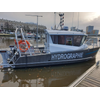
Hybrid Hydrographic Boat Delivered in France
French builder Alumarine Shipyard has delivered a new hydrographic survey boat to the Port of La Rochelle.The eight-meter aluminum vessel, dubbed Cassiopée, is powered by a dual electric/diesel propulsion system. The newbuild is designed to transit at 20-25 knots under diesel power between the home port and the acquisition area, then shift to the electric outboards while performing scans of the seafloor.Electric…
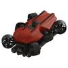
Copenhagen Subsea Debuts the Gorilla ROV
Copenhagen Subsea launched a new powerful Remotely Operated Vehicle (ROV), specifically developed for the offshore industry. The ROV is based on Copenhagen Subsea’s rim-driven thruster technology and is designed to be robust and reliable in challenging environments – qualities which inspired us to name it the Gorilla.In fact, reliability has been first and foremost throughout the design and development of the Gorilla.
Ocean Geophysics Introduces ‘Recycling’ of Free Seismic Data for Wind Farms
Renewable energy industry supplier Ocean Geophysics has introduced a solution to recycle and reprocess freely available seismic data, which can help developers reduce cost and risk when deciding which wind farms to bid for or not.In Europe and Australia, historical seismic data – for example from the offshore oil and gas or offshore renewable industry – is often freely available through national energy authorities.This is the case in the U.K.…

NOAA Promotes Nancy Hann to Deputy Under Secretary
NOAA Commissioned Officer Corps Rear Adm. Nancy A. Hann has been selected for promotion to the rank of vice admiral and will serve as NOAA’s deputy under secretary for operations, beginning August 2024. Since 2021, Hann has served as director of the NOAA Corps and NOAA Office of Marine and Aviation Operations (OMAO).In her new role as deputy under secretary for operations, Hann will be responsible…
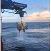
Saipem’s Hydrone-R Marks Subsea Milestone at Equinor’s Njord Field
Saipem’s underwater intervention drone Hydrone-R, currently operating on Equinor's Njord Field development project offshore Norway, has achieved the milestone for continuous subsea residency of 167 days.The project, for which Saipem’s Hydrone-R is deployed, is part of a 10-year contract signed in 2019 with Equinor.The drone is tasked to carry out inspections and interventions on subsea assets, thus…
DeepOcean Gets Pipelines Inspection Job in North Sea
Ocean services provider DeepOcean has been awarded a contract by Equinor to deliver inspection and survey work on the operator’s pipelines in the North Sea.DeepOcean’s scope of work includes pipeline inspections, seabed mapping, and ad-hoc pipeline survey and light construction work. The agreement, whose value was not disclosed, is valid for 2024.In addition to its extensive infield pipeline networks…
GAO: U.S. Can Do Better on Arctic Policy
The U.S. needs a better strategy to coordinate and prioritize its policies related to the Arctic region, according to a Government Accountability Office (GAO) study out today that was released by Reps. Rick Larsen (WA-02), Tim Bishop (NY-01), John Garamendi (CA-03) and Senator Lisa Murkowski (AK). The GAO study focused on U.S. participation in the Arctic Council, a voluntary body started in 1996 that includes the eight Arctic nations—Canada…

Atlas Elektronik to Launch Lithium Iron Phosphate
ATLAS ELEKTRONIK Group and Advanced Lithium Systems Europe (ALSE) will soon launch their new Lithium Iron Phosphate rechargeable exercise battery for electrical torpedoes on the market. The advanced features of this new battery include a longer battery life, enhanced safety, easier handling and more flexible use as well as markedly lower life cycle cost. With cells de-signed to replace the legacy design…


