Partners Aim to Unlock More Value from Hydrographic Data
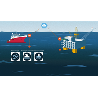
software solutions provider QPS and marine geo-information specialist TrueOcean have teamed up to develop digital workflows that they say can optimize the journey of hydrographic data from ping to cloud, by improving on traditional data sharing practices including the use of hard drives or standalone cloud services.The partners are working together to take the next steps in digitizing the data value process in offshore projects. Their focus is on building seamless integration between QPS software solutions and the new TrueOcean Marine Data Platform (MDP), with the shared objective of eliminating friction
UK: Eleven Firms Win Offshore Wind Growth Partnership Grants
.PanGeo Subsea PanGeo will undertake a demonstration project to validate a new data collection concept that supports GHG emission reductions via a smaller offshore vessel, faster data collection, and a multi-sensor survey doubling our existing data collection swath.Ryder Geotechnical Hadrian Cloud Services speeds up the analysis and interrogation of geotechnical data and allows its users to streamline offshore geotechnical surveys and construction projects. Hadrian enables responsive data driven design decisions to be made throughout a project life cycle offering increased efficiency and significant
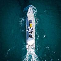
Need a Survey? There’s a USV for That
are trying to address though bandwidth exploitation.Kongsberg’s Seatex Maritime Broadband Radio (MBR) offers high bandwidth communications and direct control over 10s of km, says Mills. Telemetry, video, payload or mission data can then be rebroadcast anywhere via Kongsberg’s Kognifai cloud services. Doing this with satellite communications is a next step, but this will mean dealing with bandwidth limitations and latency. “So we will need to be more selective about what information is transmitted and what commands are available,” he says. “That may mean transferring more
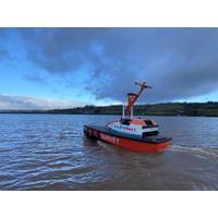
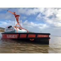
HydroSurv, Sonardyne in 'Transformative' USV Tech Collab for Offshore Industry
sensing and data acquisition technologies for offshore operations.The project is part-funded by Innovate UK. HydroSurv’s REAV-40 USV will be paired with intelligent seafloor and vessel-mounted instruments from Sonardyne. These will then be used in combination with internet-based cloud- services to provide an end-to-end seabed-data-to-shore service initially targeted towards the offshore wind industry. Key elements of the project include a self-transiting USV, acoustic positioning of and data harvesting from seabed instruments, a real-time gathering of geo-referenced current
NOAA’s Cloud and Data Strategies to Unleash Emerging Science and Technologies
will seek to improve the coordination and use of emerging science and technology across the agency. The NOAA Cloud and Data strategies are foundational for each of these.The Cloud Strategy provides a common vision and guide for future cloud initiatives, building on NOAA’s past experience with cloud services. Recent NOAA cloud initiatives are already demonstrating significant potential improvements in data storage, access and analytics of environmental data in areas such as numerical weather prediction, ocean models, assessments of living marine resources, and big data analysis, storage and dissemination
Miros RangeFinder Achieves Certification
and fouling associated with submerged equipment.RangeFinder is available as an IoT-based sensor, meaning that it is truly plug-and-play, needing only power and an internet connection to provide secure local and remote real-time ocean state data to any device.The sensors can also be complimented with Cloud services from Miros, such as web displays, database integration, data processing and device management services, making weather data available to all stakeholders

Equinor Announced Partnership with Microsoft
Equinor partners with Microsoft for cloud services delivered from new cloud data centers in NorwayAs part of a strategic partnership agreement, Equinor will provide industry knowledge and business needs to support Microsoft in developing new solutions for our industry. Microsoft will provide expertise to accelerate Equinor’s IT development and establish new data center regions in Stavanger and in Oslo.The strategic partnership is a seven-year consumption and development agreement in the hundreds of millions of dollars (USD).Equinor said its partnership with Microsoft enables it to shape and
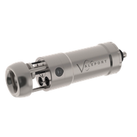
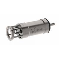
Valeport Unveils New Probe
the need to gain switch at higher turbidity levels.Using a ‘twist and go’ switch on the unit, data can be quickly downloaded, reviewed wirelessly via Bluetooth, using the new Valeport Connect app, allowing data to be instantly shared in industry standard formats through email and cloud services. Valeport's new Connect software is also available on PC and can be used with a USB cable for instrument setup, data extraction, display and translation to common-format data strings and additional tools. Designed specifically for the operation of SWiFTplus and new to market Bluetooth enabled
Van Oord selects Valeport SVPs
and has been designed for easy handling weighing in at 2kg. Data from the SWiFT SVP can be easily and quickly downloaded, reviewed and translated to common SVP formats wirelessly via Bluetooth Smart, which uses the SWiFT APP on iOS devices where data can be instantly shared via FTP, email and cloud services. Valeport’s standard DataLogX2 software for PC use will also support the SWiFT SVP. Wim Balvert, Survey Workshop manager for Van Oord commented: “We bought the SWiFT SVPs from Valeport because they are a successful and experienced sensor manufacturer, producing reliable