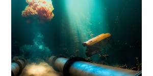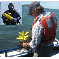
Underwater Video Aids Scientists and Search Teams
is towed by a boat and the camera “sees” what a diver would see, but has the advantage of being able to stay submerged for an unlimited amount of time without concern of getting cold, running out of air or need for decompression. Mark Finkbeiner, Division Chief of Science and Geospatial Services at the office, reports his team has been using the TOV for years and “it’s still our workhorse.” The camera was deployed in shore mapping project for the state of New York where it surveyed parts of Hempstead Bay, Moriches Bay and Great South Bay. “In Hempstead Bay
Fugro, US Army Corps of Engineers Ink Mapping Deal
District in the coming years.” Mapping completed under this contract will support the Corps’ Center of Expertise for Photogrammetric Mapping in their endeavours to provide full service, rapid response photogrammetric mapping. Task orders from the contract will span the range of geospatial services that Fugro offers, including photogrammetry, LIDAR elevation mapping, oblique imagery solutions, remote sensing, topographic and planimetric mapping, land use/land cover analysis and disaster response services. Under this contract, task orders are issued from the St. Louis District and
Proteus Delivers Satellite Derived Bathymetry
Proteus, a provider of satellite derived mapping and geospatial services, has delivered satellite derived bathymetry to Royal Haskoning DHV during April 2016. Proteus was commissioned by Royal Haskoning to deliver the data as part of a port design project in Saudi Arabia and to identify suitable and cost effective approaches to the port. The 8,000 sq km area of interest was surveyed and delivered within six weeks and depths up to 20 m were successfully reached. “Partnering with Proteus helped Royal Haskoning DHV to deliver our project on time and on budget,” said Peter Simpson, Coastal
TerraSond Wins USACE Surveying and Mapping Contract
Northwest US. TerraSond has been supporting the USACE since 1995 under nine separate multi-year IDIQ contracts, and completed hundreds of projects to-date under separate regional contracts within USACE districts including Texas, Alaska, and Washington State. TerraSond provides geospatial services and solutions for clients in the oil and gas, pipeline, power, telecom, renewable energy, mining, shipping, dredging, construction and engineering sectors, as well as federal, state, local and foreign government agencies
Underwater Technology Seminar Held in Abu Dhabi
, seafloor imagery and water column data processing software that enables the simultaneous processing of multibeam, backscatter, side scan sonar, LiDAR and single beam data. “Bayanat is pleased to work with Unique and Kongsberg in delivering this event. As a regional geospatial services leader, we are keen to collaborate with industry leaders in the geospatial and hydrographic survey domain to better serve our customers in the UAE and beyond. We look forward to further enhancing this fruitful partnership with Unique in the future as well.” said Dr. Adel Al Shamsi, Chief
Fugro Opens New office in Mozambique, East Africa
comprehensive range of services now available in Mozambique includes onshore and nearshore geotechnical and CPT testing, geotechnical engineering reporting and airport and pavement evaluation. Fugro say that their expertise is also provided in diving and salvage services, offshore positioning and geospatial services.