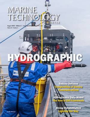
Inertial Measurement Unit News

Image courtesy Exail

Exail Launches SWaP-C AUV Inertial Nav System

Exail launched its latest product, the Phins 9 Compact, an inertial navigation system (INS) designed for all unmanned underwater vehicles.The Phins 9 Compact is built around a Fiber-Optic Gyroscope (FOG)-based Inertial Measurement Unit (IMU) with advanced accelerometers. With compact dimensions, a DVL-aided position accuracy of 0.1% TD, and a power consumption of less than 7 W, it is particularly suited for compact subsea vehicles operating in demanding applications with low power requirements.“The Phins 9 Compact represents a significant advancement in subsea navigation technology," said

Inspection of Silicon Sensing DMU41 9 DoF, tactical grade IMU (Credit: Silicon Sensing Systems)

Silicon Sensing’s Sales Rise 65% as it Hits 25th Anniversary

the location of surface vessels,” said David Sommerville, General Manager, Silicon Sensing Systems.Silicon Sensing’s patented, micro electro-mechanical systems (MEMS) technology spans a range of inertial requirements, from single, silicon vibrating ring sensors to full 6 axis inertial measurement units (IMU’s).The latest inertial measurement unit, the DMU41, redefines the capabilities of MEMS technology, bringing high-performance sensing in a smaller, more cost-effective unit. This robust unit has proven to operate flawlessly in temperatures from -40°C to +85°C, setting

Dr. Mark Marshall, Chief Engineer, Silicon Sensing Systems. Image courtesy Silicon Sensing

Silicon Sensing Appoints Dr. Marshall as Chief Engineer

inertial programs.  Immediately prior to commencing as Chief Engineer he was the company’s Consultant Engineer and Electronics Discipline Manager.  In this role he was responsible for the electronics and mechanical design of the company’s latest generation, tactical grade inertial measurement unit (IMU) - the DMU41.“These are remarkable times in inertial sensing with a long held technological status quo now rapidly shifting," said Dr. Marshall. "A number of recent micro-electro-mechanical systems (MEMS) inertial product launches are truly challenging fiber-optic gyro

Applying ‘deep learning’ methods for the detection, classification and tracking of ships and buoys during navigation. Photo: DTU

Partnering on the Digital Ship: Inside Denmark’s ShippingLab

Technology, Maritime Engineering DTU, CBS, the Danish Metalworkers Union and the Danish Maritime Authority.”A sensor platform acquiring data during navigation. The platform is equipped with two color cameras, two monochrome cameras, an infrared camera, FMCW radar, a GNSS receiver and an inertial measurement unit (IMU). (Photo: DTU)Full-scale Autonomous OperationBased on ongoing research efforts by Professor Mogens Blanke, Associate Professor Galeazzi and Associate Professor Søren Hansen, a proposal was made to set up an innovation project for the development and full-scale demonstration

MIT’s fleet of robotic boats has been updated with new capabilities to “shapeshift,” by autonomously disconnecting and reassembling into different configurations to form various floating platforms in the canals of Amsterdam. In experiments in a pool, the boats rearranged themselves from a connected straight line into an “L” (shown here) and other shapes.
Image Credit: MIT

ROBOATS: MIT's Shape-Shifting Autonomous Boats

platform” (CVP). All coordinator and worker units have four propellers, a wireless-enabled microcontroller, and several automated latching mechanisms and sensing systems that enable them to link together.Coordinators, however, also come equipped with GPS for navigation, and an inertial measurement unit (IMU), which computes localization, pose, and velocity. Workers only have actuators that help the CVP steer along a path. Each coordinator is aware of and can wirelessly communicate with all connected workers. Structures comprise multiple CVPs, and individual CVPs can latch onto one another

Photo: Silicon Sensing Systems

Silicon Sensing Unveils New MEMS IMU

Silicon Sensing Systems  will launch a new high performance all-MEMS inertial measurement unit (IMU), AMU30, at Sensors Expo this month. AMU30 is the company’s first IMU to combine high performance motion sensing with full attitude and heading reference system (AHRS) capabilities.  Based upon the DMU30, the AMU30 is designed to respond to growing demand for a tactical grade, non-ITAR (International Traffic in Arms Regulations) IMU that also outputs pitch, roll and heading data. The AMU30 is a micro electro-mechanical system (MEMS) product offering a real alternative to heavier

(Image: SBG Systems)

SBG Systems Unveils New IMU

Inertial motion sensing solutions provider SBG Systems has released the Horizon IMU, a FOG-based high performance inertial measurement unit (IMU) designed for large hydrographic vessels surveying harsh environments.Navsight Marine Solution consists in a powerful and ready-to-use inertial navigation solution dedicated to hydrographers. It is available at different levels of accuracy to meet the various application requirements and can be connected to various external equipment such as Echo-sounders, LiDAR, etc.Navsight Marine Solution already offered two levels of performance with the Ekinox and Apogee

A Hugin AUV being launched (Courtesy Kongsberg)

Unmanned Vehicles: 25 Years of Milestones

payload sensor suite including side-scan sonar, sub-bottom profiler, multibeam echosounders, magnetometers and cameras. Emerging payloads demonstrated on Hugin include synthetic aperture sonar and laser scanners. The navigation solution for Hugin AUVs uses raw output from an onboard inertial measurement unit (IMU) coupled with other available in-situ sensors processed in real-time using a Kalman filter. These are all significant improvements from the first Odyssey vehicles that carried little more than a temperature sensor and counted propeller turns for undersea positioning purposes.Commercially

Figure 1: The Sea Otter Surf Zone Crawler

Seafloor Crawlers: New Robotic Tools for Challenging Missions

submerged. Track design can be modified for more aggressive grip or made wider and longer to reduce the ground pressure contact. Fenders are added to minimize turbulence and drag.Autonomous navigational accuracy is achieved by fusing data from a single axis fiber-optic gyro (FOG) and a 3-axis inertial measurement unit. A dual-band GPS receives a fix when surfaced and is used as a cross-check on position. Shaft encoders on each drive side measure distance traveled.Accuracies of 2% of total range have routinely been achieved. Turn-in-place (TIP) and arc-turns are calculated to maintain path accuracy. Figure

The February 2024 edition of Marine Technology Reporter is focused on Oceanographic topics and technologies.
Read the Magazine Sponsored by

Drawing the Line: The Farthest, Deepest Limits

Marine Technology Magazine Cover Mar 2024 -

Marine Technology Reporter is the world's largest audited subsea industry publication serving the offshore energy, subsea defense and scientific communities.

Subscribe
Marine Technology ENews subscription

Marine Technology ENews is the subsea industry's largest circulation and most authoritative ENews Service, delivered to your Email three times per week

Subscribe for MTR E-news