Harvest, 3D at Depth Team in North Sea Project
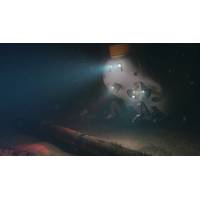
essential in providing our remote personnel onshore with the situational awareness and communications channels to perform remote laser scanning safely and efficiently,” said Tarry Waterson, Operations & Client Lead, 3D at Depth. The work scope involved 3D at Depth’s LiDAR laser scanning technology being deployed by ROV and controlled from onshore using 3D at Depth’s own remote operations technologies. This allowed 3D at Depth personnel to run the project from their Aberdeen office, reducing the requirement to mobilise personnel to the vessel. Harvest’s proprietary
Kraken Update Progress on Subsea Laser Scanner Service Activities
Kraken Robotics' SeaVision 3D underwater laser scanning technology is primarily used in assisting the offshore energy sector to acquire quality subsea asset integrity information. Specific examples include providing measurements to help clients avoid unscheduled interruption of production and enabling reverse engineering of damaged subsea equipment to enable repairs in-place. During several recent offshore deployments, Kraken’s SeaVision technology has shown that as-built 3D dimensions of installed subsea structures differ from their existing documentation, especially when servicing
ROV Solution Demonstrated for US Navy at ANTX Coastal Trident
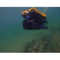
safe and remote neutralization of the identified target.Subsea TechnologiesVoyis’ Perception skid is a survey-grade 3D inspection solution that delivers real-time dense 3D modelling and image mapping from smaller ROV platforms. The skid includes Voyis’ industry leading underwater laser scanning technology and 4K digital stills imaging package, tightly coupled with Sonardyne’s SPRINT-Nav Mini positioning solution to create accurate, georeferenced results for true representation of subsea assets.EIVA’s NaviSuite Mobula is a plug-and-play ROV control and inspection software, allowing
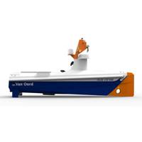
Van Oord Orders Autonomous Offshore Vessel from Demcon
said that the existing Demcon situational awareness system – ‘where am I and what do I see around me?’ – will be expanded for navigation at sea.It will operate at short distances (150 meters) and in complex enclosed environments using, amongst others, 360-degree laser scanning technology with LiDAR sensors. Different types of cameras, radar, and electronic navigation chart data will be used to look further away and in different weather conditions. Smart algorithms process and fuse the information of all of these sensors and sources into a digital world model of the environment
Kraken Scores $7.1 Million of Contracts for Offshore Subsea Inspections
as part of a $4 million Fast Remote 3D Digital Inspection (FR3DI) Technology Demonstration Project. During the FR3DI project Kraken will demonstrate the inspection of critical subsea infrastructure for Cenovus Energy Inc. and Suncor Energy Inc. using Kraken’s SeaVision 3D underwater laser scanning technology. The offshore demonstration campaign will consist of several inspection scopes of work to create digital twins of subsea infrastructure as prioritized by Cenovus and Suncor. The applications include inspection of infrastructure in the water column and critical seabed assets including flowlines
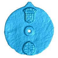
Earliest Known Marine Navigation Tool Found
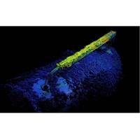
State-of-the-art laser scanning technology has helped researchers to confirm that an artifact recovered from the wreck of a sunken 15th century ship in the Indian Ocean is the earliest known marine navigation tool. When the Blue Water Recovery team found the object in 2014, they believed it was an astrolabe used by mariners to measure the altitude of the sun during voyages, but they were not certain as there were no visible navigational markings. The team approached Professor Williams, who conducts high-tech scanning analyses in his laboratory at WMG University of Warwick in the U.K.
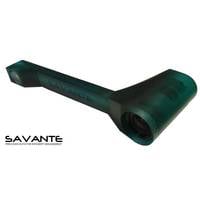
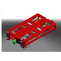
Precision Underwater Laser Scanner for Divers
Aberdeenshire-based Savante Subsea Lasers has miniaturized its dynamic laser scanning (DLS) technology into an integrated diver-operated 3D laser measurement solution. The CTS-3D underwater laser scanner, a handheld diver operated tool, integrates Savante’s 3D laser scanning technology into a compact, lightweight unit. It quickly creates an accurate, digital-virtual representation of submerged structures using a cloud of precisely-determined 3D points (a "surface point cloud"). Accompanied with photometric measurement of the intensity of optical energy at each
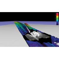
Underwater Laser Scanning for Subsea Pipeline Inspection
events occur is a constant reminder of this need for responsible and safe continued operations. A key aspect to this safe continued operation is inspection monitoring maintenance and repair (IMMR) activities. Major oil producers recognize this requirement and have begun to employ underwater laser scanning technology for a variety of applications. C & C Technologies is setting new standards for subsea asset inspection through the use of underwater laser scanning technology provided by2G Robotics. Laser scanning has a number of benefits for close range inspection over traditional acoustic techniques
CDL Pursues Joint Venture with 3D at Depth
to introduce a comprehensive range of underwater scanning technology. CDL and 3D at Depth have been working together for quite some time on CDL’s most recent product launch - INSCAN, the world’s 3D scanning subsea laser designed for use in the oil and gas industry. The new laser scanning technology offers subsea angle and range measurements at tens of meters with proven sub-centimeter accuracy. The resulting 3D point cloud can be viewed at the surface within minutes of a scan. Application uses such as Brown field scanning/as-builts, metrology functions, pipeline inspections and change


