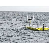
A Breath of Fresh Air: USVs Map Hypoxia in the Gulf
to develop and modernize each of its steps, saving time, money and even lives. Data collection, the middle step of the scientific method, is no exception. Many projects require robust datasets, often collected from extreme environments or over lengthy periods of time. The University of Southern Mississippi (USM), with the help of SeaTrac Systems, has turned to autonomous solutions while conducting hypoxia research in the Gulf of Mexico.The partnership, which includes the National Oceanic and Atmospheric Administration (NOAA), maps potential hypoxia in the Gulf and how it impacts local fisheries
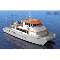
All American Marine Builds University of Texas Marine Science Institute Research Vessel
trips, and up to 14 personnel on extended offshore missions.Operations will include near-shore research based out of Port Aransas, Texas, as well as multi-day expeditions across the Gulf of Mexico. These missions will span near-coastal waters to deep-water environments, including the Texas shelf, the Mississippi, Trinity, and Sabine River Deltas, Salt Dome, and the Flower Garden Banks. To support this work, the vessel is outfitted with a suite of scientific systems that allow researchers to collect water samples, study marine life, map the seafloor, and conduct geophysical surveys. Specialized equipment&m
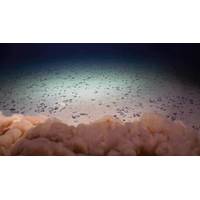
Deep-sea Mining Threatens “Twilight Zone” Ecosystem
all zooplankton and 60% of micronekton, which feed on zooplankton, would be impacted by the discharge of the mining waste, which could ultimately impact predators higher up on the food web.“When the waste released by mining activity enters the ocean, it creates water as murky as the mud-filled Mississippi River. The pervasive particles dilute the nutritious, natural food particles usually consumed by tiny, drifting zooplankton,” said Michael Dowd, lead author of the study and oceanography graduate student in the UH Mānoa School of Ocean and Earth Science and Technology (SOEST).“Micronekton
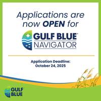
Gulf Blue Navigator Program Now Accepting Applications for Cohort 4
The University of Southern Mississippi’s (USM) Gulf Blue Navigator Program is now accepting applications for Cohort 4, which begins in January 2026. This four-month accelerator is designed to help post-pilot, blue-tech startups scale their technologies by connecting them with key partners across government, industry, and academia.Unlike traditional startup accelerators, the Gulf Blue Navigator takes a hands-on approach to foster collaboration among federal and state agencies, research institutions, and private industry. Participants gain access to state-of-the-art research facilities, wet-labs
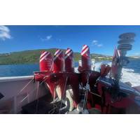
Mini USV Collects Data in a Category 5 Hurricane
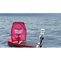
A small, wind–powered uncrewed surface vehicle (USV) captured and transmitted data from inside a Category 5 hurricane on September 28, as part of research by NOAA, the United Kingdom-based robotics company, Oshen, and the University of Southern Mississippi (USM).NOAA has teamed up with Oshen and USM to operate seven USVs called C-Stars to gather weather data from the surface of the ocean during the 2025 hurricane season.During Hurricane Humberto, one of the C-Stars became the smallest USV to gather data from the eyewall of the Category 5 hurricane. Two other C-Stars penetrated Hurricane Humberto
NOAA and Partners Deploy C-Star USVs to Collect Hurricane Data
NOAA, in partnership with The University of Southern Mississippi and with the robotics company Oshen, launched five small uncrewed surface vehicles (USVs) called C-Stars in the waters off the U.S. Virgin Islands on August 31st to collect critical data to better understand hurricane development and activity. The deployment is the latest effort by NOAA to advance data collection to improve hurricane research and forecasting.Two additional C-Stars will be stored in Gulfport, Mississippi, and will be ready for launch ahead of actively developing storms in the Gulf this fall.“Understanding weather
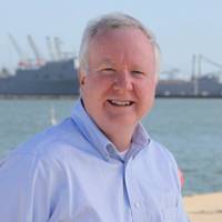
Saildrone: USVs Have Only Scratched the Surface of Maritime Security
of unscrewed surface vehicles (USVs), is redefining how oceans are explored, monitored and protected.At the helm is Brian Connon, vice president of ocean mapping and a former U.S. Navy oceanographer. After leaving the Navy, Connon joined a hydrographic research center at the University of Southern Mississippi, which lead to his role at Saildrone. Now, four and a half years in, Connon has helped establish and scale up the company's ocean mapping capabilities.Saildrone sets the standardIn just over a decade, Saildrone has logged more than two million nautical miles and 50,000 days at sea, from the

NOAA, Partners to Announce Findings From 2025 Gulf of America "Dead Zone" Monitoring
the record-setting 8,776 square-mile dead zone observed in 2017.During the teleconference, speakers will discuss factors influencing this year’s zone size, potential impacts to living marine resources, the accuracy of the spring hypoxia forecast, and ongoing federal and state initiatives in the Mississippi River watershed focused on reducing nutrient runoff into the Gulf.Speakers will include:Cassandra Glaspie, Associate Professor, Louisiana State University; Chief scientist of survey cruiseSean Corson, Director, NOAA’s National Centers for Coastal Ocean ScienceGretchen Oelsner, Hydrologist
Kraken Robotics Banks $3m in SAS Sales
new orders totaling more than $3 million for Kraken Synthetic Aperture Sonar (SAS). The Kraken SAS systems will be integrated on small and medium-class uncrewed underwater vehicles (UUVs) for clients in Asia Pacific, Europe, and North America.One of the orders is for the University of Southern Mississippi’s Roger F. Wicker Center for Ocean Enterprise, which will be outfitting a variety of autonomous underwater vehicles (AUVs) and autonomous surface vessels (ASVs) with Kraken SAS to support research, development, testing, and evaluation activities.Kraken SAS integrates the capability to perform