NOAA Awards 5-yr Hydrographic Gig to Fugro
allow Fugro to deliver high quality hydrographic services with increased safety and efficiency, and a significantly reduced carbon footprint.Two new technologies available to NOAA for upcoming task orders include RAMMS, a next-generation airborne lidar bathymetry system already used by the United Kingdom Hydrographic Office and the Canadian Hydrographic Service, and an uncrewed surface vessel (USV) designed for coastal surveys in challenging areas of shallow water, uncharted shoals and/or water clarity issues.The new IDIQ contract will run from 1 January 2020 to 31 December 2024. Fugro is one of seven
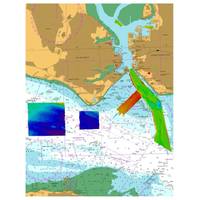
UKHO Contracts with TCarta
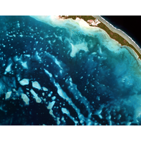
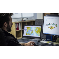
TCarta Marine was contracted by the United Kingdom Hydrographic Office (UKHO) to provide a baseline dataset of water depths and seafloor classification around the Republic of Kiribati. Located in the Pacific Ocean, the island nation is threatened by rising sea levels.TCarta won the open bid for supply of Satellite Derived Bathymetry (SDB) to the UKHO to extract water depth measurements and seafloor classifications, including habitat types, from multispectral satellite imagery. In this project, TCarta is processing eight-band DigitalGlobe WorldView-2 and -3 data predominantly, as well as four-band
Jamaica Updates Hydrographic Information
Jamaica has begun upon updating hydrographic charts in key maritime developmental areas to improve coastal navigation, marine infrastructure works and other maritime activities, with assistance from the UK Government.United Kingdom Hydrographic Office (UKHO) has conducted hydrographic surveys of Kingston Harbour and its Approaches and Portland Bight as part of the UK Government’s Foreign and Commonwealth Office initiative – the Commonwealth Marine Economics Programme (CMEP).Welcoming the data, MAJ Director General, Rear Admiral (Ret’d) Peter Brady, who is also chair of Jamaica’s
L3 ASV to Conduct UK Autonomous Navigation Study
L3 ASV has announced that it has received U.K. government funding for a pioneering project on autonomous navigation of maritime vessels. The company will conduct a study with its partners in the Maritime & Coastguard Agency (MCA) and United Kingdom Hydrographic Office (UKHO), focusing on the future of marine navigational data and charts. The project is funded by the Department for Transport’s Transport Technology Research Innovation Grant (T-TRIG) and aims to promote early-stage science, engineering or technology innovations with the potential to advance the U.K.’s transport system.
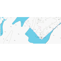
UKHO Creates High Density ENC of the Bristol Channel
The United Kingdom Hydrographic Office (UKHO) has disclosed details of a new Electronic Navigational Chart (ENC) which could help to improve situational awareness and safety. Developed to cover an area of the Bristol Channel known as ‘The Bridge’, this ‘high density’ ENC displays depth contours at one-meter intervals, allowing ECDIS to set safety contours at corresponding levels to support navigation through shallow water. ECDIS will select safety contours based on a safety contour depth value set by the mariner. As most charts contain depth contours at
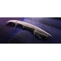
Seabed Mapping Underway in Belize
The United Kingdom Hydrographic Office (UKHO) has deployed two vessels to survey the waters of Belize as part of the Commonwealth Marine Economies (CME) Program, the organization has announced. Following a stakeholder meeting with the Belize Port Authority and wider government earlier this month, priority areas will be surveyed, capturing sonar data of Belize's main ports and approaches. High frequency mapping sonars are being used, which have no negative impact on its diverse ecosystems and marine life. The surveying is expected to continue throughout February and will focus on areas including
UKHO Supports HMS Queen Elizabeth in Portsmouth
The United Kingdom Hydrographic Office (UKHO) has supported the safe arrival of HMS Queen Elizabeth into Portsmouth by providing specialist marine geospatial and hydrographic expertise and data capabilities. Following initial dredging operations to make Portsmouth’s navigation channel and entrance deeper, hydrographic data was collected by the survey launch HMS Gleaner using modern multibeam echosounder technology to confirm the available water depth. As well as providing advice during data collection, the final dataset was then validated by the UKHO to ensure it was the to the
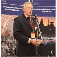
Kortenoeven Wins UKHO Award
Captain Peter Kortenoeven, Hydrographer of the Royal Netherlands Navy, has been presented with the United Kingdom Hydrographic Office’s (UKHO’s) Alexander Dalrymple Award at a ceremony in London. The award is dedicated to Alexander Dalrymple who was the first Hydrographer of the Navy when the office was founded in 1795. The award was instituted in 2006 to coincide with the annual World Hydrography Day and is made to an individual who, in the opinion of the Senior Leadership team at UKHO, has shown outstanding dedication and delivered major contribution to world hydrography. After
IMarEST Becomes an Observer Organization at the IHO
as a observer organization to the IHO. It provides our members with a fantastic opportunity to have their voice heard and further highlights the global reach and influence that the IMarEST has.” “Additionally, over the past year or so, we have been working closely with the United Kingdom Hydrographic Office, supporting the professional development of their staff, so the timing is excellent.” The IMarEST also has consultative status at the International Maritime Organization (IMO), observer status at the International Oceanographic Commission of UNESCO, and it has special consultative