Over 1000 Coral Reefs Mapped in Northern Australia
© Australian Institute of Marine Science
Australian Institute of Marine Science (AIMS) scientists have unveiled and mapped more than 1000 previously uncharted coral reefs in northern Australia, all without setting foot on a boat, or even leaving their offices.
Despite being a habitat for a wide range of marine life, and possibly known by locals, reefs from Houtman Abrolhos in Western Australia through to western Cape York in Queensland have until now been mostly invisible and overlooked in conservation and development planning. The Marine and Coastal Hub project, led by AIMS, and run in partnership with the University of Queensland (UQ), unveiled the reefs which are typically hidden in sediment-rich waters.
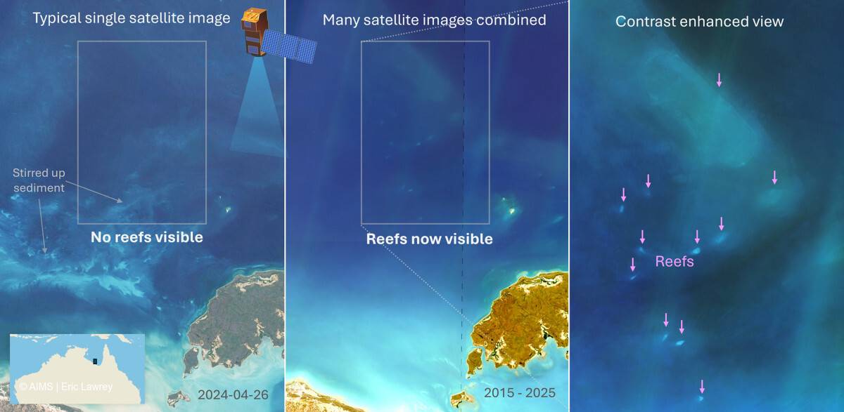
AIMS e-Atlas Project Manager Dr Eric Lawrey said he first got the idea about 12 years ago, when satellite imagery, such as Google Earth, became ubiquitous. The challenge was that, even on a clear day, it was very difficult to see these reefs as they were often located deep in turbid waters.
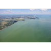
“If you look at any one satellite image, the water just looks like turquoise paint and you can’t really see reefs,” he said. “But if we overlay 200 images of the area, taken at different times, to create a composite image, all the swirly patterns of the moving water move around and average out while the reefs are constant. Their signal gets reinforced and they become much clearer. It allows us to peek deeper into the water column than we could in one image.”
It took 700 hours just to digitize the reefs and assign classifications to them.
Dr Lawrey said the work revealed that northern Australia had a similar quantity of reefs as the Great Barrier Reef, albeit many of the reefs were much smaller.
Previously, most of the northern Australian coastline was unsurveyed. The best mapping of northern Australia could be found in the marine charts which did not distinguish between coral reefs and rocky reefs as they were simply designed to warn vessels to stay clear.
The team mapped and classified reef boundaries to create the first comprehensive view of coral reefs boundaries across northern Australia. This includes more than 3600 coral reefs and 2900 rocky reefs.
The final datasets are openly available through public data portals, including the eAtlas and AODN.