
Fugro Provides Airborne Mapping Support to FDOT Ahead of Hurricane Isaias
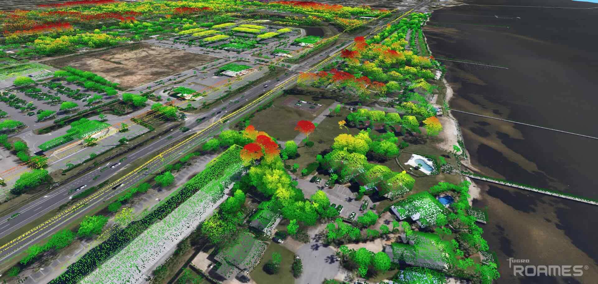
ROAMES data. Image credit: Fugro
Fugro mobilized airborne mapping resources for the Florida Department of Transportation (FDOT) to support the state’s response to Hurricane Isaias. By capturing lidar data and aerial imagery immediately before and after the hurricane made landfall, Fugro provided timely Geo-data to help assess changes across vulnerable coastal areas and inform recovery planning.
As Hurricane Isaias approached Florida’s Gulf Coast, FDOT requested an urgent survey of coastal areas near the storm’s anticipated landfall in the Florida Panhandle. Within 13 hours of receiving the request, Fugro had developed an operational plan, mobilized aircraft and personnel, secured flight approvals and deployed to the survey area.
Fugro conducted aerial mapping missions on the day before and two days after the hurricane made landfall. Hurricane Isaias came ashore near Destin on October 9 as a Category 2 hurricane, with maximum sustained winds of 105 mph. It caused widespread damage and left hundreds of thousands of customer accounts without power across Florida.
Across approximately 150 square miles and a 70-mile stretch of coastline and barrier islands, Fugro collected 20-point-per-square-meter topographic lidar data and four-band aerial imagery. Processing through Fugro’s ROAMES platform enabled the rapid delivery of survey products, including analysis showing changes between pre- and post-storm conditions.
The resulting information provides state agencies with a consistent view of conditions immediately before and after the storm, supporting infrastructure assessments, recovery prioritisation and longer-term resilience planning. Despite challenging weather and operational constraints, Fugro completed surveys of the full area of interest twice, including authorized operations within military-restricted airspace.




 August 2026