Real-time Mapping, Visualization in CARIS Onboard 2.0
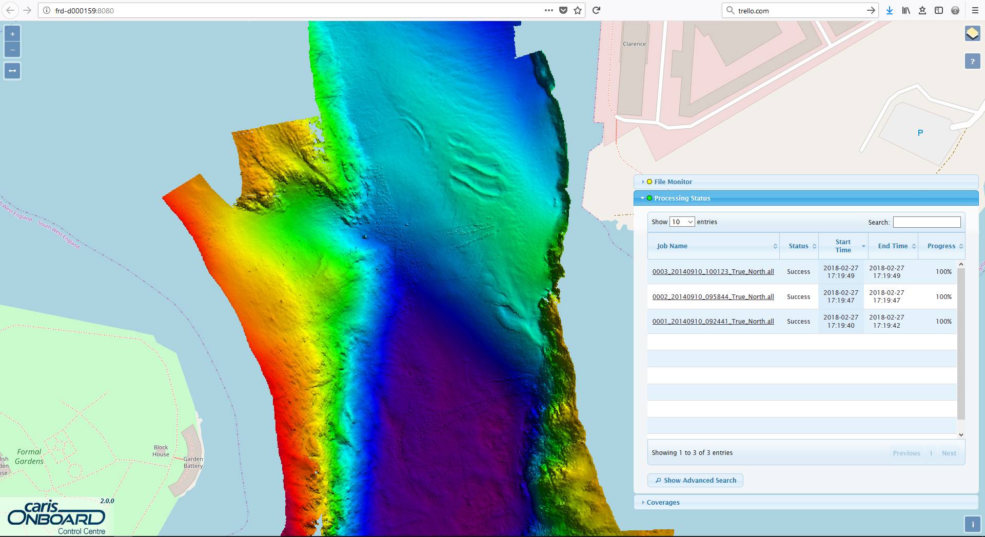
CARIS Onboard Control Centre (lower right) showing background connection to Open Street Maps, with a dynamically updated Digital Terrain Model (DTM) being rendered in near-real time (Photo: Teledyne CARIS)
Teledyne CARIS has announced the release of CARIS Onboard 2.0. CARIS Onboard enables users to apply processes automatically to their data in near real-time, resulting in minimized data conversion and processing times.
By making the processed products available at the office or on a survey vessel during survey operations, CARIS Onboard helps improve survey efficiency by valuably reducing the turn-around time and helping to ensure that data quality and coverage requirements are met before leaving an area.
Focused around the latest web map technology, the redesigned control centre dynamically controls and monitors the automated system. Products generated including surfaces, backscatter mosaics, and the survey track lines are live-streamed during acquisition and accessed through a web browser. By providing access to processed products in a web application, the new Control Centre allows review of a survey dataset from any device with a network connection to the vessel. This increased access allows information about survey operations to be accessible when and where needed.
Other updates in this version include a simplified installation process for CARIS Onboard and process improvements to help increase ease of use. Vessel parameters will now be automatically read from the raw data files and applied during processing, further streamlining the workflow.
CARIS Onboard 2.0 also introduces several improvements to the File Monitor, with support for multiple sensors and advance filters to provide more control over which files are processed. By creating up to four File Monitors, each with a unique filter and unique Process Model, a single installation of CARIS Onboard can process data from all sensors on a given survey platform.
The official release date of CARIS Onboard 2.0 is March 13th, coinciding with Oceanology International 2018.