Marine Technology News Search
Search term • "advanced navigation"
Create an email alert for "advanced navigation"
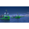
Sonardyne's Sensors for Ocean Infinity's Armada USV Fleet
Ocean Infinity, a U.S. based marine survey firm developing the world's largest fleet of unmanned surface vessels - Armada - has ordered Sonardyne sensors for its robotic vessels.As reported previously, Ocean Infinity in February launched Armada, a marine technology and data company boasting the industry's largest fleet of unmanned surface vehicles (USV).Sonardyne said Wednesday it would provide the…
BIRNS Launches Ecommerce Capability for NPT Penetrators
BIRNS, Inc., a designer and manufacturer of high performance connectors, cable assemblies and lighting systems, announced its new e-commerce offering for NPT (National Pipe Thread) penetrators on its website.This new capability provides customers an online one-stop shop for BIRNS’ ABS Product Design Assessment (PDA) certified penetrators. Available configurations on the site include sizes P25N-16-RA-LS, P25N-12-RA-LS, P13N-4-RA-LS and P19N-12-RA-LS, available with 4, 12 or 16 conductors.
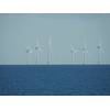
US Targets 30GW of Offshore Wind by 2030, 110GW by 2050
On Monday, March 29, the White House announced a government-wide effort to advance offshore wind, including 30 gigawatts (GW) of offshore wind by 2030, 110GW of U.S. offshore wind by 2050 and the development of a sustainable local offshore wind supply chain.“The announcement formalizes the current situation and provides more confidence to developers and the supply chain,” said World Energy Reports' Philip Lewis.

Conference on Oceans Law & Policy: Peaceful Maritime Engagement in East Asia and the Pacific Region
The World Maritime University (WMU)- Sasakawa Global Ocean Institute will co-host the worldwide Conference on Oceans Law & Policy: Peaceful Maritime Engagement in East Asia and the Pacific Region that will take place virtually from May 10 – 12, 2021. Co-hosts include the Japanese Institute of International Affairs, the International Sasakawa Peace Foundation, and the Stockton Center for International Law at the United States Naval War College.The Conference will be opened by Dr.
INTERVIEW: Rutgers University Uses Slocum Glider for Ocean Acidification Study
Grace Saba, Assistant Professor, Center for Ocean Observing Leadership, Department of Marine and Coastal Sciences, Rutgers University discusses the value of the Slocum glider and pH sensor technology in the study of Ocean Acidification. Grace, to start us off, can you just give us a short introduction of yourself and an overview of your responsibilities?I'm an assistant professor at Rutgers University: I teach…
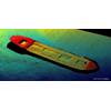
Royal IHC sells TSHD Easydredge
Royal IHC announced the sale of an Easydredge 3700, the largest vessel in the Easydredge series of standard twin-screw trailing suction hopper dredgers (TSHD), which are designed and built by IHC. This innovative and flexible Easydredge concept can be tailor-made to suit requirements, without compromising on delivery times or price. Available from stock, they are fit for all common maintenance and land reclamation jobs and offer customers maximum cost efficiency and affordability…
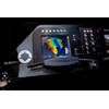
New Shallow-medium Depth Multibeam Echo Sounder
Kongsberg Maritime has introduced a new multibeam echo sounder designed for survey and inspection operations in shallow and medium water depths: the new KONGSBERG EM 712 multibeam echo sounder, the second generation of wideband multibeam for these water depths. The EM 712 supersedes the EM 710. All users of the EM 710 will be offered an upgrade path, making it easy to integrate the EM 712 into operations.
Partners to Advance Subsea Robotic Inspection
A first-of-its-kind integration of artificial intelligence, autonomous underwater vehicles, laser sensors and 3D imaging aims to advance inspection services for the oil and gas industry. Kraken Robotics Inc.’s wholly-owned subsidiary, Kraken Robotic Systems Inc., has partnered with GE Venture Avitas Systems to integrate autonomous underwater vehicles (AUVs), acoustic and laser sensor technology and…

Inside Sofar Ocean Technologies' Epic Quest to Open Ocean Data
Tim Janssen, CEO, Sofar Ocean Technologies, discusses this real-time ocean intelligence platform’s quest to collect, network and distribute vast amounts of ocean information and insight, essentially creating the ‘nervous system for the oceans.’Tim, to start, please give us a by the numbers look at your company?We are a startup, with 50 people in our San Francisco office, and 50 on the water. We have more than 1…

Shell Ocean Discovery XPRIZE Winner Annouced
The GEBCO NF- Alumni Team was announced as the $4 million grand prize winner of the Shell Ocean Discovery XPRIZE, a three-year global competition that challenged teams to advance deep sea technologies for autonomous and unmanned, fast and high-resolution ocean exploration. The team's winning concept includes the use of a unique unmanned surface vessel (USV) / autonomous underwater vessel (AUV) and…
MacArtney: Custom EMO Multiplexer
Upgrading the subsea survey and camera interfaces of an ROV represents the primary purpose of the MUX having been deployed in Singapore. The requirements for reliable transmission of large amounts of data and video from ROVs, ROTVs, ocean observatories and instrumentation packages are contantly being sharpened. Gathering high-quality data from the deep sea is an im¬mense undertaking, which calls for…
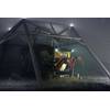
Sonardyne’s Sonar on SubSea Craft's New Diver Delivery System
Underwater obstacle avoidance technology from Sonardyne International Ltd. has been chosen for a new design diver delivery unit (DDU) being built by SubSea Craft.Sonardyne’s Vigilant forward looking sonar (FLS) will provide a critical hazard avoidance capability for the crew and embarked divers of the VICTA Class DDU when navigating on or below the surface.Using a compact and sophisticated bow-mounted transducer arrangement…
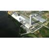
Nexans Opens Expanded Subsea Cable Facility in Charleston
France-based offshore cable manufacturer and installation contractor Nexans announced Tuesday it has officially opened its transformed high voltage subsea cable plant in Charleston, S.C.From the Charleston facility Nexans will deliver subsea cables up to 525kV HVDC and 400kV HVAC, covering the full range of needed products for export cables for offshore wind and subsea interconnectors. The first subsea high voltage export cable will be delivered to an offshore windfarm in the U.K.
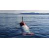
UK’s Test XLUUV Demonstrates Obstacle Avoidance Capabilities
An extra-large, uncrewed, underwater vehicle (XLUUV) built and operated by Plymouth-based MSubs Ltd has recently demonstrated advanced underwater obstacle avoidance technology, as part of the first phase of the UK’s Defense and Security Accelerator’s (DASA) ‘Uncrewed Underwater Vehicle Testbed – Opportunity to Integrate’ competition, run jointly with the Royal Navy and the Defense Science and Technology Laboratory (Dstl).Vigilant…

Teledyne Marine Technology Workshop: Speakers Wanted
Teledyne Marine said it is seeking speakers for its joint Teledyne Marine Technology Workshop (TMTW) to be hosted in San Diego, October 6-9, 2019.The company’s 23 brands will once again join forces to host an expanded users’ conference in which users from around the globe will converge to explore, learn and share their experience on a broad range of applications and technologies. A key component of…
MarineNav ROVs for Marine Inspections
MarineNav, located in Montague, Prince Edward Island, Canada, has been showcasing its latest technologies and equipment serving defense, aquaculture, law enforcement and first responder needs in marine operations. The company’s offerings include marine-grade navigation components such as computers and displays; advanced vessel monitoring (AVM) and fleet management systems; and customizable industrial underwater remotely operated vehicles (ROVs).Interchangeable ROV componentsFor its ROVs…
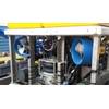
Ashtead Technology Adds iXblue Tech to Rental Fleet
UK-based subsea equipment rental and solutions specialist Ashtead Technology said Monday it had strengthened its rental fleet with "a significant investment" in iXblue subsea navigation systems.The investment includes the addition of further Rovins and Rovins Nano inertial navigation systems as well as Octans attitude and heading reference systems which are now available to rent throughout the company’s nine international technology and service hubs…
IKM Subsea's ROV to Sport Nauticus Robotics Olympic Arm
Norwegian ROV operator and subsea services company IKM Subsea has selected the Nauticus Robotics Olympic Arm, a fully electric work-class manipulator, for its subsea resident remotely operated vehicle (ROV) system. The Olympic Arm increases subsea reliability and capability while extending residency dive time. It also boasts the strength, weight, and size characteristics of traditional work-class hydraulic arms without the chronic maintenance needs…
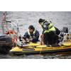
Tech File: Sonar Equipment Critical to Search and Recovery
According to the CDC, 3,960 fatal unintentional drownings, including boating-related drownings, occurred in 2020. To locate the missing persons and provide closure to families, it takes dive teams time to assemble, gather their equipment, and begin searching sometimes vast bodies of water. Searching via divers is not only a long process, but it adds a considerable level of risk to an already dangerous assignment.
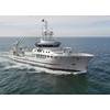
New Fisheries Research Vessel for Angola
A new 74-meter fishery research vessel (FRV) will be built at Damen Shipyards Galati, Romania and delivered to the Angolan Ministry of Fisheries in July 2018. Kongsberg Maritime has been awarded a contract by Damen Schelde Naval Shipbuilding of Vlissingen, the Netherlands to provide a diverse, integrated technology solution for the high-tech vessel, which was designed by Skipsteknisk and uses Silent…


