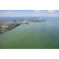
NOAA Predicts Moderate Harmful Algal Bloom for Western Lake Erie
NOAA and its research partners are forecasting a moderate harmful algal bloom (HAB) in western Lake Erie this summer. This year’s bloom is expected to measure 3.5 on the HAB severity index, with a potential range of 3 to 4.5.“Toxic algae affect not only the health of people and Great Lakes ecosystems, but they can negatively impact local and regional economies by preventing people from fishing, swimming, boating and visiting the shoreline,” said Nicole LeBoeuf, assistant administrator for NOAA’s National Ocean Service. “NOAA’s Lake Erie harmful algal bloom
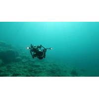
Live Broadcast Planned for Deepest Point in Great Lakes
years ago, scientists descended here in a submersible. Since then, the depths have remained virtually unexplored, until now.Using a cinema grade Boxfish Luna ROV, the team aim to view deepwater life uniquely adapted to these conditions. They also hope to encounter one of the rarest fish in the Great Lakes, the kiyi, a deepwater cisco now found only in Lake Superior, and never photographed alive in its natural habitat.Joining the dive is fisheries research biologist Shawn Sitar from the Michigan Department of Natural Resources. His research covers the appearance of “zombie fish”, emaciated
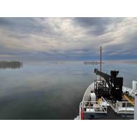
NOAA Ship Thomas Jefferson Returns to the Great Lakes to Map the Region
For the first time since 2022, the NOAA Ship Thomas Jefferson is underway in the Great Lakes. The vessel and its crew of NOAA Corps officers and professional mariners are working with NOAA scientists to map the waters of western and central Lake Erie and eastern Lake Ontario this year to improve navigation safety. Survey work will also occur within Lake Ontario National Marine Sanctuary to identify critical habitats located within the area.Western Lake Erie, one of the shallowest areas within the Great Lakes marine transportation system, is highly trafficked by commercial and recreational vessels and
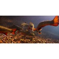
Great Lakes Wildlife Film Project Includes Interactive Live Events
Award-winning filmmakers Yvonne Drebert and Zach Melnick are setting out to reveal it in their most ambitious project yet: Hidden Below: The Great Lakes — a new TVO Original wildlife documentary exploring the Great Lakes watershed.Production is already underway, with Drebert and Melnick deploying next-generation underwater drones capable of reaching the deepest depths of the lakes.Over the next two years, the team’s cameras will capture a hidden world of survival and spectacle — deepwater sculpin guarding their nests hundreds of meters below the surface, rare lake trout with oversized
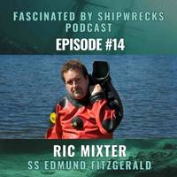
Fascinated by Shipwrecks Podcast: Episode 14
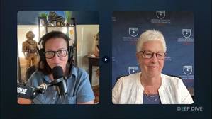
The SS Edmund Fitgerald was the largest ship on the Great Lakes when she was launched on June 7, 1958. She sank in a storm on November 10, 1975, on her way from Superior, Wisconsin, to Zug Island, Detroit, Michigan, with a load of taconite ore pellets. All 29 men were lost, and a haunting bell-ringing ceremony continues annually on November 10, at the Great Lakes Shipwreck Museum and the Mariner’s Church in Detroit, in tribute.In this episode, host Kathy A. Smith talks with Ric Mixter, wreck researcher, investigative journalist, and one of the foremost experts on the ship. He shares stories from
NV5 Advances Hydrography in the Great Lakes: Join the August 27 Live Webinar
NV5 has unveiled its latest precision hydrography innovations in the Great Lakes, enabling maritime stakeholders to “Own the Lakebed, Master the Mission." To showcase these breakthrough capabilities, NV5 will host a free, live webinar on Wednesday, August 27 at 1:00 PM CT/ 2:00 PM ET, offering a deep dive into how integrated hydrographic, terrestrial, and lidar data are transforming infrastructure planning and environmental monitoring in the region.From shoreline restoration to subsea cable routing and coastal resilience projects, complex Great Lakes environments demand highly accurate

Advancing Hydrography in the Great Lakes
In this live webinar, you’ll discover how our latest hydrographic survey innovations, developed and refined across multiple years of Great Lakes operations, can support your infrastructure, energy, and environmental initiatives.Hydrospatial experts from NV5, NOAA, and Exail will be presenting.We’ll highlight:- Survey efficiencies that cut timelines without compromising quality- Integration of hydrographic, terrestrial, and topobathymetric lidar data- Real-world applications that power better planning and decision-makingWednesday, August 27 at 1:00 PM CT / 2 PM ET.Register here.
US Announces $575 Million for Coastal Climate Resilience
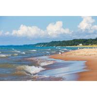
The U.S. Department of Commerce announced its first-ever Climate Resilience Regional Challenge, which will provide $575 million in funding through President Biden’s Investing in America agenda to help coastal and Great Lakes communities, including tribal communities in those regions, become more resilient to extreme weather and other impacts of the climate crisis. The Challenge is the first and largest funding opportunity released under the $2.6 billion Inflation Reduction Act climate resilience framework that the Department unveiled in June. “Through this first-ever regional approach to
NOAA, Coast Guard to Collect Data from a Great Lakes Icebreaker
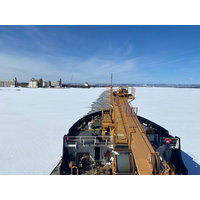
This week, NOAA's Office of Response and Restoration (OR&R) scientists worked with the U.S. Coast Guard during ice-breaking in Lake Superior Harbor in Duluth, Minnesota, aboard the Coast Guard Cutter Spar. This project is the first set of experiments funded by the newly developed Great Lakes Center of Expertise.Teams from both Coast Guard District 9 and NOAA deployed uncrewed aircraft system (UAS) with multispectral, thermal and LIDAR sensors to collect data while the Spar was breaking ice in the harbor. The team collaborated to develop data and mapping products that will advance


 August 2026