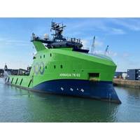
"No Find, No Fee" Search for MH370 to Commence
to civilian air traffic control systems.Military radar later showed the aircraft deviated sharply from its planned route, turning back across northern Malaysia and Penang Island before heading northwest into the Andaman Sea. It then turned south, after which all contact was lost.Satellite data from Inmarsat suggested the aircraft continued flying for several hours and likely crashed in a remote stretch of the southern Indian Ocean, west of Australia. That analysis guided a multinational underwater search launched by Malaysia, Australia and China, covering about 120,000 square kilometers of seabed.

Crew Connectivity Evolves from Luxury to Lifeline
The maritime industry has long wrestled with the challenge of attracting and retaining skilled seafarers. But according to Eric Griffin, VP of Offshore Energy & Fishing, Maritime, at Inmarsat, one factor now sits firmly at the center of the conversation: seamless connectivity.On October 22, Maritime Reporter & Engineering News will host a webinar entilted Crewed Up or Crew Cut? Rethinking retention and recruitment at sea. Click here to register and to learn from vessel owners their own experience in utilizing connectivity for seafarer recruitment and retention.“Traditionally, seafarers
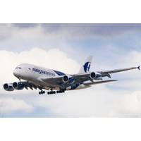
A Decade Later, Ocean Infinity Continues the Search for MH370
engaged Ocean Infinity in 2018 to search in the southern Indian Ocean, but two attempts failed.They followed an underwater search by Australia, China and Malaysia over an area of 120,000 sq km (46,332 sq mile) of the southern Indian Ocean, based on records of automatic connections between an Inmarsat satellite and the aircraft.MH370's last transmission was about 40 minutes after it took off from Kuala Lumpur for the Chinese capital. The pilots signed off as the plane entered Vietnamese air space over the Gulf of Thailand and soon after its transponder was turned off.Military radar showed

Inmarsat Launches NexusWave to Boost Maritime Communications
Mobile satellite communications provider Inmarsat, a Visata company, has launched NexusWave, a fully managed connectivity service designed to improve maritime communications and global coverage at sea.NexusWave is underpinned by a bonded multi-dimensional network, offering high-speed connectivity, unlimited data, global coverage, and ‘secure by design’ infrastructure, according to Inmarsat.Delivered by a single provider, NexusWave offers fully managed service that seamlessly integrates multiple high-speed networks in real time – Global Xpress (GX) Ka-band, low-Earth orbit (LEO)
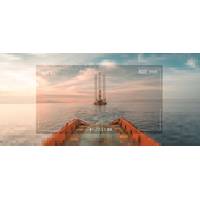
Connecting the Dots: From Remote Operations to Full Autonomy
;In 2018, we set out with a mission to make remote operations possible, with a longer-term view of enabling the path towards robotics and autonomy.”Today, by Brown’s estimation, Harvest supports the majority of tier-one service providers within the IMR space.“We've recently joined Inmarsat Maritime's initiative as a certified application provider, so that's giving us access to a significant part of the global maritime and shipping sector,” he said.“In 2018, we set out with a mission to make remote operations possible, with a longer term view of enabling the path

Strategizing Connectivity for Fleet Optimization, Remote Ops
Chris Sepp, Vice President of IT at Atlas Corp. (Seaspan), explains how a strategic approach to connectivity, as recommended by Inmarsat, can help shipping companies to realize fleet-wide optimisation, automation and enable remote operations.Digital technologies are becoming an established feature of modern shipping and are critical to the industry’s future success. Capabilities such as AI-enhanced voyage management and IoT-backed condition-based maintenance can make a significant contribution to the optimization and automation of vessel operations, but their fleet-wide implementation can also
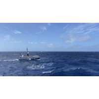
Inmarsat Supports Sea-Kit's USV Tonga Eruption Site Survey
Satellite communication specialist Inmarsat said Wednesday it had provided SEA-KIT International’s uncrewed surface vessel (USV) Maxlimer with connectivity services to transmit data and video from the site of the recent underwater volcanic eruption in Tonga. As part of an international project to assess the environmental damage caused by the eruption, the 12-meter remotely operated vessel mapped the volcano’s submerged caldera and measured local marine conditions.In 2021, Inmarsat installed a Global Xpress antenna and Fleet LTE hardware on board Maxlimer, adding to the USV’s
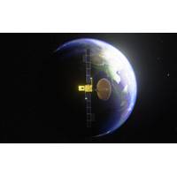
New InmarsatSatellite Reaches Geostationary Orbit, Testing Begins
I-6 F1, Inmarsat's most sophisticated commercial communications satellite\, has reached geostationary orbit and begun on-orbit testing, Carrying both L-band and Ka-band payloads, I-6 F1 will deliver a further enhancement of Inmarsat’s ELERA and Global Xpress networks respectively.The satellite, the size of a London double-decker bus, with a solar array ‘wingspan’ larger than a Boeing 767, was launched by MHI in Japan in December 2021. Since its launch, it has been moving towards geostationary orbit (GEO) approximately 36,000km (~22,500 miles) above the Earth via its all-electric
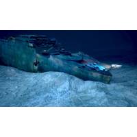
Inmarsat's Satellite Services for OceanGate Expeditions' 2022 Titanic Survey Expedition
OceanGate Expeditions has announced Inmarsat as the satellite service provider for the 2022 Titanic Survey Expedition. Inmarsat’s Fleet Xpress high-speed satellite service will enable OceanGate Expeditions’ at-sea crew to instantly connect with scientific and operational resources anywhere in the world and to share important findings immediately while enhancing safety for the entire operation. Following the tragic loss of life in the sinking of Titanic, the International Convention for Safety of Life at Sea (SOLAS) was adopted. Over the years the SOLAS Convention evolved as

 February 2026