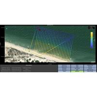
Australia Invests in Undersea Navigation Technology Development
work underwater, while technologies such as sonar can reveal a vessel’s location.The Undersea Navigation Challenge asked Australian companies for innovative solutions to the challenge of autonomously navigating underwater. They needed to create small size, low weight, low power and low cost navigation systems suitable for autonomous underwater vehicles, which can operate independently for extended periods.The Undersea Navigation Challenge is a joint effort across Defence, with support provided by Defence Science and Technology Group, Joint Capabilities Group and the Royal Australian Navy
Intruder Alert: Ports Face a Range of Underwater Threats
for reconnaissance or payloads designed to damage ships or infrastructure, all without risking human life. Their low acoustic signatures make them difficult to detect in the acoustically cluttered environments typical of busy ports, and they can infiltrate harbors autonomously using advanced navigation systems. And the growing affordability and accessibility of UUV technologies means underwater strike capabilities are no longer limited to specialized military units, and may increasingly enter the toolkit of both state and non-state actors.As these risks grow, coastal installations are increasingly
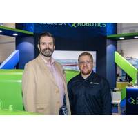
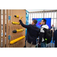
Cellula Robotics Selects Sonardyne for Long-Range AUVs
Autonomous subsea robotic systems developer Cellula Robotics has chosen Sonardyne navigation and positioning technology for its long-range autonomous underwater vehicle (AUV) platforms.The company has ordered multiple Sonardyne SPRINT-Nav X navigation systems - Sonardyne's highest grade and underwater navigation system.The company has also selected Sonardyne’s AvTrak 6 for tracking, communications and mission control. Part of the package/purchase is multiple Sonardyne Ranger 2 Ultra-Short BaseLine (USBL) positioning and communications systems for both AUV end users and demonstration and
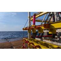
Exail Supplies LBL Positioning Systems for Deepwater Projects in Brazil and Angola
, supporting subsea construction, offshore infrastructure installation, and survey operations in complex environments at depths of up to 4,000 meters.In Brazil, for a major ultra-deepwater gas development, Exail is supplying a network of 56 Canopus acoustic transponders paired with Rovins inertial navigation systems (INS). This installation establishes the primary subsea positioning reference required for the field’s critical construction phases. In Angola, on a mature offshore oil field, Exail’s technology is supporting the expansion of existing subsea infrastructure. By interfacing Ramses
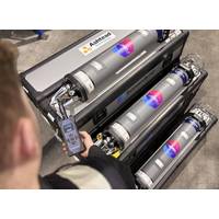
Ashtead Technology Places New Order for Sonardyne’s Fusion 2 Platform
and wireless structure deflection monitoring.These features significantly reduce transponder count, vessel time and operational costs while ensuring centimetric accuracy in subsea positioning.As well as Compatt 6+ and ROVNav 6+ Ashtead Technology’s expanded fleet now includes SPRINT-Nav navigation systems, Nano transponders and RT 6 acoustic releases.Together, these technologies form the most capable and compatible subsea positioning and navigation solutions available in their fleet. "Fusion 2 represents five decades of pioneering innovation at Sonardyne, driven by our goal to make
Automatic docking as an enabling technology for the operational autonomy of underwater systems
in the overall duration of data acquisition campaigns.The evolution of docking technology has followed a gradual path: from early manual or assisted solutions, which required significant operator support, to more recent implementations of automatic docking. The latter are based on precision navigation systems, acoustic and optical proximity sensors, advanced control algorithms and autonomous decision-making logics, capable of robustly managing the approach, capture and disconnection phases even under challenging environmental conditions.Automatic docking does not represent a mere incremental improvement
Greensea IQ Introduces Bayonet Insight Post-Mission Analysis Toolset
maritime robotics software products deployed to defense forces. Bayonet Insight supports all software deployed on Bayonet Autonomous Underwater Ground Vehicles (AUGVs), EOD Edge and EOD Workspace deployed on Mission Specialist Defender ROVs by VideoRay (an AeroVironment company), RNAV diver navigation systems by STIDD Systems, Bayonet Underwater Control (BUC) systems, and Greensea’s EverClean ship maintenance and inspection robots. The tool was developed in response to a persistent need from operators for faster access to mission insight.Bayonet Insight enables operators to process raw mission
Teledyne Marine Will Debut New Technologies at Oceanology International 2026
density and significant time and cost savings for survey operators.Live demonstrations aboard the Maplin The demos will feature the new SeaBat T51-R Integrated Dual Head multibeam system and the Compact Navigator in action for the first time. Attendees will see how tightly integrated sonar and navigation systems work together to deliver reliable, high-resolution seabed mapping, improved operational efficiency and confidence in data quality.Click here to reserve a seat at one of Teledyne Marine’s on-water demo sessions.
Teledyne Marine RESON Celebrates 50 Years
continuity, craftsmanship, and technical depth, supported by a highly experienced team, many of whom have been with the company for decades.Since becoming part of Teledyne Technologies in 2013, RESON has expanded its offering with advanced processing solutions, new sonar models and integrated navigation systems. Several new RESON products will debut at Oi26, with full details revealed exclusively at the show.Teledyne RESON will host its 50th Anniversary Reception at stand F100 at Oceanology International, ExCel London on March 10 at 3:00 pm. The celebration will include new product launches and opportuniti