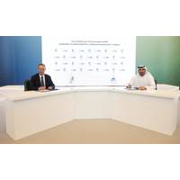
ADNOC L&S, SeaOwl Designing Unmanned Supply Vessels for Offshore Operations
operations in support of the UAE’s Net Zero by 2050 Strategic Initiative and ADNOC’s 2030 Sustainability Agenda," ADNOC L&S said.The design for the 55 meters long unmanned remotely operated vessel will allow the vessels to be operated from an onshore control room through a satellite link using the latest automation and self-navigation technology. The design will utilize state of the art artificial intelligence systems to control propulsion, dynamic positioning, remote communication and cyber security, ADNOC L&S said.SeaOwl, a French company specializing in the automation
Harvest Smart Buoy Tech Helps Deliver Data from the Seafloor
access to real-time data from the sea floor.The system uses acoustic transfer technology to securely transmit data 24/7 from a monitoring structure on the sea floor to a “smart buoy” at the surface. The smart buoy acts as a modem to communicate data back onshore via mobile or satellite link – at a fraction of the bandwidth typically required, alleviating the challenge of relying on retrospective data to make critical operational decisions.“Harvest’s Nodestream protocol allows customers to receive a live video feed of their subsea assets from anywhere via any mobile
Seatronics Sells Two Reusable Mine Disposal Systems to Elbit
;The Seagull USV is an ideal host platform for remote deployment of the Seatronics MIDS remotely operated vehicle (ROV) using a custom launch and recovery system. The MIDS ROV can be deployed from the Seagull in fully autonomous, semi-autonomous or supervised autonomy operational mode, or operated via satellite link from the mother ship or any other remote location," Seatronics explained.The Seatronics MIDS shares several design features with the company’s proven VALOR platform, the company said. However, it also includes a range of highly specific, leading-edge sensors, such as an advanced inertial
EcoLight AZFP Buoy to Monitor Light and Under-Ice Zooplankton
abundant solar power, the buoy will sample for 20 minutes every two hours, limited by the amount of data that can be transferred via the Iridium satellite modem connection. In the winter, the buoy will sample for six minutes every three hours, limited mostly by available backup battery capacity. This satellite link is bi-directional allowing for the downloading of data as well as the ability to reconfigure instrument parameters remotely.Others involved in this project include Dr. Lovro Valcic (Bruncin Observation Systems); Dr. Julienne Stroeve (University College London); Dr. Michael Karcher (Ocean Atmosphere
MTR100: Teledyne Marine
well as RDI’s short range DVS for boundary measurements, and Citadel CTDs for conductivity, temperature and depth measurements• Benthos acoustic modems for reliable wireless data transmission from the mooring to the surface for data download from ship of opportunity or transmission via a satellite link to shore.• Benthos glass-housings to house instrumentation and/or relieve dangerous mooring strain.• Benthos acoustic releases to ensure mooring/data retrieval. And now, via a GNSS upgrade to the topside unit, users can survey in their moorings, for fast and easy mooring relocation
MTR100: Five "Ones to Watch"
is the only vehicle currently on the market capable of undertaking long-term residency in difficult to access locations.”Saab Seaeye has also been working on other systems, such as remote operability of its light world class Leopard ROV. It’s been working with Boeing doing trials over a satellite link across the US, controlling the ROV to do manipulator work, mating connectors, flying missions and way point control. Even when the latency was pushed to up to three seconds and data rates “messed with”, the system still performed, says Siesjö.Meanwhile, Saab Seaeye is also working
Expendable Unmanned Vehicle for Mine Countermeasures
unmanned surface vessels (USV) built by a partner company. The USV is equipped with an inspection function using the K-STER I and a destruction one using K-STER C. All the vehicles are launched autonomously with an automated launch and recovery system (LARS), remotely piloted via a radio or satellite link. Onshore, crew launches and pilots remotely from the control and command center the inspection vehicle. If a mine is found a Ddsposal vehicle KSTER C is deployed by a dedicated launching system, in order to destroy the mine. This project is the result of more than 20
Uncontended Voice and Data Through TDMA Networks
;s clients now conduct operations through an onshore command center and maintain active communications with the crews offshore operating the equipment. As vessels become more automated, the need for connectivity only increases. The visibility that’s made possible through Harris CapRock’s satellite link has become a necessity for the subsea operations, and through it, Oceaneering has been able to provide more sophisticated solutions because of reliable communications across its fleet of vessels. * Editor’s Note: On November 1, 2016, Harris’ CapRock Communicat
New System Taps Ocean Thermal Energy to Power Underwater Vehicles
in deep waters off the coast of Hawaii, a TREC Battery-powered underwater unmanned vehicle (UUV) completed more than 1,000 dives, each to a depth of 500 meters while recording depth, ocean temperature and salinity. At the end of each dive, its oceanographic data and GPS location were uploaded via satellite link to a ground station. When the autonomous test vehicle had completed its mission, it signaled its location with a GPS beacon for a recovery by ship. The seed round funding for continued research, development and commercialization of the TREC Battery ended in December 2016, including funds


