CSIRO Deploys World-First Sensors in Great Barrier Reef
Source: CSIRO
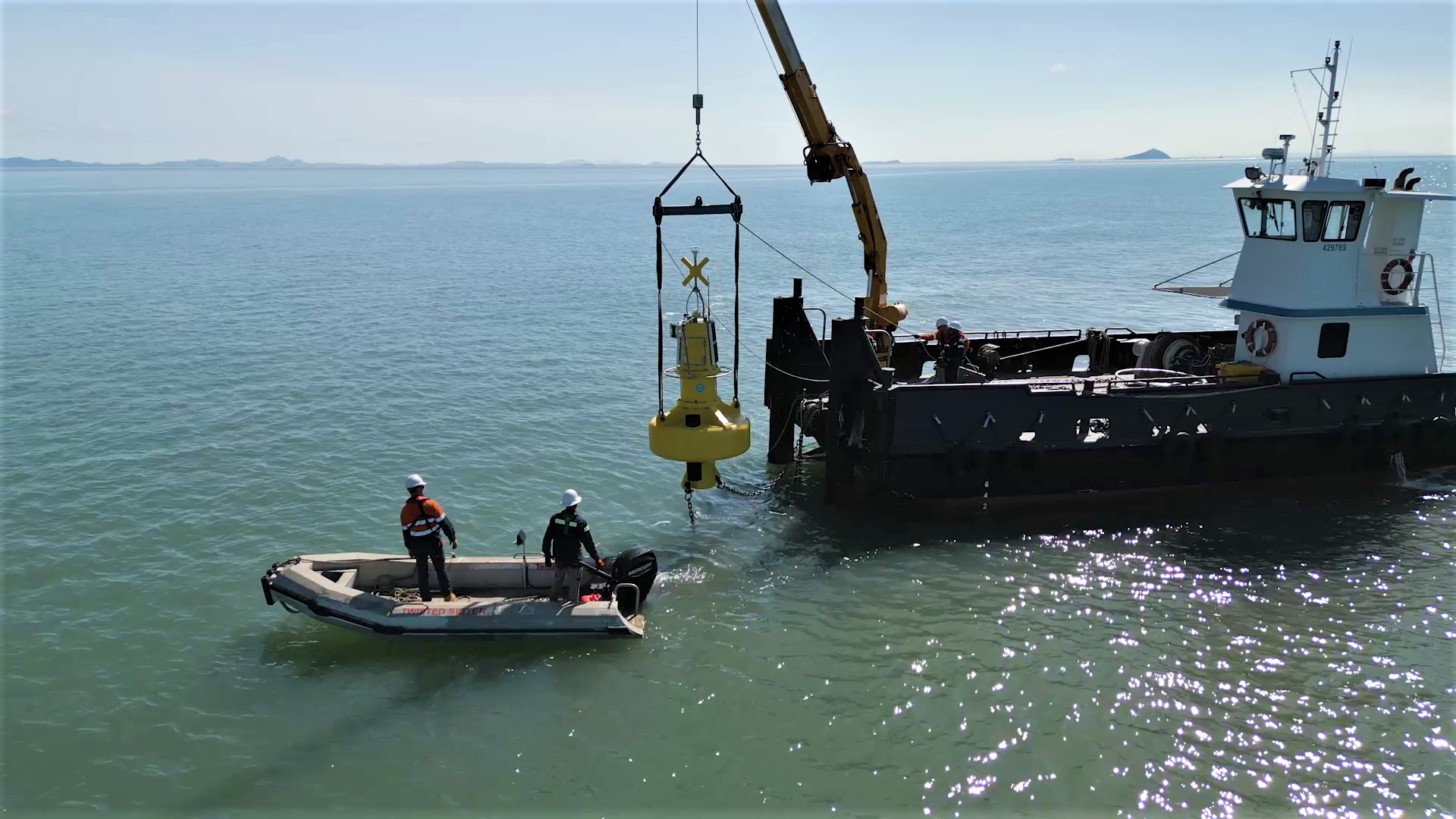
Australia’s national science agency, CSIRO, has installed specialized sensors on Darumbal Sea Country in the Southern Great Barrier Reef to help monitor and forecast sediment run-off, which impacts the UNESCO World Heritage site’s marine ecosystem.
The reef is one of seven test sites for CSIRO’s AquaWatch Australia Mission, which is creating a world-first ‘weather service’ for water quality using a combination of specialized sensors and satellite data.
Dr Alex Held, CSIRO’s AquaWatch Mission Lead, said the project has the potential to support planning decisions in protecting areas of the reef, which brings in A$5.2 billion annually and generates more than 64,000 full-time jobs.
"We are testing our systems for monitoring the flow of sediment and dissolved organic carbon – an indicator of the carbon exchange between land and ocean – from the Fitzroy River out into Keppel Bay towards the southern region of the reef,” Dr Held said. “Too much sediment can be a problem for coastal areas surrounding the river outlet because it blocks sunlight from reaching the seafloor, restricting the growth of marine plant life like seagrass. This then impacts the food availability for biodiversity in the area, including the reef’s colorful array of marine wildlife.”
Dissolved organic carbon blocks light that phytoplankton in the ocean need for photosynthesis, a process that removes carbon dioxide from the atmosphere much like plants do.
"We will also be able to identify higher levels of chlorophyll in the water, which can be indicative of a potential harmful algal bloom,” said Held. "Harmful algal blooms can be devastating for marine ecosystems when they produce toxins that can cause health problems and even kill fish."
Dr Nagur Cherukuru, a senior CSIRO researcher, said modelling and artificial intelligence (AI) would be applied to the combined sensor and satellite data set to predict the sediment flows – ultimately identifying certain areas of the river where interventions can be made. “The modelling and AI will integrate not only the AquaWatch sensor data, but other factors like ocean currents, wind speed, wind direction and tidal conditions to improve the accuracy of forecasts from AquaWatch.
“Much like having a weather report for guidance, the information can be used by water managers to inform marine and land planning decisions both during normal environmental patterns and in flood situations, when large volumes of sediment can be washed out to sea.”
While this test data will only be available to research partners and Traditional Custodians initially, the long-term goal for AquaWatch is to provide national water quality monitoring and forecasts to all Australians via an app or integration into current weather reporting.