A Double-Sided Trident: Dual-Use Environmental Data Underpins Subsea Defense
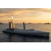
U.S. Naval Oceanographic Office conducts a hydrographic survey by launching an unmanned surface vessel, supported by a Bahrain Coast Guard escort, in the U.S. Central Command area of responsibility. Credit: Official U.S. Navy photo
On December 15, 2016, the USNS Bowditch, a Pathfinder-class oceanographic survey vessel, was operating approximately 50 nautical miles off the coast of Subic Bay, Philippines when she was approached by a Chinese Dalang III-class rescue and salvage vessel, the ASR-510. Bobbing in the water nearby was a U.S. littoral battle space glider (LBS), a Teledyne Webb Slocum glider designed to measure a wide range of environmental data, including temperature, depth, and salinity. As the Bowditch was preparing to recover the glider, the ASR-510 launched a small boat, approached the AUV, and seized it as the stunned Bowditch crew looked on. Bridge-to-bridge calls demanding its return were ignored, and the incident quickly escalated into a diplomatic confrontation, with the Pentagon demanding the immediate return of what it described as a sovereign immune U.S. vessel. China eventually returned the glider, some five days later.
 The USNS Bowditch oceanographic survey ship at sea. Credit: U.S. Navy photo
This was not the first time the Bowditch had been harassed by China’s maritime forces. Fifteen years before, while conducting hydrographic survey operations in the Yellow Sea, the vessel was confronted by a People’s Liberation Army-Navy (PLAN) frigate and ordered to halt its survey and immediately depart the area. (She would later return under the watchful eye of a U.S. Navy destroyer.) While both of these incidents raise legal and diplomatic questions surrounding both crewed and uncrewed vessels operating on the high seas, they also underscore how hydrographic survey and oceanographic data collection sit squarely on the front line of national security—both literally, in the conduct of everyday operations at sea, and figuratively, by providing the critical environmental intelligence that informs and shapes operations in an increasingly contested underwater battlespace.
Throughout the world, seafaring nations maintain fleets of research and survey vessels equipped with a wide range of sensors designed to characterize both the water column and the seafloor. On any given day, dozens of these vessels are dotting the world’s oceans, sampling their chemical composition, measuring their depth, and charting their floors and coastlines to ensure the safe navigation of vessels operating both on and below the surface. These operations provide an ongoing picture of an environment that is complex, dynamic, and operationally challenging. For scientists, the data are the building blocks of knowledge, offering insights into fragile underwater ecosystems, the effects of climate change, deep ocean circulation, and geological forces. But to those for whom the underwater domain is a battlespace, the data are key to ensuring mission success, and can mean the difference between life and death.
As crewed and uncrewed undersea operations proliferate and their geographic reach expands, a current, accurate picture of the operational environment is essential. Yet even as more oceanographic data is being generated than ever before, the ocean depths remain largely opaque, with entire swaths of the seabed uncharted. The consequences of incomplete environmental awareness can be severe. In 2021, the USS Connecticut, a U.S. Navy Seawolf-class nuclear-powered attack submarine, struck an uncharted seamount while transiting the South China Sea, injuring 11 crew members and causing extensive damage. (Nearly five years later, Connecticut remains in drydock under repair, with a return to service scheduled for September, 2026.) In 2005, the USS San Francisco struck an unchartered seamount off the coast of Guam, resulting in multiple injuries and one death among the crew.
 USS Connecticut (SSN 22) is docked for its Extended Docking Selected Restricted Availability July 12 at Puget Sound Naval Shipyard & Intermediate Maintenance Facility. Credit: Wendy M Hallmark/U.S. Navy
Beyond navigational safety, environmental data such as bathymetry, seabed composition, currents, salinity, and temperature provide navies with the means to protect their undersea forces, or monitor those of their adversaries. Modern anti-submarine warfare (ASW) is not just a contest of humans, machines, and sensors, but of models, algorithms, and, increasingly, artificial intelligence. But no matter how sophisticated the data processing, it is only as effective as the data itself. Sound energy bends, attenuates, and scatters depending on water temperature, salinity, pressure, seabed composition, and topography. Without thorough knowledge of these characteristics, it would be extremely challenging if not impossible to classify or localize acoustic contacts, or to gain operational advantage by exploiting phenomena like temperature gradients to foil active sonar.
U.S. and Western navies rely extensively on dedicated survey ships like the Bowditch as well as fleets of autonomous systems, fixed sensing networks, or partnerships with civilian institutions to obtain critical environmental intelligence. Hydrographic survey operations, in particular, can provide both defensive awareness of vulnerabilities, as well as offensive options by mapping the locations of submarine telecommunications cables, pipelines, seabed sensor arrays, or the contours of strategically important chokepoints for prepositioning sensor or weapon systems
U.S. and Western adversaries are also well aware of the need for up-to-date environmental intelligence in order to successfully operate in, and exploit the opacity of, the undersea domain. Both Russia and China operate large fleets of oceanographic research vessels, ostensibly for benign research missions, but are also suspected of engaging in dual-use intelligence gathering and even sabotage. Russia’s Yantar in particular is widely regarded in Western security circles as a special mission platform masquerading as a research vessel. Yantar, is attached to Russia’s benignly named Main Directorate for Deep Sea Research (GUGI), a highly secretive branch of the Ministry of Defense headquartered on the Kola Bay, which is also known to operate a fleet of special-purpose submarines and deep-sea submersibles. Yantar has been observed operating near critical underwater infrastructure in the Baltic, North, and Irish Seas, and even off the southeast coast of United States near Naval Submarine Base King’s Bay, home to U.S. Navy ballistic missile submarines. Equipped with a wide range of sophisticated crewed and uncrewed deep diving submersibles, Yantar is capable of mapping, imaging, as well as inspecting, deploying, or manipulating objects on the sea floor for purposes of identifying the locations of seabed sensors, submarine telecommunications cables, or crash debris from missile tests or aircraft mishaps. Yantar is closely monitored by NATO navies wherever she operates, but she is also known to operate “dark,” turning off her AIS transponder to make it more difficult to be tracked, a highly suspect activity for an oceanographic research vessel
China’s expansive and growing fleet of research and survey vessels, operated under the guise of government agencies, universities, and civilian research institutes, is also capable of generating environmental intelligence of direct relevance to PLAN operations. While survey operations are largely concentrated in the South China Sea and Western Pacific, China has been extending its reach with surveys of the Indian Ocean as well as the Arctic, where the U.S. Coast Guard routinely monitors vessels operating within the U.S. Extended Continental Shelf (ECS). Chinese oceanographic vessels often deploy numerous underwater gliders and profiling floats, providing a near real-time operating picture of the underwater environment, and enabling PLAN submarines to operate covertly in the waters of neighboring states, many of whom are in increasingly acquiring their own submarine fleets to secure their maritime interests. Like Yantar, Chinese vessels also periodically go dark, or sometimes deliberately spoof their positions to conceal operations, particularly when operating in the waters surrounding Taiwan where detailed seabed imagery could inform submarine, amphibious assault, and mine warfare operations, as well as identify the locations of subsea cables that could be targeted during conflict.
As the undersea domain becomes increasingly operationalized and contested, hydrographic survey will become more tightly and critically woven into subsea defense, and oceanographic research vessels, both crewed and uncrewed, will likely find themselves increasingly on the front line of national security and geopolitical stability. In an era of gray zone operations, proliferating autonomous systems, and intensifying great-power maritime competition, oceanographic data is not only scientific information—it is environmental intelligence that is fundamental to subsea navigation, undersea warfare, seabed operations, and strategic deterrence.
 A hydrographic survey ship operated by the Royal Australian Navy. Credit: Adobe Stock/Ryan - stock.adobe.com