Greensea IQ Introduces Bayonet Insight Post-Mission Analysis Toolset
© Greensea IQ
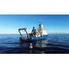
Greensea IQ announced the release of a new post-processing software toolset called Bayonet Insight for its maritime robotics software products deployed to defense forces.
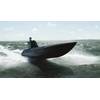
Bayonet Insight supports all software deployed on Bayonet Autonomous Underwater Ground Vehicles (AUGVs), EOD Edge and EOD Workspace deployed on Mission Specialist Defender ROVs by VideoRay (an AeroVironment company), RNAV diver navigation systems by STIDD Systems, Bayonet Underwater Control (BUC) systems, and Greensea’s EverClean ship maintenance and inspection robots. The tool was developed in response to a persistent need from operators for faster access to mission insight.
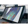
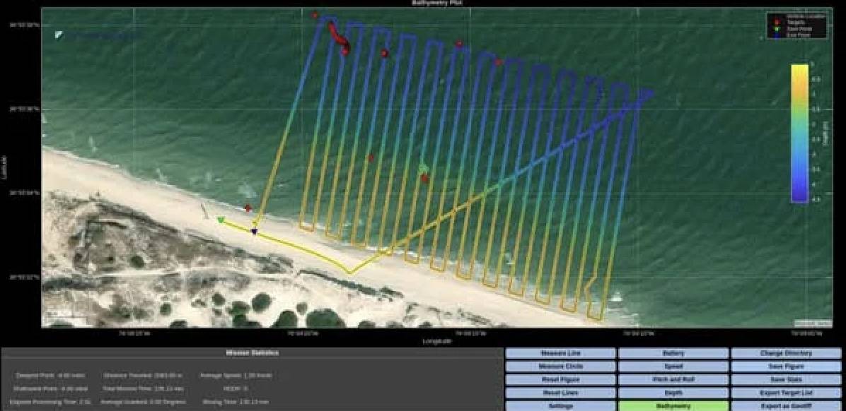
Bayonet Insight enables operators to process raw mission data immediately, during a mission or after recovery, and produce valuable intelligence products that can easily be distributed or uploaded into battlespace management platforms such as TAK. The post-mission analysis toolset allows the generation of numerous products, including bathymetry maps, geo-referenced mission summaries, contact reports, sonar and video exports, and plots of any telemetry channel within the system. This type of intelligence traditionally takes hours of processing after a mission using a variety of tools, delaying reporting, decision-making, and follow-on tasking.
Developed as a standalone application and distributed with all Greensea software, Bayonet Insight allows users to load mission data files and automatically organize critical telemetry, mission events, sensor data, sonar data, and video into a structured workspace. From there, operators can quickly generate plots and data products as well as 2D and 3D bathymetric visualizations. Interactive tools allow users to inspect specific points along a mission track, capture synchronized sonar and video snapshots, and extract precise measurements and coordinates.
One of the most significant benefits is the ability to export georeferenced bathymetric images and mission data directly as GeoTIFFs, enabling seamless integration with mission planning, reporting, and GIS systems in a single workflow.
Bayonet Insight has already been demonstrated in live operational settings, where it successfully enabled rapid data product generation and on-time intelligence for mission stakeholders and decision makers. This software will be available to customers with current EVERGREEN subscriptions.