New USGS National Map Data Reveals the Potomac River’s Submerged Topography
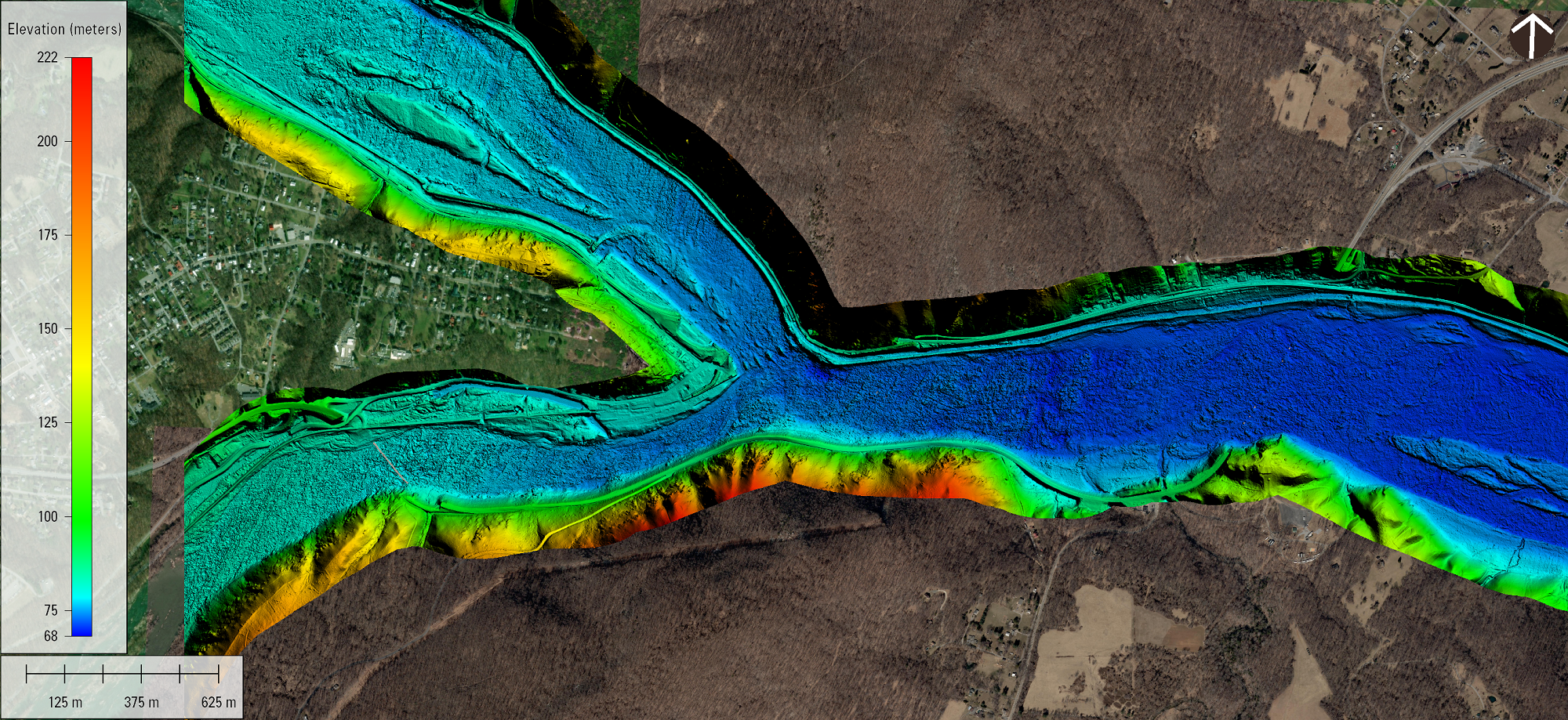
Topobathymetric digital elevation model of the confluence of the Potomac and Shenandoah Rivers at Harper’s Ferry, West Virginia. (Image: USGS)
The U.S. Geological Survey recently published a new topobathymetric lidar dataset for the Potomac River as part of its 3D Elevation Program (3DEP).
Topobathymetric lidar provides 3D maps of the submerged riverine topography. The maps were produced in two phases for more than 120 river miles of the Potomac River through a data-acquisition contract with Dewberry. The study area began near Hancock, Md., and extended downstream to the Little Falls dam near Washington, D.C.
The project was co-funded by the USGS and the Interstate Commission on the Potomac River Basin (ICPRB). The publication of topobathymetric lidar for inland rivers was made possible in part by Inflation Reduction Act investments, which are advancing the 3D National Topography Model 3DEP initiative to better map and integrate the Nation’s elevation and hydrography.
“We are just beginning to learn how to take advantage of this new state-of-the-art dataset,” said Cherie Schultz, Director of Operations for ICPRB’s Section for Cooperative Water Supply Operations on the Potomac. “We’ve used it to build a preliminary two-dimensional river-flow model which gives amazingly accurate results, and that has provided us with a much better tool to predict the fate and transport of an oil spill in the Potomac River.”
ICPRB uses such tools to estimate the arrival time and peak concentrations of contaminant plumes to help protect drinking-water supplies for the Washington, D.C. metropolitan area. Other organizations are using the data for engineering studies for bridges and roads, mapping aquatic habitats for biological assessments, flood mapping, and many other applications.
The lidar point clouds and topobathymetric digital elevation models for the Potomac River Basin can be visualized or downloaded through the 3DEP LidarExplorer here.
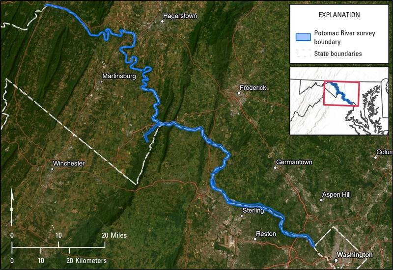 Map of the Potomac River topobathymetric lidar survey area in Virginia, Maryland, and West Virginia. (Image: USGS)