Australian Scientists Study the Antarctic


-
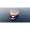
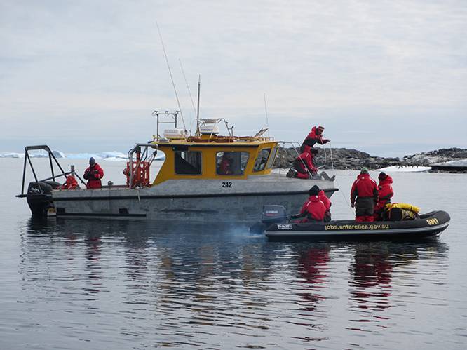 Joint hydrographic and seabed characterization survey in coastal waters off Davis station, Antarctica. (Photo: Royal Australian Navy)
-
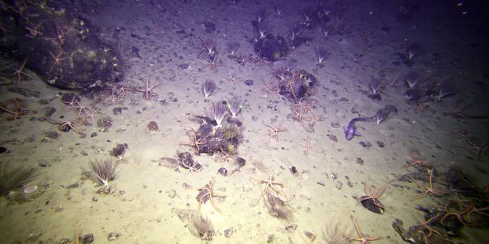 Brittle stars, feather stars and fish on the Sabrina Coast seafloor, East Antarctica. (Photo: Marine National Facility/CSIRO)


Australian scientists recently concluded several Antarctic geoscience and geophysical data acquisition surveys in hopes of helping to increase understanding of these precious environments to better manage and protect them.
Geoscience Australia's Antarctic Geoscience program, which carries out marine and onshore research for the Australian government, has completed three Antarctic surveys during the 2016-2017 field season.
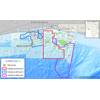
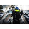
Three Geoscience Australia marine specialists, Dr. Jodie Smith, Kim Picard and Ian Atkinson, were part of a two month survey of the near-shore region near Australia's Davis research station. This survey was completed in collaboration with the Royal Australian Navy and the Australian Antarctic Division (AAD), as part of a three year program to map the high-use areas close to Australia's three Antarctic stations, supporting objectives within the whole-of-government Australian Antarctic Strategy and 20 Year Action Plan.
“The highly successful survey collected a range of datasets, including hydrography data, which provide us with a detailed picture of the shape of the seafloor, and seabed characterization information about what material is on the seafloor and also what organisms live there,” Dr. Smith explained.
“We also used equipment called a sub-bottom profiler to look below the seafloor for the very first time in this area. The next step is to bring all this information together to understand the ‘why’.”
Scientists will now further examine the data to determine the relationships between the shape and composition of the seafloor and what lives there. This information can then be used to better manage this unique environment.
Marine geoscientist Dr. Alix Post participated in a voyage to the Sabrina Coast region of East Antarctica on board the RV Investigator. The voyage, led by Macquarie University, completed the most extensive hydrographic survey in East Antarctica to date and collected long sediment cores that contain a rich archive of climate information. In addition, the survey completed detailed assessments of benthic ecosystems, studying the organisms that live on or near the seafloor and mapped the seafloor, in support of Australia's efforts to establish a Marine Protected Area in the region.
“It was amazing to see the variety of organisms living at depths of up to 2000 meters, in water temperatures close to zero,” Dr. Post said.
“Some of the organisms that we've seen include sea stars, octopus, rays, brittle stars, all sorts of fish, huge sea spiders and even colorful soft corals,” she added.
In February, geophysicist Aki Nakamura spent one week at Casey Station conducting an absolute gravity survey. Casey Station is one of Australia's three Antarctic research stations and is the operations hub for a multi-year multi-national airborne geophysics program, ICECAPII, being run by the AAD, which Geoscience Australia supports by providing geophysical expertise.
The ICECAPII program is collecting a range of airborne geophysical datasets, including ice-penetrating radar, LiDAR, gravity and magnetics, across large areas of East Antarctica. This information is being collected to better understand the volume and dynamic behavior of the vast East Antarctic Ice Sheet, as well as the underlying bedrock topography and geological characteristics.
The absolute gravity survey will provide a valuable benchmark for the airborne gravity dataset – essential to improving the utility and value of airborne gravity for further use by Geoscience Australia and other science organizations that use this data.