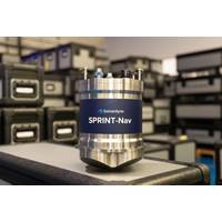
Sonardyne Expands SPRINT-Nav into Family of Navigation Products
embedded software suite, including the same web UI and API, manufacturers and operators can easily “swap out and swap in” their navigation solution, as mission needs grow.In addition to faster initialization, all of the latest SPRINT-Navs can now also support survey operations with our Fusion 2 software, unlocking LBL range aiding and SLAM calibration.All variants retain the same tightly integrated INS and DVL, factory pre-calibration, true north seeking heading, free-inertial capability and sensor fusion, but now with even easier setup, quicker deployment and less offshore configuration
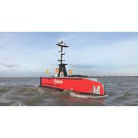
From Radar Returns to Safe Decisions: Radar Processing for Maritime Autonomy
using formats including ASTERIX, NMEA-0183, TAK, and SAPIENT.Combining sensorsA radar track may show that an object is approaching or on a steady bearing without identifying it. AIS may provide identity data that can be correlated with the track, while a camera may offer visual confirmation. Sensor fusion combines these observations into a more complete picture.Successful fusion depends on consistent timing and coordinate systems and an understanding of the accuracy of each source, particularly where position is concerned. Bounding boxes defining uncertainty margins are critical with the aim of maximizing
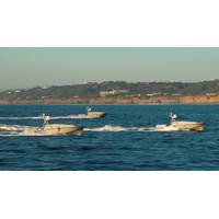
Autonomous Vehicles Solve (and Create) Problems for Ports
platform, software and sensor creators. Late last year, Ocean Power Technologies (OPT) announced a partnership with Mythos AI to integrate AI-driven autonomy software across OPT’s fleet of WAM-V autonomous surface vehicles (ASVs). These vehicles leverage real-time edge processing, multi-sensor fusion and adaptive learning for enhanced situational awareness, obstacle avoidance and multi-vehicle coordination.Dr. Fritz Stahr, chief technology officer at Open Ocean Robotics, says the integration of AI to analyze data streams from autonomous vehicles is transforming the field. Enhanced Horizon, Open
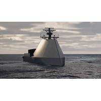
U.S. Navy Selects HII USV to Advance to At-Sea Testing
in 30 countries, transforming vehicles into intelligent robotic systems. Through flexible vehicle-, module-, and algorithm-level implementations across diverse platforms, sensors, payloads, and mission profiles, Odyssey Advanced Autonomy Solutions deliver multi-vehicle collaborative autonomy, sensor fusion, and advanced perception capabilities.The ROMULUS family of Unmanned Surface Vessels is designed to meet the current and emerging requirements of the U.S. Navy, U.S. Marine Corps, joint forces, and allies. They deliver high-endurance, sustained open-ocean autonomy with a focus on lethality, cost
Integrated, Multi-Domain Port Security
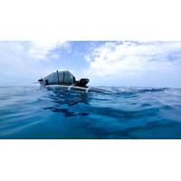
vehicles (ASVs) and its PowerBuoy platforms that will be able to charge them. The aim is to accelerate the range of integrated aerial and subsea solutions the company can deliver to customers in defense, security and commercial sectors. The systems will leverage real-time edge processing, multi-sensor fusion and adaptive learning for enhanced situational awareness, obstacle avoidance, multi-vehicle coordination, and, in later phases, advanced vehicle-buoy collaboration.It’s challenging to defend against uncrewed systems, says Jason Weed, SVP Commercial Sales at OPT, so many ports are now focused
China Mapping Ocean Floor Ready for Submarine Warfare
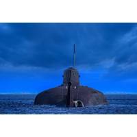
, Parker and other experts added, even where data is gathered for scientific purposes, the integration of civilian scientific research and military technology development has become a key focus of the Chinese government under President Xi Jinping. Beijing refers to this approach as "civil-military fusion."China's ministries of defense, foreign affairs and natural resources didn't respond to requests for comment about the seabed mapping and ocean-monitoring activities.The U.S. Defense Department didn't respond to questions from Reuters.In testimony to a congressional commission this
China Maps Ocean Floor as It Builds Submarine Warfare Capability
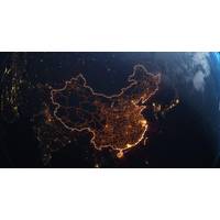
, Parker and other experts added, even where data is gathered for scientific purposes, the integration of civilian scientific research and military technology development has become a key focus of the Chinese government under President Xi Jinping. Beijing refers to this approach as "civil-military fusion."China's ministries of defense, foreign affairs and natural resources didn't respond to requests for comment about the seabed mapping and ocean-monitoring activities.The U.S. Defense Department didn't respond to questions from Reuters.In testimony to a congressional commission this

Advanced Navigation Raises $110M Series C to Support Increased PNT Technology Demand
, artificial intelligence (AI), and high-precision sensing, Advanced Navigation is deploying a layered, multi-sensor architecture designed to operate with total autonomy, even when GPS signals are degraded or lost.At the core of this architecture is AdNav Intelligence (AI), the company’s software fusion engine. It continuously combines and cross checks data from multiple sensors in real time, while adapting to each mission’s requirements. This ensures autonomous vehicles, aircraft, ships and robots understand exactly where they are and keep moving with confidence, no matter the environment
Ashtead Technology Places New Order for Sonardyne’s Fusion 2 Platform
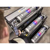
Sonardyne has received a major new order for its Fusion 2 platform and 6+ technology from Ashtead Technology.This investment increases Ashtead Technology’s rental fleet of Sonardyne Compatt 6+ to well over 1,000 units. The units integrate Long BaseLine (LBL) and SPRINT INS into a single, streamlined platform, Fusion 2, supported by Sonardyne's 6+ hardware.Fusion 2’s advanced capabilities include full LBL support, real-time SLAM calibration for sparse arrays and wireless structure deflection monitoring.These features significantly reduce transponder count, vessel time and operational



 August 2026